Alabama 811 | Know What's Below.

Archive for February 9th, 2010

From The Blizzard Of 2010

From The Blizzard Of 2010

| February 9, 2010 @ 9:56 pm | 6 Replies

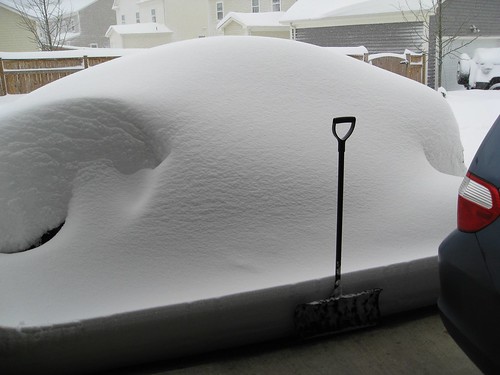
Thanks to Kerry Colburn for these images, and his service to our nation… he writes: “Hi James, I am stationed at Fort Belvoir, VA and Saturday I opened my garage to find this huge pile of snow. After about an hour of shoveling I found a car in it. It’s my car, but you would […]

Read More

Breaking News!

Breaking News!

| February 9, 2010 @ 5:26 pm | 6 Replies

How about a little sunshine? Clearing has been progressing steadily across West and Central Alabama during the past few hours… see the SKYCAM shots below. More clouds should rotate back down in here later tonight, so I am not sure tomorrow will be a totally sunny day, but we will take what we can get…

Read More

An Icy Wind This Afternoon; Snow Friday????

An Icy Wind This Afternoon; Snow Friday????

| February 9, 2010 @ 3:01 pm | 155 Replies

An all new edition of the ABC 33/40 Weather Xtreme video is available in the player below. You can subscribe to the Weather Xtreme video on iTunes by clicking here. GETTING COLD: Our forecast today mentioned temperatures falling from the 40s this morning into the 30s this afternoon, and that is right on target as […]

Read More

BMX Snow Statement

BMX Snow Statement

| February 9, 2010 @ 2:45 pm | 3 Replies

SPECIAL WEATHER STATEMENT NATIONAL WEATHER SERVICE BIRMINGHAM AL 335 PM CST TUE FEB 9 2010 ALZ011>015-017>050-101000- AUTAUGA-BARBOUR-BIBB-BLOUNT-BULLOCK-CALHOUN-CHAMBERS-CHEROKEE- CHILTON-CLAY-CLEBURNE-COOSA-DALLAS-ELMORE-ETOWAH-FAYETTE-GREENE-HALE- JEFFERSON-LAMAR-LEE-LOWNDES-MACON-MARENGO-MARION-MONTGOMERY-PERRY- PICKENS-PIKE-RANDOLPH-RUSSELL-SHELBY-ST CLAIR-SUMTER-TALLADEGA- TALLAPOOSA-TUSCALOOSA-WALKER-WINSTON- 335 PM CST TUE FEB 9 2010 …WINTER WEATHER POTENTIAL FOR FRIDAY… OVER THE LAST COUPLE OF DAYS MUCH HAS BEEN DISCUSSED IN REGARDS TO THE POTENTIAL FOR WINTER WEATHER FRIDAY. UNFORTUNATELY…DUE TO […]

Read More

Is it our turn?  Tuesday 130 pm update

Is it our turn? Tuesday 130 pm update

| February 9, 2010 @ 1:41 pm | 34 Replies

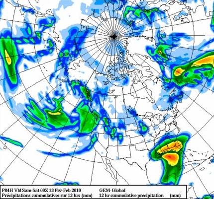
Models are now diverging with the storm only 3 days away! The Canadian GEM keeps the Gulf low close enough to the coast to spread heavy snow into parts of central Alabama on Friday, the European is a little farther south but shows enough upper-level dynamics for at least some snow in BHM, and the […]

Read More

Early Afternoon in Chilly Alabama

Early Afternoon in Chilly Alabama

| February 9, 2010 @ 1:40 pm | 2 Replies

Cold front at 1 o’clock this afternoon had advanced as far east as about the Fort Payne-Anniston-Alexander City line. The Birmingham temperature has dropped seven degrees in the last three hours or so. Almost all the rain has gone away. There was a narrow area of light rain from about Anniston to east of Alexander […]

Read More

Good Ole Alabama Just Before 10

Good Ole Alabama Just Before 10

| February 9, 2010 @ 9:50 am | Reply

Most of the rain that we saw/heard overnight has shifted east into Georgia. However, there is a fairly wide band of rain (mostly light) that extends along and east of a line from Huntsville to Birmingham to Marion. Moving east. WHERE IS THE COLD FRONT? Knocking on Birmingham’s door as we type this. It is […]

Read More

Sharply Colder This Afternoon

Sharply Colder This Afternoon

| February 9, 2010 @ 6:15 am | 150 Replies

An all new edition of the ABC 33/40 Weather Xtreme video is available in the player below. You can subscribe to the Weather Xtreme video on iTunes by clicking here. MESSY MORNING: Rain is falling early this morning across Alabama, but it is already ending over the western part of the state, and it looks […]

Read More