Alabama 811 | Know What's Below.

Archive for February 11th, 2010

Snowstorm Taking Shape

Snowstorm Taking Shape

| February 11, 2010 @ 10:54 pm | 45 Replies

Our low pressure system is out over the Gulf of Mexico tonight. It exited the Texas coast near Corpus Christi earlier this evening. A vigorous upper disturbance is passing south of the Dallas/Ft. Worth Metroplex at this hour. Light snow was continuing in the Metroplex, but snow was intensifying ahead of the disturbance over eastern […]

Read More

Check This Out

Check This Out

| February 11, 2010 @ 10:23 pm | 36 Replies

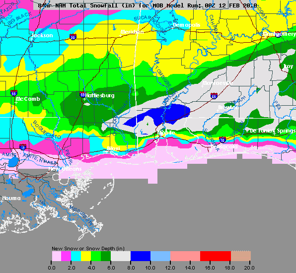
Below are the 00Z NAM snow accumulation graphics. How about 8 to 10 inches just north of Mobile!!!

Read More

9:00 News

9:00 News

| February 11, 2010 @ 9:06 pm | 41 Replies

Some notes from the weather office… *The 00Z NAM prints 0.30″ liquid for Birmingham, or around 3 inches of snow. Makes the NWS idea of 2 to 4 inches here look pretty good. We will stick with 1-2 inches for the I-20 corridor. *Timing still looks good; snow begins over West Alabama soon after midnight, […]

Read More

Rare Southern Snowstorm

Rare Southern Snowstorm

| February 11, 2010 @ 8:08 pm | 17 Replies

A rare southern snowstorm is in full force at this hour. Dallas has recorded a record snowfall for ANY calendar day, with 8.7 inches today. Snow will continue in the Metroplex for a few more hours. Haslet TX in Tarrant County, TX (where Fort Worth is) reports 10.1 inches of snow. Snow is now being […]

Read More

Historical Snow Info…

Historical Snow Info…

| February 11, 2010 @ 6:21 pm | 52 Replies

000 NOUS44 KBMX 120020 PNSBMX ALZ011>015-017>050-130000- PUBLIC INFORMATION STATEMENT NATIONAL WEATHER SERVICE BIRMINGHAM AL 620 PM CST THU FEB 11 2010 …PUBLIC INFORMATION STATEMENT… THE FOLLOWING ARE A FEW CENTRAL ALABAMA SNOWFALL STATISTICS. GREATEST CALENDAR DAY FEBRUARY SNOWFALL… BIRMINGHAM… 5.0 INCHES 2/23/1901 MONTGOMERY… 3.1 INCHES 2/09/1973 ANNISTON….. 4.5 INCHES 2/04/1998 CLANTON….. 10.0 INCHES 2/13/1899 FAYETTE…… […]

Read More

How Much?

How Much?

| February 11, 2010 @ 6:05 pm | 10 Replies

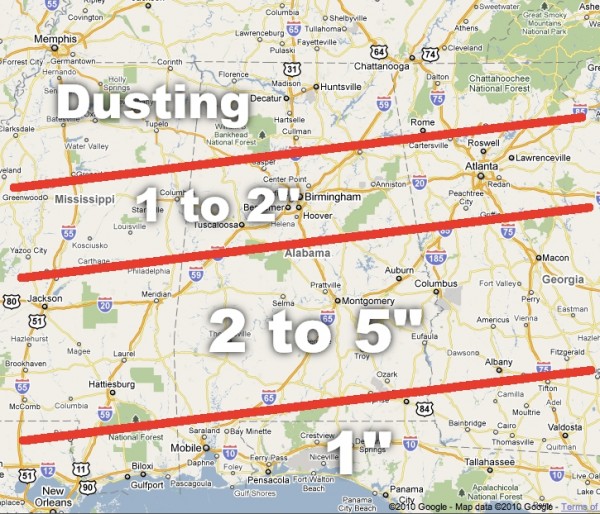
Below is a comparison of the NWS accumulation, and the one I put together earlier (mine is the one on top)… you can see the NWS is a little more aggressive with snow the I-20. One way or another, the heaviest snow should be over the southern half of Alabama tomorrow. We will talk about […]

Read More

Special Tonight At 7:00

Special Tonight At 7:00

| February 11, 2010 @ 6:03 pm | 2 Replies

While Jason and Ashley are at Storm Alert 2010 in Sumiton, I am staying behind for a special live report at 7:00 on our live stream and the digital WeatherNow channel (33.2 and 40.2) on cable systems around Alabama. If you aren’t able to watch on TV… you can watch via the stream, which you […]

Read More

Late Afternoon Update

Late Afternoon Update

| February 11, 2010 @ 4:33 pm | 19 Replies

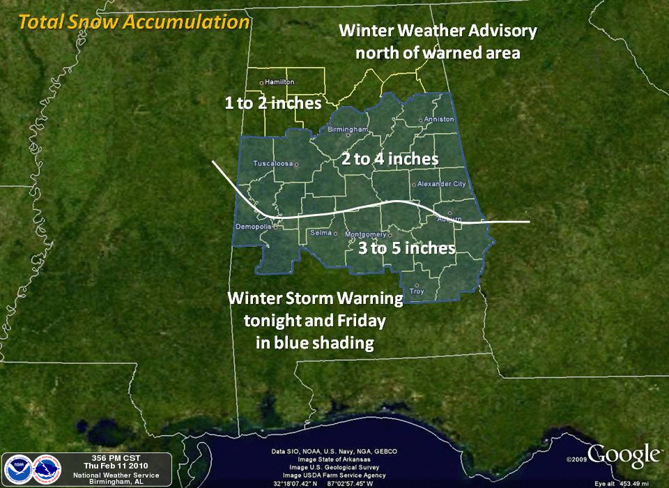
Below is the snow accumulation projection from the Birmingham NWS office… might be a tad aggressive, but certainly possible: Understand that is for their CWA only (county warning area)… heavy snow is likely over South-Central Alabama below that zone as well. RIGHT NOW: Lots of snow in North Texas; scroll down for the images from […]

Read More

More From Texas

More From Texas

| February 11, 2010 @ 4:24 pm | 1 Reply

Thanks to Kevin Selle for this image from his place in Arlington (with the time stamps), and John Oldshue for images taken by relatives in Rockwall (just east of Dallas)…

Read More

Texas Snow Update

Texas Snow Update

| February 11, 2010 @ 3:51 pm | Reply

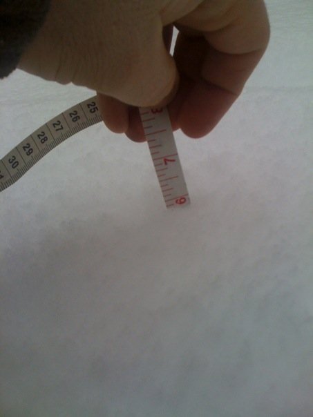
Thanks to Keith Franklin for this image from Fort Worth, Texas… he writes… “Got 6″ here so far and still snowing!! Lights have been flickering. I have one big tree limb down in the yard. Heavy wet snow. Heard a report that 15,000 is without power so far. Power might be an issue when this […]

Read More

Winter Storm Knocking On Our Door

Winter Storm Knocking On Our Door

| February 11, 2010 @ 2:44 pm | Reply

An all new edition of the ABC 33/40 Weather Xtreme video is available in the player below. You can subscribe to the Weather Xtreme video on iTunes by clicking here. WINTER STORM WARNING: Scroll down to see the Winter Storm Warning issued by the NWS. They have gone 2 to 4 inches for Birmingham metro…. […]

Read More

Snow update 230 pm and atmospheric dynamics

Snow update 230 pm and atmospheric dynamics

| February 11, 2010 @ 2:31 pm | 5 Replies

**NATIONAL WEATHER SERVICE ISSUES WINTER STORM WARNING** **SEE JAMES’ POSTS BELOW FOR DETAILS** In blog posts below from James, JB, and me, you’ll see that we have raised the snow totals in central Alabama somewhat, and it looks like it may start as early as 7 am in BHM. 12 UTC model runs are fairly […]

Read More

Winter Storm Warning – NWS B’ham

Winter Storm Warning – NWS B’ham

| February 11, 2010 @ 1:56 pm | Reply

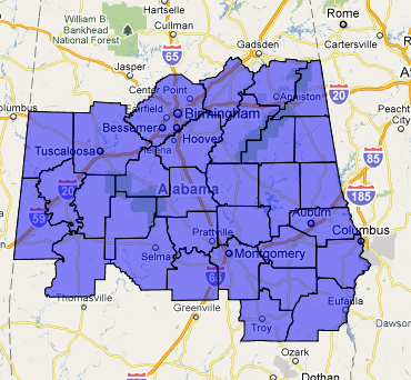
WWUS44 KBMX 111951 WSWBMX URGENT – WINTER WEATHER MESSAGE NATIONAL WEATHER SERVICE BIRMINGHAM AL 151 PM CST THU FEB 11 2010 …WINTER STORM EXPECTED LATE TONIGHT INTO FRIDAY… ALZ030-033-039>050-121200- /O.UPG.KBMX.WS.A.0001.100212T0600Z-100213T0000Z/ /O.NEW.KBMX.WS.W.0001.100212T0600Z-100213T0000Z/ SUMTER-PERRY-MARENGO-DALLAS-AUTAUGA-LOWNDES-ELMORE-MONTGOMERY- MACON-BULLOCK-LEE-RUSSELL-PIKE-BARBOUR- INCLUDING THE CITIES OF…LIVINGSTON…MARION…DEMOPOLIS… LINDEN…SELMA…PRATTVILLE…FORT DEPOSIT…HAYNEVILLE… WETUMPKA…TALLASSEE…MONTGOMERY…TUSKEGEE…UNION SPRINGS… AUBURN…OPELIKA…PHENIX CITY…TROY…EUFAULA 151 PM CST THU FEB 11 2010 …WINTER STORM WARNING IN EFFECT […]

Read More

Winter Storm Warning From Mobile NWS

Winter Storm Warning From Mobile NWS

| February 11, 2010 @ 1:25 pm | 3 Replies

You don’t see these too often… WWUS44 KMOB 111921 WSWMOB URGENT – WINTER WEATHER MESSAGE NATIONAL WEATHER SERVICE MOBILE AL 121 PM CST THU FEB 11 2010 …SIGNIFICANT SNOWFALL ACCUMULATIONS EXPECTED FOR MUCH OF THE NORTH CENTRAL GULF COAST LATE TONIGHT AND FRIDAY… .THE COMBINATION OF A SURFACE LOW PRESSURE SYSTEM MOVING EASTWARD ACROSS THE […]

Read More