Alabama 811 | Know What's Below.

Archive for March 1st, 2010

Update 1146 pm

Update 1146 pm

| March 1, 2010 @ 11:45 pm | 4 Replies

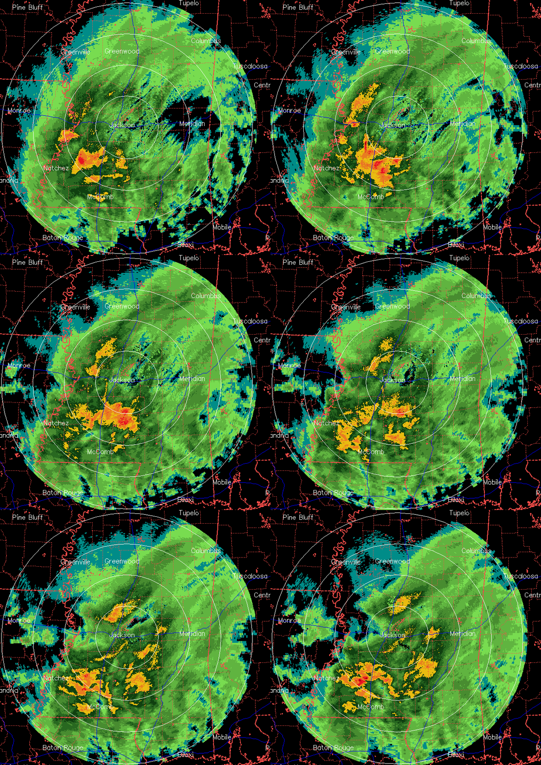
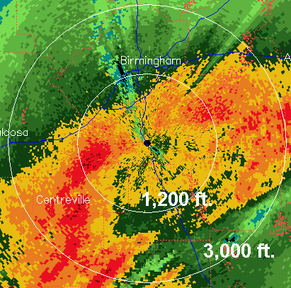
BMX radar at 0.5 degrees elevation angle BMX radar at 3.4 degrees elevation angle The two radar images above show what normally looks like very heavy precipitation. But, especially in the higher elevation scan, one can see that the higher radar returns are in a circle around the radar. When snow melts as it falls, […]

Read More

In The Middle of The Night–11:45 Report

In The Middle of The Night–11:45 Report

| March 1, 2010 @ 11:43 pm | Reply

Raining over most of the state as midnight approaches. Brighter radar return in the center of the state, may be some sleet involved TEMPERATURES ONLY The temperature is crucial tonight as we watch for cooling from above and not just colder air coming in from the west or northwest. Thanks to our 33/40 Skywatchers (we […]

Read More

Alabama Tonight–9:45 Report

Alabama Tonight–9:45 Report

| March 1, 2010 @ 9:45 pm | 24 Replies

Raining over most of Alabama tonight and temperatures continue to slowly fall. Brightness of the radar return hints that sleet may be in the mix over Bibb, Perry and Hale County in West Central Alabama, Light sleet was actually reported at Columbus AFB in Extreme Mississippi. Latest position report on the low pressure area in […]

Read More

Waiting and Watching

Waiting and Watching

| March 1, 2010 @ 9:39 pm | 7 Replies

A few notes from the forecast office… *Looks like a gravity wave is moving along the Gulf Coast. Winds at the Pensacola Naval Air Station just gusted to 53 knots, or 61 miles per hour. These high winds should stay near the coast during the next couple of hours. *Dynamic cooling is showing up over […]

Read More

Early Evening Alabama–6:50 Report

Early Evening Alabama–6:50 Report

| March 1, 2010 @ 6:48 pm | 57 Replies

Rain has spread into Alabama this evening–part of the overall storm system that will affect the state tonight and Tuesday and even some snow for some parts of the state. At 6:50 p.m., the heaviest rain was over SW Alabama, but there was some moderate to heavy rain in West Alabama, including Hale, Bibb and […]

Read More

Another Early March Snow Threat

Another Early March Snow Threat

| March 1, 2010 @ 5:02 pm | 47 Replies

Scroll down for thoughts from Dr. Tim, the afternoon Weather Xtreme video and blog discussion, and other good tidbits. The highlights of our thinking… *The best chance of accumulating snow should be over the eastern side of the state, especially East-Central and Northeast Alabama. *Dynamic cooling from a very cold upper trough will have to […]

Read More

Snow update – 330 pm

Snow update – 330 pm

| March 1, 2010 @ 3:57 pm | 7 Replies

“This is truly a throwing at a dart board to determine” “…this thing is fraught with danger for a forecaster” “THERE IS DEFINITELY A WIDE RANGE OF SOLUTIONS TO CHOOSE FROM THIS MORNING WHEN IT COMES TO THE AMOUNT OF THE WHITE STUFF WE WILL SEE.” “we are still in the process of looking at […]

Read More

Heaviest Snow Should Be Over East Alabama

Heaviest Snow Should Be Over East Alabama

| March 1, 2010 @ 2:50 pm | Reply

An all new edition of the ABC 33/40 Weather Xtreme video is available in the player below. You can subscribe to the Weather Xtreme video on iTunes by clicking here. We had to switch to our high traffic mode this afternoon due to the blog being hammered with traffic; remember we have a real time […]

Read More

Winter Weather Advisory

Winter Weather Advisory

| March 1, 2010 @ 2:30 pm | Reply

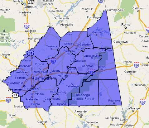
WWUS44 KBMX 012037 WSWBMX URGENT – WINTER WEATHER MESSAGE NATIONAL WEATHER SERVICE BIRMINGHAM AL 237 PM CST MON MAR 1 2010 …ANOTHER SNOW STORM POSSIBLE OVER NORTH-CENTRAL AND NORTHEAST ALABAMA LATE TONIGHT AND TUESDAY… .A STORM SYSTEM…OVER THE NORTHWESTERN GULF OF MEXICO…WILL INTENSIFY TONIGHT AS IT TRACKS EAST ACROSS THE NORTHERN GULF OF MEXICO TO […]

Read More

Snow Forecast

Snow Forecast

| March 1, 2010 @ 1:49 pm | 4 Replies

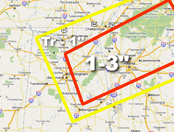
Here is a quick look at our snow accumulation projection for late tonight and tomorrow morning… We had to go to “high traffic mode”, but you can chat in real time anytime on our weather chat here. We will have the comments enabled shortly as soon as the extreme traffic levels settle down. A detailed […]

Read More

From Atlanta NWS

From Atlanta NWS

| March 1, 2010 @ 12:10 pm | 28 Replies

Our friends to the east tell us in their chat session… “Update…probably going with a winter storm warning for a good chunk of north ga tuesday. HPC winter wx desk prelim accums have 2-4 over all but nw tip of GA. 1″ line goes from Columbus to Millidgeville” Based on the 12Z model runs, no […]

Read More

Late Morning Peek

Late Morning Peek

| March 1, 2010 @ 11:00 am | 29 Replies

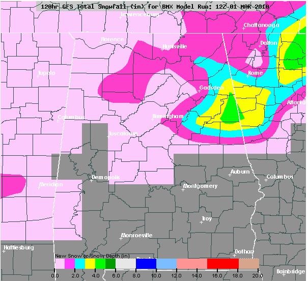
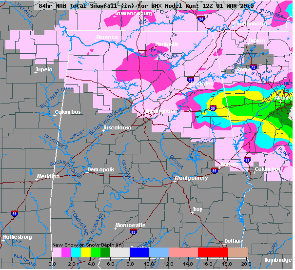
The 12Z model runs have come in a little wetter and colder. Here is the snow output from the 12Z NAM: At first glance, I don’t see enough evidence for any serious forecast changes, but I do think the idea of a heavier strip of snow is not a bad one… along the I-20 corridor […]

Read More

Precipitation Progress–10:40am

Precipitation Progress–10:40am

| March 1, 2010 @ 10:39 am | 13 Replies

Radar shows that some precipitation had spread as far eastward as West Mississippi with the leading eastern edge one-half way across Mississippi. However, none of the official surface reporting stations are reporting rain, which means it is not reaching the ground. Radar also shows a line of heavy showers over West Louisiana. At 10:00 a.m., […]

Read More

The Wellington Avalanche Disaster

The Wellington Avalanche Disaster

| March 1, 2010 @ 10:10 am | 2 Replies

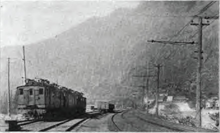
A view of Wellington, Washington before the 1910 avalanche. During the early morning hours of Tuesday, March 1, 1910, the crack Northern Pacific Railroad passenger train, the Spokane Express, sat on the tracks in the station at Wellington, Washington. Wellington was a tiny town just west of the tunnel at Stevens Pass along the summit […]

Read More