Alabama 811 | Know What's Below.

Archive for October 27th, 2012

Tsunami Warning for West Coast

Tsunami Warning for West Coast

| October 27, 2012 @ 10:43 pm

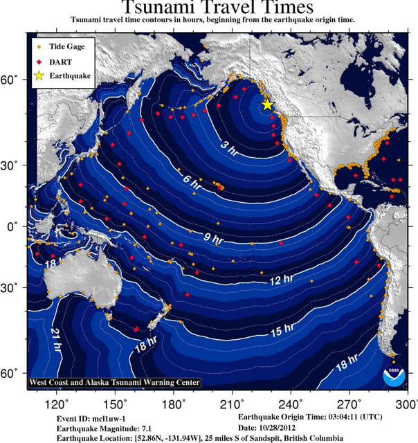
A tsunami Warning is now in effect which includes the coastal areas of British Columbia and Alaska from the north tip of Vancouver Island, British Columbia to Cape Decision, Alaska (85 miles SE of Sitka). Event details: Preliminary magnitude 7.1 (Mwp) earthquake / Lat: 52.863, Lon: -131.942 at 2012-10-28T03:04:11Z Tsunami warnings mean that a tsunami […]

Read More

Weather Update:  Cold Air and Sandy

Weather Update: Cold Air and Sandy

| October 27, 2012 @ 9:32 pm

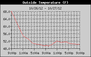
Cold air came into Alabama on the heels of a cold front which moved through the area last night. The temperature changed very little today as you can see from the temperature trace below. In fact, nearly all of the reporting stations in Central Alabama observed their high temperatures for the day at 12:01 am. […]

Read More

Overnight Lows

Overnight Lows

| October 27, 2012 @ 6:00 pm

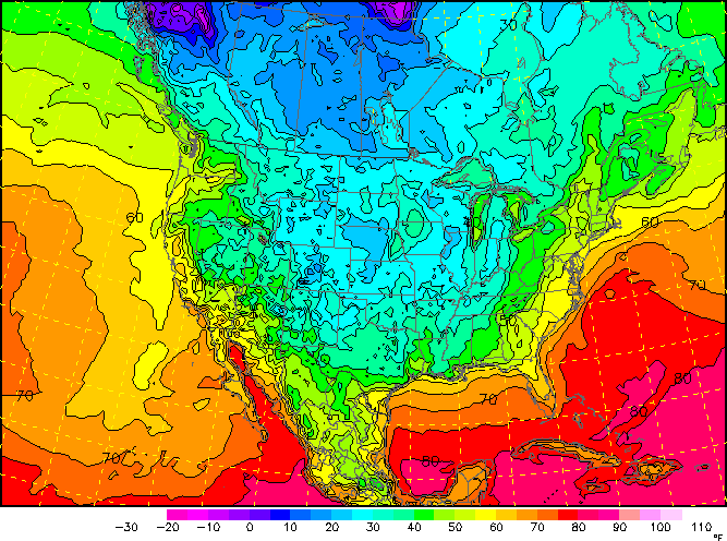
As we head into the overnight hours temperatures will continue to drop across the state. Below is the forecast temperature map for early Sunday morning. Much of central Alabama will have overnight lows in the low 40s, with north Alabama getting down into the mid-to-upper 30s. Temperatures will not go as low as they could […]

Read More

4 p.m. Fast Facts on Sandy

4 p.m. Fast Facts on Sandy

| October 27, 2012 @ 4:14 pm

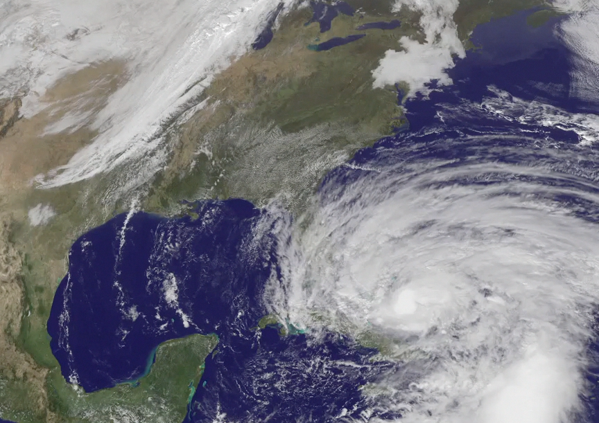
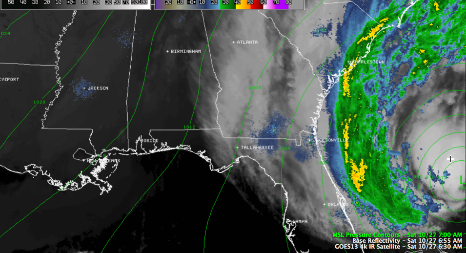
Hurricane Sandy continues pushing northeast this afternoon. It is expected to maintain hurricane force winds until it makes landfall, which is forecast to occur after midnight Monday night. It will make the transition to a non-tropical low sometime on Monday. FAST FACTS AT 4 ———————————————- LOCATION…30.2N 75.2W ABOUT 335 MI…540 KM ESE OF CHARLESTON SOUTH […]

Read More

Sandy’s Impact on Alabama

Sandy’s Impact on Alabama

| October 27, 2012 @ 3:00 pm

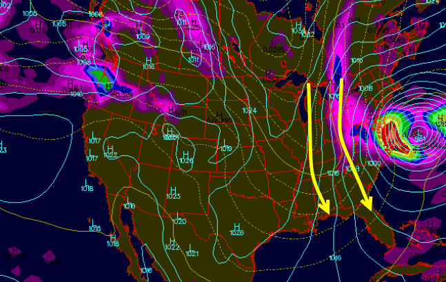
Very often as strong storm systems head up the East Coast of the United States, they will influence the weather of Alabama. Last night a strong cold front moved across the state, which is typical for this time of year. Usually temperatures will remain cold for 2 or 3 days and then begin to moderate. […]

Read More

Quick Check on Sandy

Quick Check on Sandy

| October 27, 2012 @ 1:06 pm

Sandy is still a hurricane early this afternoon. It definitely has a warm core, with a temperature inside the eye of 24C, vs 17C outside the eye. The plane found maximum flight level winds of 82 mph in the southwestern quadrant just after 11 a.m., with a 91 knot report earlier. They maintain Sandy as […]

Read More

Clouds are Hanging Around Today

Clouds are Hanging Around Today

| October 27, 2012 @ 1:00 pm

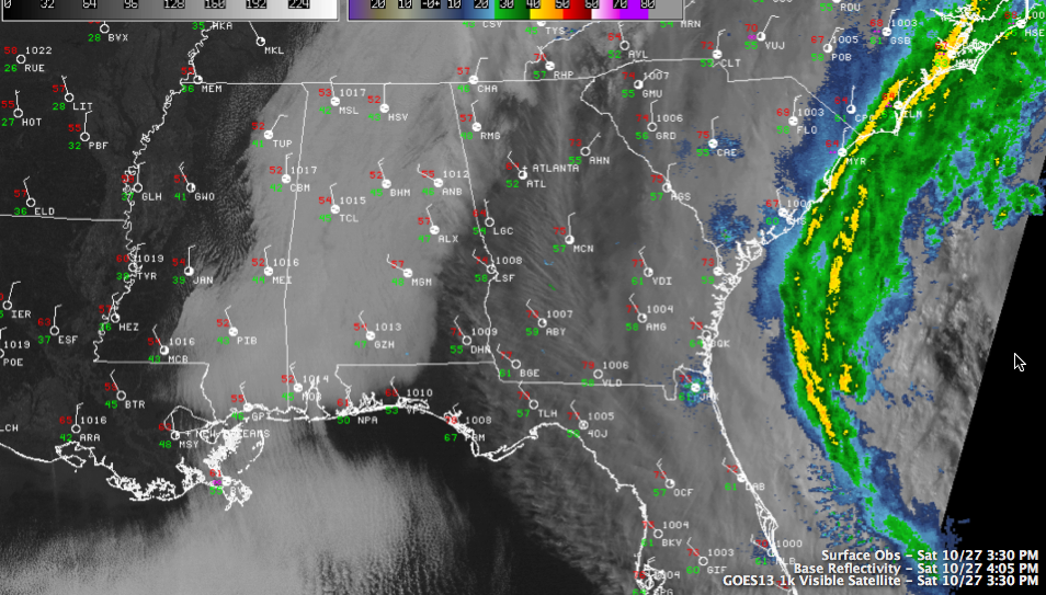
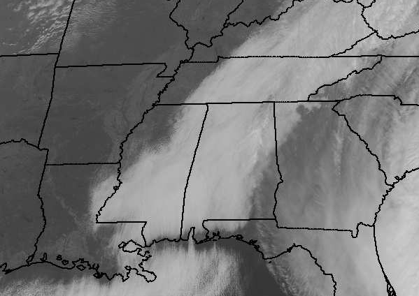
As we look at the latest satellite image, the clouds are hanging around Alabama, clearing line is in northwest Mississippi and is slowly working it ways towards us. Parts of northwest Alabama could see some peeks of sunshine later this afternoon, but for the rest of us, it is going to be a struggle to […]

Read More

WeatherBrains Sandy Special

WeatherBrains Sandy Special

| October 27, 2012 @ 9:18 am

This was recorded live last night…

Read More

Colder Plus Big East Coast Storm

Colder Plus Big East Coast Storm

| October 27, 2012 @ 8:47 am

An all new edition of the ABC 33/40 Weather Xtreme video is available in the player on the right sidebar of the blog. You can subscribe to the Weather Xtreme video on iTunes by clicking here. 8:49 am – Some technical problems and I’m working on getting the audio fixed in the Weather Xtreme Video. […]

Read More

Sandy A Hurricane (Again)

Sandy A Hurricane (Again)

| October 27, 2012 @ 7:16 am

Sandy was downgraded to a tropical storm earlier this morning, but an Air Force plane has once again found hurricane force winds and it has been upgraded back to hurricane. These small distinctions don’t matter, as it is a function of just a few mph in an observation from a small part of a big […]

Read More