Alabama 811 | Know What's Below.

Archive for February 10th, 2013

Late Night Look

Late Night Look

| February 10, 2013 @ 11:09 pm

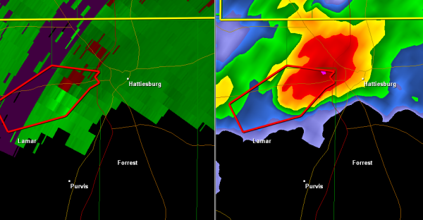
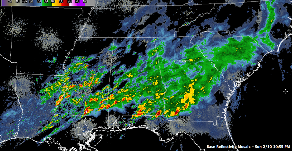
Quick late night check on Central Alabama weather… No severe weather overnight across North Central Alabama. All of the activity has pushed into South Alabama. But showers and storms are increasing in coverage and intensity tonight over southern Mississippi south of I-20. A large severe thunderstorm is unfortunately approaching Hattiesburg, which was hard hit by […]

Read More

No Tornado Warnings

No Tornado Warnings

| February 10, 2013 @ 8:44 pm

A beautiful sight on this Sunday night: no tornado warnings anywhere in the country. The storms have weakened a bit as they have moved into lower dewpoint air over South Alabama.

Read More

Tornado Watch Cancelled

Tornado Watch Cancelled

| February 10, 2013 @ 8:42 pm

All counties in our area have been cleared from the tornado watch. The severe weather has calmed down the last hour or so. Rain and showers continue over central portions of Alabama where flood and flash flood watches remain in place until the morning. 

Read More

Severe Thunderstorm Warning : Pike/Barbour Counties until 830 PM

Severe Thunderstorm Warning : Pike/Barbour Counties until 830 PM

| February 10, 2013 @ 7:43 pm

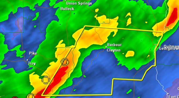
THE NATIONAL WEATHER SERVICE IN BIRMINGHAM HAS ISSUED A * SEVERE THUNDERSTORM WARNING FOR… BARBOUR COUNTY IN SOUTHEAST ALABAMA… SOUTHEASTERN PIKE COUNTY IN SOUTHEAST ALABAMA… * UNTIL 830 PM CST * AT 744 PM CST…THE NATIONAL WEATHER SERVICE INDICATED A LINE OF SEVERE THUNDERSTORMS CAPABLE OF PRODUCING DAMAGING WINDS IN EXCESS OF 60 MPH. THESE […]

Read More

2 more counties out of watch

2 more counties out of watch

| February 10, 2013 @ 7:39 pm

The tornado watch for Lowndes and Montgomery Counties has been cancelled. Barbour, Bullock and Pike remain in the watch that last until 11 PM

Read More

Another Tornado Headed Toward Washington/Choctaw

Another Tornado Headed Toward Washington/Choctaw

| February 10, 2013 @ 7:25 pm

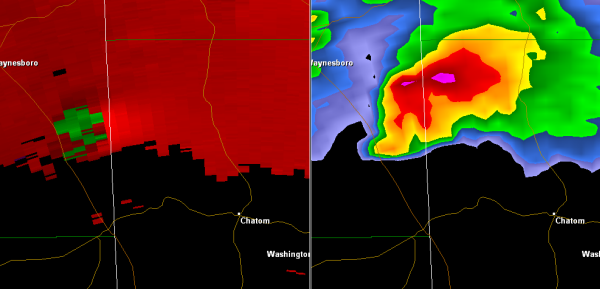
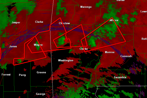
Another tornado is on the ground now just southeast of Waynesboro MS. An Emergency manager in Wayne County reported the tornado on the ground just southwest of Clara at 7:16.

Read More

Extremely Dangerous Storm

Extremely Dangerous Storm

| February 10, 2013 @ 6:47 pm

Latest scan of this storm shows a very strong velocity couplet. This storm continues to produce a large, violent and very dangerous tornado. Very dangerous storm crossing the Alabama state line. This is the same storm that produced widespread damage in Hattiesburg. The storm has consistently had a very strong couplet with a debris ball. […]

Read More

Watch Changes

Watch Changes

| February 10, 2013 @ 6:37 pm

For Marengo and Dallas Counties the tornado watch has been cancelled. The tornado watch continues for Lowndes, Montgomerym Barbour, Bullockn and Pike Counties until 11 Pm THIS INCLUDES THE CITIES OF…EUFAULA…FORT DEPOSIT… LOWNDESBORO…MONTGOMERY…TROY AND UNION SPRINGS.   

Read More

Heads Up Washington, Choctaw and Clarke Counties

Heads Up Washington, Choctaw and Clarke Counties

| February 10, 2013 @ 6:28 pm

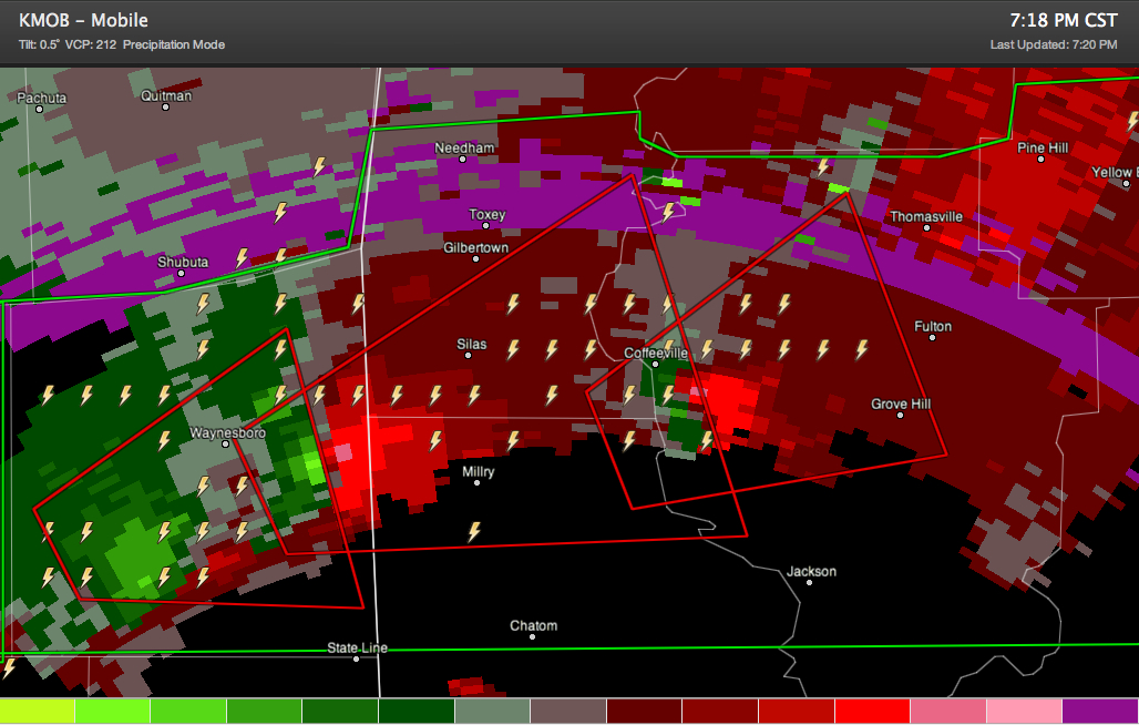
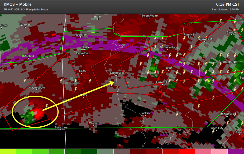
Very dangerous tornado still clearly indicated on radar now over southern Wayne County MS passing south of Waynesboro. It will move into northern Washington and southern Choctaw Counties and into Clarke County. Folks from Milry and Silas northeastward to Coffeyville then to Thomasville and Grove Hill need to be making initial preparations and watching this […]

Read More

Numerous tornado signatures in Southern Mississippi and Alabama.

Numerous tornado signatures in Southern Mississippi and Alabama.

| February 10, 2013 @ 5:57 pm

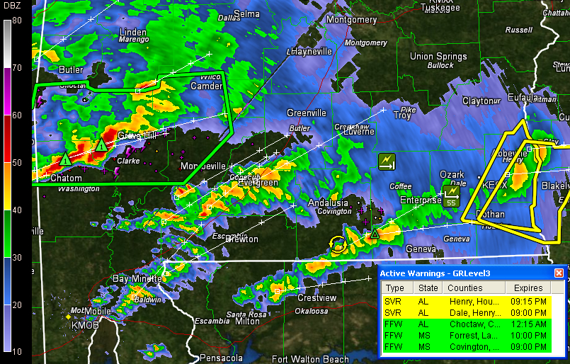
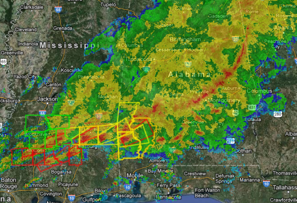
No county in our area is under a warning currently, but numerous tornado warned storms across southwest Alabama and southeast Mississippi. Here is a look at the numerous velocity couplets in the area. The couplet in the northwest portions of Perry County Mississippi is responsible for the large tornado that moved through the Hattiesburg area […]

Read More

Image of Hattiesburg Tornado

Image of Hattiesburg Tornado

| February 10, 2013 @ 5:50 pm

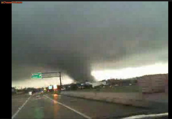
Large tornado going through Hattiesburg, MS. Widespread damage reported through out the town. Photo courtesy of chasertv.com

Read More

Mississippi Tornado Reports

Mississippi Tornado Reports

| February 10, 2013 @ 5:44 pm

Reports are always sketchy at first following a tornado event. Here is some information taken from reports of the Jackson NWS office this afternoon. 3:42 pm 3 SE Arm, Lawrence County Home damaged along with trees and powerlines down. Possible tornado. Additional report of 3 homes damaged along with several barns. 4:28 pm 1 WSW […]

Read More

Tornado Emergency for Hattiesburg

Tornado Emergency for Hattiesburg

| February 10, 2013 @ 5:16 pm

The latest scan shows a very intense velocity couplet very near Hattiesburg. Continued reports of a large violent tornado on the ground. Numerous reports from storm spotters and local law enforcement in southern Mississippi of a large violent and very dangerous tornado on the ground approaching Hattiesburg. Reports of significant damage with this cell. The […]

Read More

Strong Storms to our South

Strong Storms to our South

| February 10, 2013 @ 5:12 pm

Moderate and heavy rain continues to fall across Central Alabama, strong and severe thunderstorms are ongoing across Southwest Alabama and Southern Mississippi. Looks as though the main severe weather threat has shifted south of much of our area. Numerous tornadoes warning to our south, and it looks as though a tornado is heading toward the […]

Read More