Alabama 811 | Know What's Below.

Archive for June 27th, 2013

Storms Dropping South, An Active Friday

Storms Dropping South, An Active Friday

| June 27, 2013 @ 10:38 pm

Some showers and thunderstorms developed over East Alabama this evening. A few of them even reached severe limits and did produce tree and power line damage in several counties southeast of Birmingham. These storms have since pushed out of our CWA. Over the last few hours some additional strong storms developed along a boundary in […]

Read More

Evening Radar Check

Evening Radar Check

| June 27, 2013 @ 8:53 pm

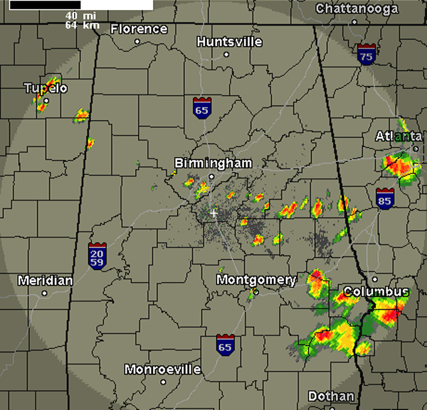
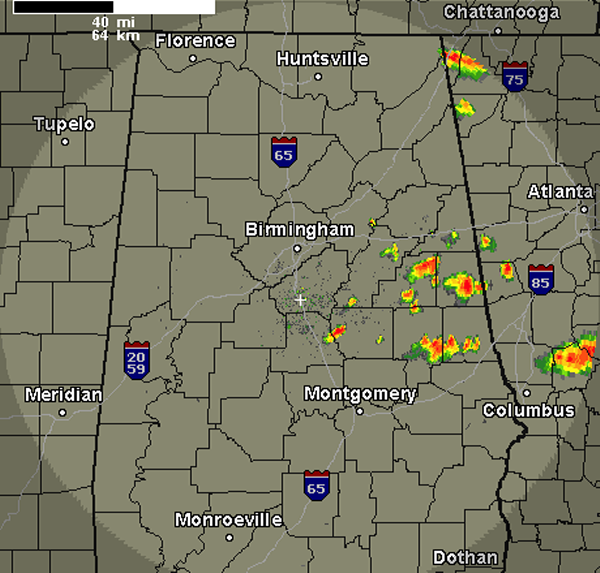
A quick look at the radar this evening shows a few additional showers and thunderstorms are developing across portions of Central Alabama. Thunderstorms have popped up across Randolph, Clay, Talladega, Coosa, Shelby, Jefferson and Lamar Counties. These storms are developing along a boundary and they will continue to drop south and are producing lightning and […]

Read More

Severe Thunderstorm Warning Barbour/Bullock/Russell

Severe Thunderstorm Warning Barbour/Bullock/Russell

| June 27, 2013 @ 7:40 pm

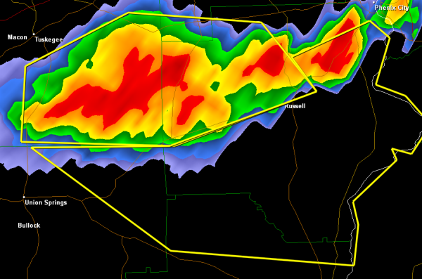
Severe storms continue to drop south this evening. The storms will be impacting Highways 431, 82 and 26. Hurtsboro, Seale and Pittsville are some of the communities that are in this storm’s path. These storms are producing frequent lightning, torrential rain and could be producing hail. The main threat with these storms remains the threat […]

Read More

Severe Thunderstorm Warning Lee/Macon/Russell

Severe Thunderstorm Warning Lee/Macon/Russell

| June 27, 2013 @ 7:10 pm

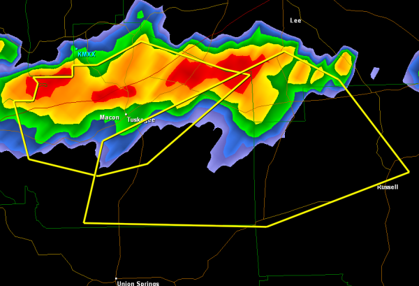
A complex of severe storms continues to drop southward over East Alabama. These storms have a history of producing damaging winds and numerous tree and power lines have been damaged. The core of these storms is south of Interstate 85 and will be impacting Highways 80, 51 and 26. THE NATIONAL WEATHER SERVICE IN BIRMINGHAM […]

Read More

Severe Thunderstorm Warning Elmore/Macon/Tallapoosa

Severe Thunderstorm Warning Elmore/Macon/Tallapoosa

| June 27, 2013 @ 6:44 pm

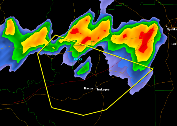
A severe thunderstorm capable of producing large hail and damaging winds is affecting portions of these three counties. Interstate 85 along with the cities of Tuskegee, Tallassee and Franklin are being impacted. This storm continues to drop south. THE NATIONAL WEATHER SERVICE IN BIRMINGHAM HAS ISSUED A * SEVERE THUNDERSTORM WARNING FOR… SOUTHEASTERN ELMORE COUNTY […]

Read More

Early Evening Radar Check

Early Evening Radar Check

| June 27, 2013 @ 5:24 pm

A quick look at the radar this evening shows that showers and thunderstorms have developed across portions of East Alabama. The storms that have developed are not currently severe and should remain below severe limits. We will have to keep and eye on them as they could pulse up and reach severe limits briefly with […]

Read More

Still Watching for Thunderstorm Development

Still Watching for Thunderstorm Development

| June 27, 2013 @ 3:42 pm

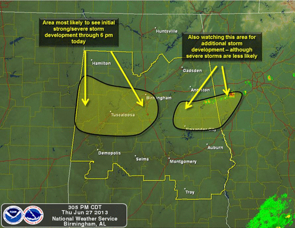
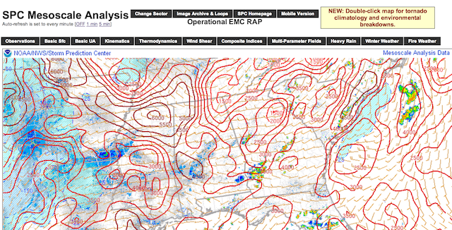
A very unstable air mass remains in place across Alabama this afternoon. Showers and thunderstorms can develop rapidly with the amount of CAPE across the state. CAPE values are greater than 5000 J/kg in many areas and that will provide the fuel for strong and severe storms if they can develop. There is a capping […]

Read More

Unsettled Summer Weather

Unsettled Summer Weather

| June 27, 2013 @ 1:32 pm

**No afternoon Weather Xtreme video today…. I have been at the American Meteorological Society Conference on Broadcast Meteorology in Nashville, and am on the way back home this afternoon. Back to the “two a day” video schedule tomorrow** UNSTABLE AIR: We expect more thunderstorm development in the moist, unstable environment across Alabama this afternoon. Seems […]

Read More

Severe Weather Watch Possible

Severe Weather Watch Possible

| June 27, 2013 @ 12:40 pm

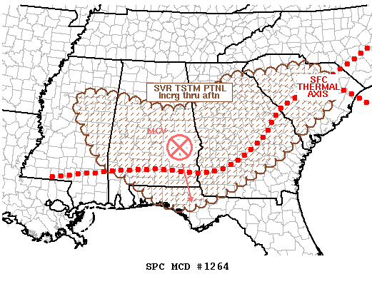
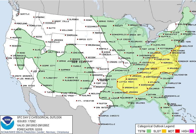
In the latest day one convective outlook, the SPC maintains much of Alabama in their standard slight risk for severe weather today. This risk mainly includes areas along and south of Interstate 20. A very moist and unstable air mass is conducive for shower and thunderstorm development this afternoon. Storm that develop could produce damaging […]

Read More

Severe Storm Over NE Alabama

Severe Storm Over NE Alabama

| June 27, 2013 @ 8:31 am

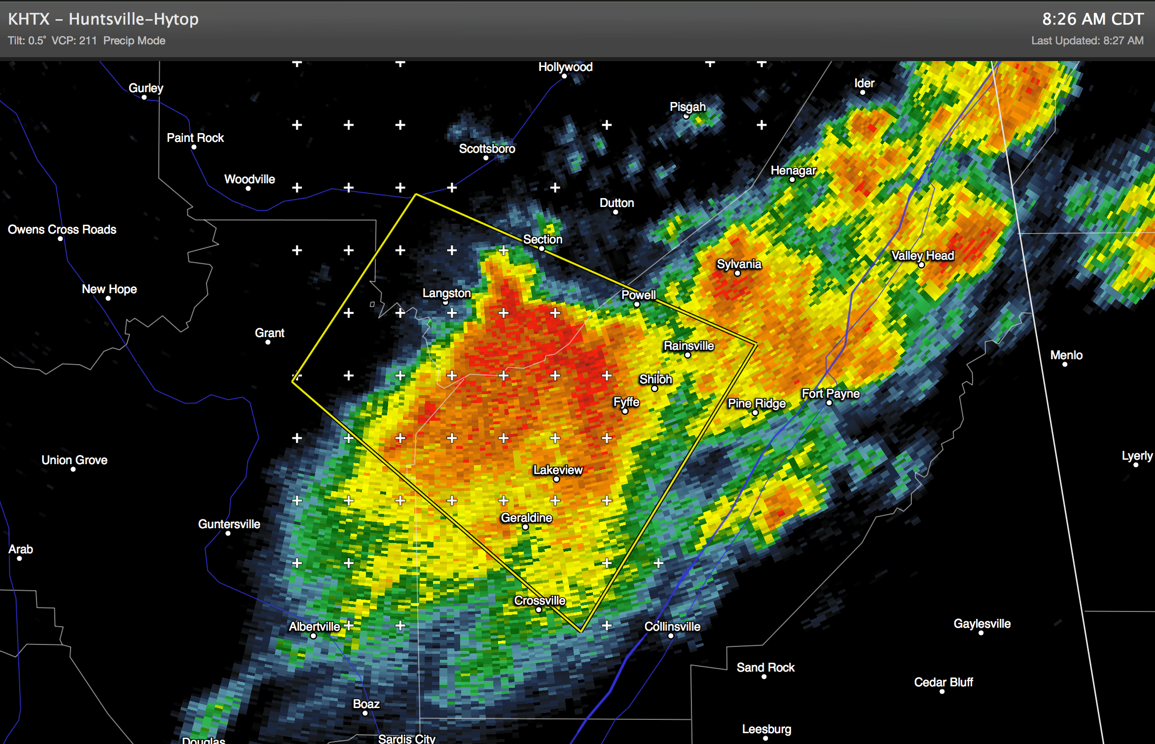
A severe thunderstorm is over parts of Jackson, Marshall, and DeKalb Counties this morning… moving southeast. The storm could produce some hail and strong, gusty winds. More storms are possible later today… scroll down for the morning forecast discussion and see the Weather Xtreme video….

Read More

Moist Air Blankets Alabama

Moist Air Blankets Alabama

| June 27, 2013 @ 6:24 am

An all new edition of the ABC 33/40 Weather Xtreme video is available in the player on the right sidebar of the blog. You can subscribe to the Weather Xtreme video on iTunes by clicking here. EARLY MORNING STORMS: A line of strong storms has been moving south across North Alabama during the pre-dawn hours… […]

Read More