Alabama 811 | Know What's Below.

Archive for July, 2013

Flash Flood Warning for Cullman County until 2:45 a.m.

Flash Flood Warning for Cullman County until 2:45 a.m.

| July 31, 2013 @ 11:50 pm

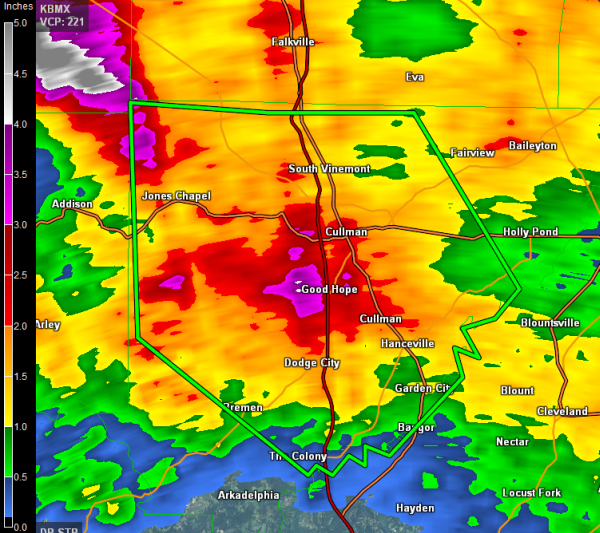
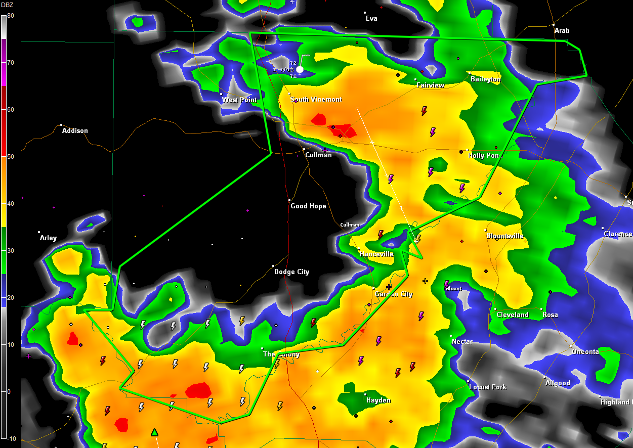
Flooding is occurring across parts of Cullman County and additional heavy rains will be moving over the area for the next couple of hours. Some areas have picked up 3-5 inches over the past two days. Remember, turn around, don’t drown! THE NATIONAL WEATHER SERVICE IN HUNTSVILLE HAS ISSUED A * FLASH FLOOD WARNING FOR… […]

Read More

Heavy Thunderstorms Late Tonight

Heavy Thunderstorms Late Tonight

| July 31, 2013 @ 11:34 pm

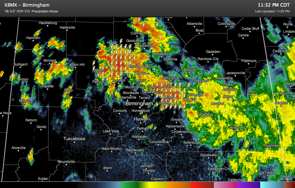
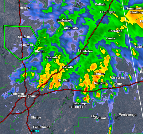
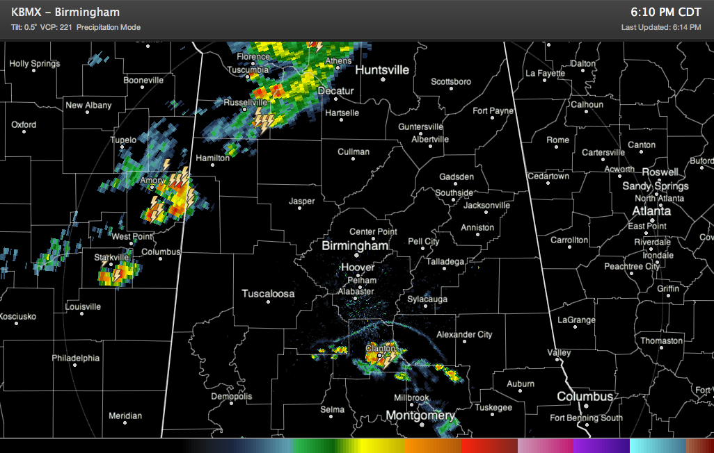
Heavy thunderstorms are massing to the northwest of the Birmingham Metro and moving southeast. They are intensifying from southeastern Winston County across eastern Walker into Cullman, southwestern Blount and northern Jefferson County. Lots of lightning and very heavy rain is being reported, but the storms are not severe. The thunder is very loud as well. […]

Read More

More Showers and Storms Developing

More Showers and Storms Developing

| July 31, 2013 @ 8:53 pm

Convection continues to develop this evening and the radar is really beginning to fill in across North-Central Alabama. Activity is dropping to the east-southeast and will continue that movement through the overnight hours. Some of the more intense activity is occurring in Pickens, Tuscaloosa, Blount, Marion and Cullman Counties. Storms are producing gusty winds, tremendous […]

Read More

Quick Evening Radar Check

Quick Evening Radar Check

| July 31, 2013 @ 7:18 pm

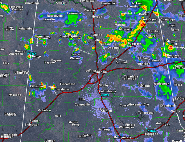
Scattered showers and storms have developed in several locations across Central Alabama this evening. Some of the more intense storms currently are affecting portions of Calhoun, Talladega and Walker Counties. Storms are producing gust winds, frequent and dangerous lightning and torrential rain. Over the next few hours storms will continue to drop towards the southeast. […]

Read More

Severe Thunderstorm Warning Lowndes County til 5:30PM

Severe Thunderstorm Warning Lowndes County til 5:30PM

| July 31, 2013 @ 4:40 pm

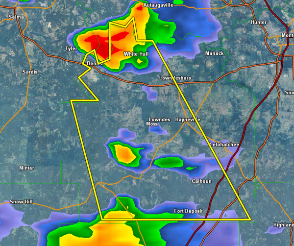
A severe thunderstorm is moving south across central Lowndes County this afternoon. It will be impacting areas along U.S. Highway 80 and State routes 21, 97 and 263. If the storm holds together it could make it to Interstate 65 and highway 31. Hail and damaging winds are the greatest threat with this storm as […]

Read More

Lone Strong Storm in Birmingham Metro

Lone Strong Storm in Birmingham Metro

| July 31, 2013 @ 2:10 pm

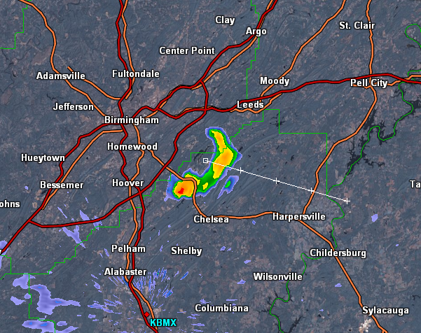
An intense thunderstorm is passing through areas on the southeast side of Birmingham. Very heavy rain, lightning and gusty winds are impacting area in northeast Shelby County along U.S. Highway 280 around Inverness and Meadowbrook. This storm is tracking off to the southeast and could impact areas around Harpersville and Chelsea. Strong, non-severe storms are […]

Read More

Unsettled Weather Throughout the Day

Unsettled Weather Throughout the Day

| July 31, 2013 @ 10:42 am

Heavy showers and storms continue to drop south across eastern portions of Alabama this morning. The leading edge of the more intense activity is now impacting portions of Chambers, Tallapoosa and Coosa Counties. It will be heading towards the Interstate 85 corridor and will impact areas around Auburn, Tuskegee and Montgomery. More showers and storms […]

Read More

Morning Radar Check

Morning Radar Check

| July 31, 2013 @ 8:14 am

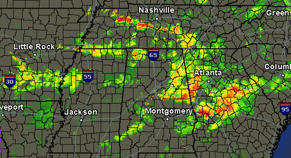
The weather will be quite unsettled today. We are already seeing showers and thunderstorms affecting many areas. A quick look at the radar this morning shows strong storms east of Interstate 65 from the Birmingham Metro to the Georgia state line. Currently the more intense activity is impacting portions of eastern Jefferson County near Trussville […]

Read More

Stormy Day on Tap

Stormy Day on Tap

| July 31, 2013 @ 6:52 am

An all new edition of the ABC 33/40 Weather Xtreme video is available in the player on the right sidebar of the blog. You can subscribe to the Weather Xtreme video on iTunes by clicking here. Several thunderstorm clusters developed along and south of the cluster that moved through Tennessee yesterday afternoon. These clusters produced […]

Read More

Flash Flood Warning Cullman County til 9:15 AM

Flash Flood Warning Cullman County til 9:15 AM

| July 31, 2013 @ 6:16 am

Very heavy rain has been falling across much of Cullman County this morning. Radar estimates show 3-4 inches have fallen in some areas with several roads under water. This warning includes the city of Cullman and driving conditions are being impacted along Interstate 65 and highways 31 and 69. Remember to TURN AROUND, DON’T DROWN. […]

Read More

Flash Flood Warning for Pike County

Flash Flood Warning for Pike County

| July 30, 2013 @ 10:17 pm

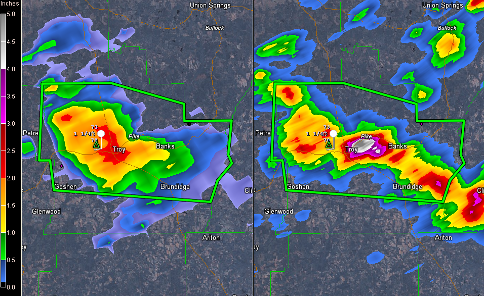
Slow moving thunderstorms have dumped as much as four or more inches of rain in and around Troy in Pike County in South Central Alabama. THE NATIONAL WEATHER SERVICE IN BIRMINGHAM HAS ISSUED A * FLASH FLOOD WARNING FOR… PIKE COUNTY IN SOUTHEAST ALABAMA… * UNTIL 100 AM CDT * AT 1014 PM CDT…LOCAL LAW […]

Read More

Showers and Storms Arriving on Cue

Showers and Storms Arriving on Cue

| July 30, 2013 @ 6:17 pm

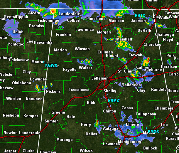
Showers and thunderstorms are northwestern Alabama and eastern Mississippi this evening, as if on cue according to the forecast. Heavy storms are over Colbert, Lauderdale and Lawrence Counties. Other are about to enter Lamar County. This activity is pushing southeastward into the state. To the south, storms are over Chilton County, They are pushing northward, […]

Read More

Quick Afternoon Update

Quick Afternoon Update

| July 30, 2013 @ 2:22 pm

It has turned into another warm day across Central Alabama as the air has warmed nicely with readings at 2 pm around the 90 degree mark. In fact, the observation at the Birmingham airport was 90 – it might go another degree or two higher – which marks only the fourth time in July for […]

Read More

Dry Today And Wetter Wed and Thu

Dry Today And Wetter Wed and Thu

| July 30, 2013 @ 6:57 am

An all new edition of the ABC 33/40 Weather Xtreme video is available in the player on the right sidebar of the blog. You can subscribe to the Weather Xtreme video on iTunes by clicking here. A quick look at the upper air sounding from the Shelby County Airport from last night’s run shows the […]

Read More