Alabama 811 | Know What's Below.

Archive for July 5th, 2013

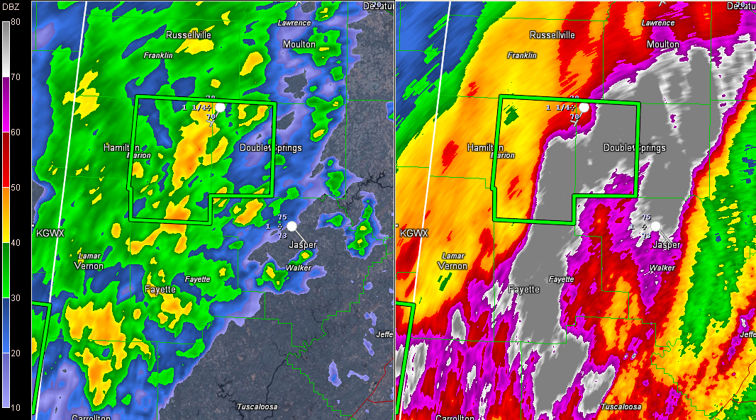
Flash Flood Warning for Parts of Marion and Winston

Flash Flood Warning for Parts of Marion and Winston

| July 5, 2013 @ 7:40 pm

AND ANOTHER LATE REPORT AT 9:59 Samantha Poe reports via Twitter: “Haleyville PD reporting possibility of foundation being washed from under railroad on AL Ave. No confirmation yet.” UPDATE – 9:35 PM Samantha Poe reports via Twitter: “Mud slides reported at old textile location on Alabama Ave in Haleyville. 13 flooded and impassable at Dime […]

Read More

Showers Continue

Showers Continue

| July 5, 2013 @ 5:13 pm

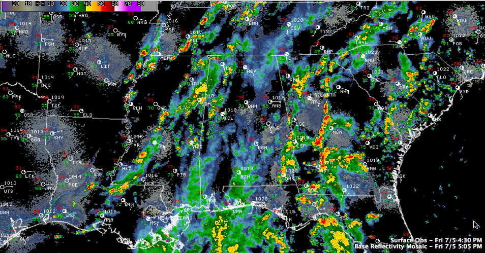
Most of the shower and thunderstorm activity has been over the western part of Alabama today, Some heavy rain moved northward out of the Florida Panhandle, but weakened as it moved away from the coast. To the east, showers and thunderstorms have been fired this afternoon along a wave of energy coming around the Bermuda […]

Read More

Still Wet At Times Through Tomorrow

Still Wet At Times Through Tomorrow

| July 5, 2013 @ 4:40 pm

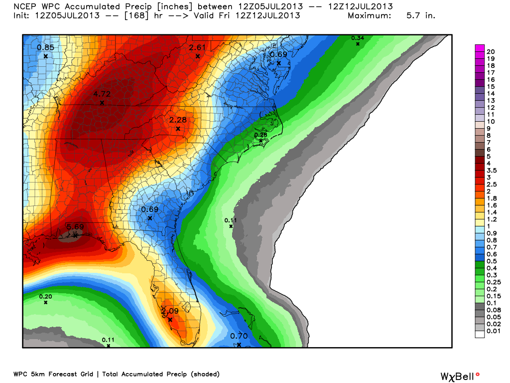
**No afternoon Weather Xtreme video today… back to the “two a day” schedule Monday** SOGGY: The National Weather Service in Birmingham has opted to continue the flash flood watch for much of Alabama through tomorrow as a deep tropical moisture axis remains in place. Below is the expected rain over the next 7 days from […]

Read More

Heavy Rain in Tuscaloosa Area

Heavy Rain in Tuscaloosa Area

| July 5, 2013 @ 1:10 pm

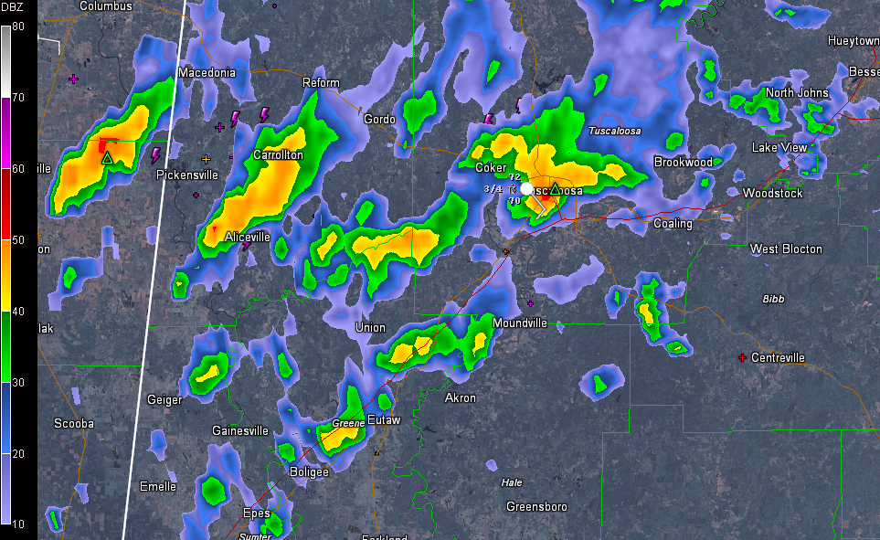
Thunderstorms with heavy rain are impacting the Tuscaloosa area now. Here is the radar, showing the heavy rain and storms extending over into Pickens County. The storms are producing up to 2.5 inches of rain in an hour, which will cause localized flooding. Some reports of flooding are being received from Tuscaloosa. Flooding reported in […]

Read More

Tornado Warning for Destin

Tornado Warning for Destin

| July 5, 2013 @ 12:50 pm

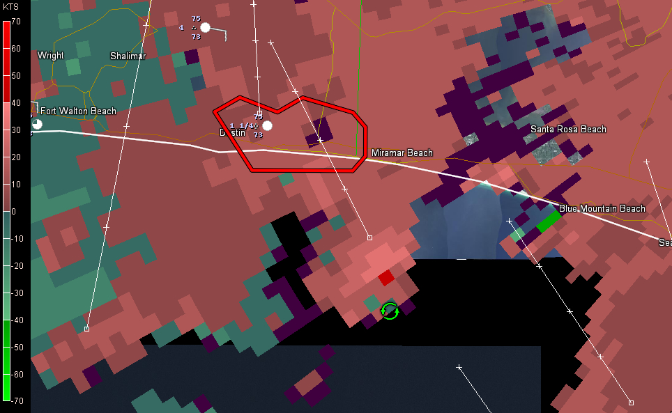
UPDATE 1:12 PM Here is a Twitter photo of a waterspout offshore from Destin. Tornado warning remains in effect for part of Okaloosa County. New warning forthcoming. Credit: Brian Ponder (@bamadirt29) ORIGINAL POST The NWS in Mobile has issued a tornado warning for the Destin area in Northwest Florida. Circulation showing up on Doppler radar […]

Read More

Some Crazy Rainfall Totals

Some Crazy Rainfall Totals

| July 5, 2013 @ 11:00 am

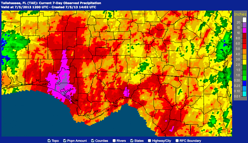
How about these extreme rainfall amounts from northwestern Florida, courtesy of the NWS Tallahassee? PUBLIC INFORMATION STATEMENT NATIONAL WEATHER SERVICE TALLAHASSEE FL 1143 AM EDT Fri Jul 5 2013 /1043 AM CDT Fri Jul 5 2013/ …LATEST EXTREME STORM TOTAL RAINFALL AMOUNTS…. INLET BEACH (WALTON CO) 19.14 0700 AM 07/05 RIVERSIDE (WASHINGTON CO) 18.50 0530 […]

Read More

Occasional Tropical Showers Continue

Occasional Tropical Showers Continue

| July 5, 2013 @ 7:18 am

An all new edition of the ABC 33/40 Weather Xtreme video is available in the player on the right sidebar of the blog. You can subscribe to the Weather Xtreme video on iTunes by clicking here. WET IS STILL THE WORD: Not much change in the overall weather pattern across Alabama through tomorrow. Copious amounts […]

Read More