Alabama 811 | Know What's Below.

Archive for July 20th, 2013

Heading into Sunday

Heading into Sunday

| July 20, 2013 @ 8:27 pm

Nearly all the convection from today has since dissipated over the last few hours since the sun has set. It should be a fairly nice evening and night across most of Central Alabama, but there still could be a very isolated storm pop up during the overnight hours. Let’s recap what happened today. As expected, […]

Read More

Isolated Storms Continue

Isolated Storms Continue

| July 20, 2013 @ 6:31 pm

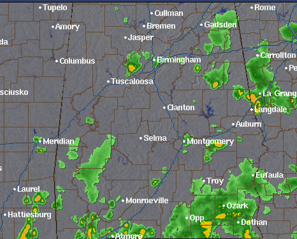
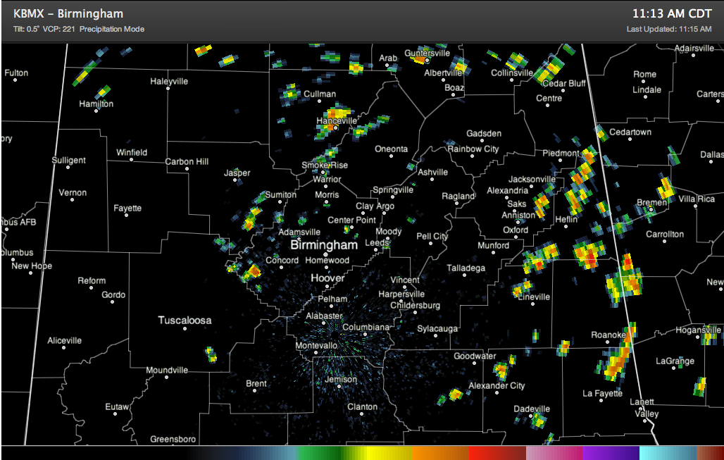
For most for most of today, showers and thunderstorms have impacted areas across Alabama. More widespread activity has been over eastern portions of the state, with even some flooding reported in Calhoun County. As we head into this evening, there are still some loud thunderboomers ongoing in some areas. A more intense storm is ongoing […]

Read More

Wet Weather Remains in the Forecast

Wet Weather Remains in the Forecast

| July 20, 2013 @ 5:00 pm

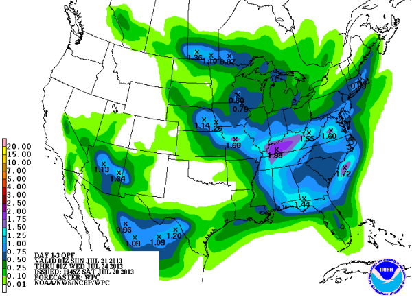
Scattered showers and storms are lighting up the radar again today. If you are not seeing rain now, odds are you will over the next 72 hours. The latest QPF outlook shows that most of Alabama could see close to an inch of rain between now and Tuesday afternoon with some areas receiving a little […]

Read More

Strong Storms in Birmingham Metro

Strong Storms in Birmingham Metro

| July 20, 2013 @ 3:04 pm

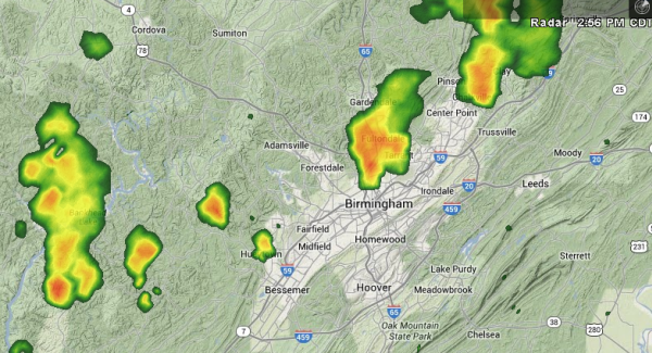
Over the last few minutes, several strong storms have developed across Jefferson County and the metro area. Across the western part of the county, storms are impacting areas along the Warrior River, in around Oak Grove, Sylvan Springs and Hueytown. There is a strong thunderstorms just north of downtown Birmingham impacting areas around Tarrant, Fultondale, […]

Read More

Afternoon Radar Check

Afternoon Radar Check

| July 20, 2013 @ 2:34 pm

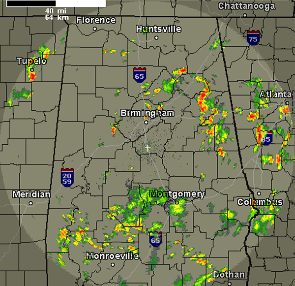
Late this morning, showers and storms began to develop across the Alabama landscape. As we continue to head through the afternoon, these showers and storms have continued to develop. The most intense activity has been across East Alabama today, affecting portions of Etowah, Calhoun, Cleberne, Clay, Chambers and Randolph Counties. The last few radar scan […]

Read More

The Flood Proof City

The Flood Proof City

| July 20, 2013 @ 12:59 pm

The weather forecast for Johnstown, PA on July 19, 1977 called for a 30 percent chance of thundershowers. Forecasters knew that it would take less than four inches of rain in three hours to cause flash flooding, but no flash flood watches were in effect despite the fact that a warm, moist airmass was in […]

Read More

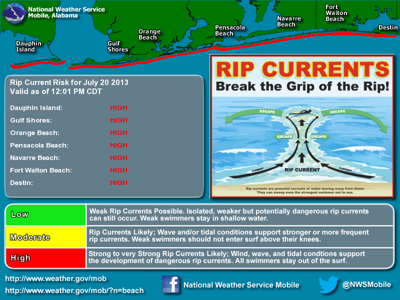
High Rip Current Risk on Alabama/NW Florida Beaches

High Rip Current Risk on Alabama/NW Florida Beaches

| July 20, 2013 @ 12:28 pm

Alert your friends and family members who might be vacationing along the beaches of Alabama and NW Florida about the importance of obeying the double red flags that are out. Storms this morning along the coast have produced rough surf that is causing the rip currents.

Read More

Bad Wreck on I-65 SB/Showers and Storms Forming Already

Bad Wreck on I-65 SB/Showers and Storms Forming Already

| July 20, 2013 @ 11:18 am

FIRST AN IMPORTANT TRAFFIC NOTE The @Spann Twitter Army alerted everyone to a major accident on I-65 southbound just south of Walkers Chapel Road. @JohnTalbot reports the SB interstate is closed. Lots of emergency vehicles. Southbound traffic backed up for miles with accidents in the traffic jam as well. Northbound traffic is starting to back […]

Read More

National Highlights

National Highlights

| July 20, 2013 @ 9:20 am

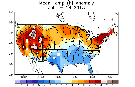
July temperatures in the northeastern United States have run as much as 6-8 degrees F above normal so far in July, and they will experience one more day of sweltering heat before a cold front brings some relief tomorrow. A heat advisory is in effect for the Megapolis from Boston to Washington, DC, including New […]

Read More

Clouds and Showers Persist

Clouds and Showers Persist

| July 20, 2013 @ 7:06 am

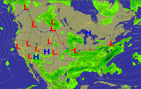
An all new edition of the ABC 33/40 Weather Xtreme video is available in the player on the right sidebar of the blog. You can subscribe to the Weather Xtreme video on iTunes by clicking here. Looks like we are dealing with a fairly complex pattern for the weekend and early next week that should […]

Read More