Alabama 811 | Know What's Below.

Archive for July 24th, 2013

Latest on Dorian

Latest on Dorian

| July 24, 2013 @ 9:52 pm

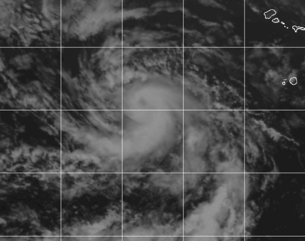
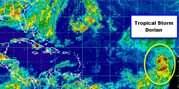
This morning we got our newest tropical storm in the Atlantic Basin as tropical depression 4 was upgraded to a tropical storm and given the name Dorian. Dorian is a typical Cape Verde storm as he developed way out in the Atlantic near the Cape Verde Islands. Dorian looks fairly impressive on satellite and has […]

Read More

Storms Persist this Evening

Storms Persist this Evening

| July 24, 2013 @ 7:03 pm

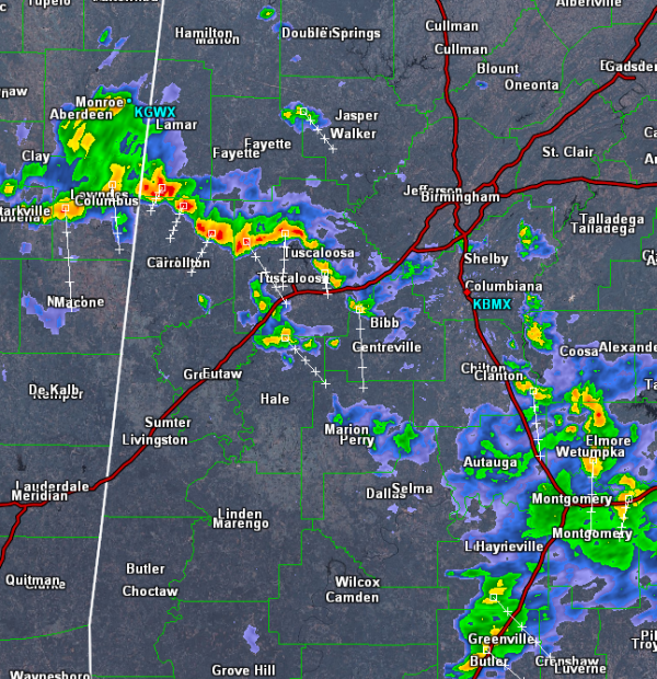
This seemingly unending bombardment of showers and storms in Alabama continues again this evening. Multiple locations are once again seeing heavy rain and storms. Currently the more intense storms are over western portions of Alabama. A line of storms from Columbus, Mississippi to northeast of Tuscaloosa are experiencing some intense storms. Lightning, heavy rain and […]

Read More

Strong Storms across West-Central Alabama

Strong Storms across West-Central Alabama

| July 24, 2013 @ 4:18 pm

As we have headed through this afternoon, some intense thunderstorms have developed in scattered areas across western portions of the state. These storms are not currently severe, but like we have seen over the past few days, torrential rain, gusty winds, hail and tremendous amounts of lightning are occurring with these storms. These storms could […]

Read More

Drier Weather Tomorrow And Friday

Drier Weather Tomorrow And Friday

| July 24, 2013 @ 3:38 pm

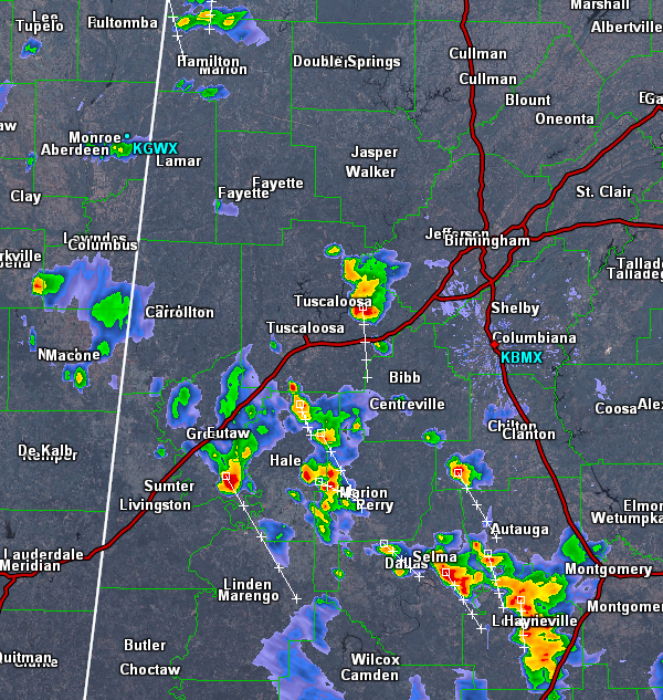
An all new edition of the ABC 33/40 Weather Xtreme video is available in the player on the right sidebar of the blog. You can subscribe to the Weather Xtreme video on iTunes by clicking here. RADAR PEEK: The most widespread rain over Alabama this afternoon is over the southern counties of the state, but […]

Read More

Severe Thunderstorm Warning Russell County until 2:45PM

Severe Thunderstorm Warning Russell County until 2:45PM

| July 24, 2013 @ 2:10 pm

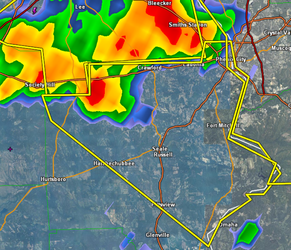
UPDATE: Lee County 911 is reporting that this storm has blown down trees along highway 29 near Beans Mill. A thunderstorm with a history of producing wind damage is now moving into portions or Russell County. Seale, Crawford, Ladonia will be impacted this storms as well as some major roadways through the county. Highways 431, […]

Read More

Strong Storms to our Southwest

Strong Storms to our Southwest

| July 24, 2013 @ 1:44 pm

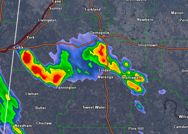
Some strong storms have developed over western portions of the state as well. Strong storms have developed in Sumter County and have moved east into Marengo County. The storms are not currently severe but are producing heavy rain, frequent lightning and gusty winds. The are impacting areas along highways 43 and 25 as well as […]

Read More

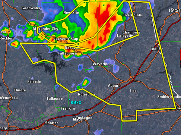
Severe Thunderstorm Warning Chambers/Coosa/Lee/Tallapoosa

Severe Thunderstorm Warning Chambers/Coosa/Lee/Tallapoosa

| July 24, 2013 @ 1:16 pm

UPDATE: Emergency manager of Tallapoosa County confirms damage from these storms. Several trees have been blown down in the Horseshoe Bend area as well as trees blown down in eastern portions of the county. Trees have been reported down on homes as well. Severe storms are moving southeast across these areas and continues to have […]

Read More

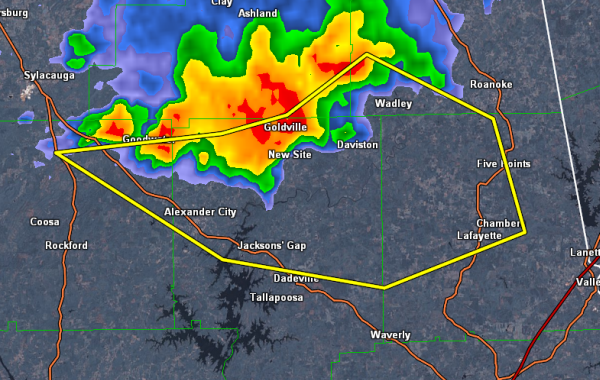
Severe Thunderstorm Warning Chambers/Clay/Coosa/Randolph/Tallapoosa

Severe Thunderstorm Warning Chambers/Clay/Coosa/Randolph/Tallapoosa

| July 24, 2013 @ 12:44 pm

A very strong thunderstorm continues to drop south across eastern portions of the state. The storm currently affecting Goodwater, Goldville and Wadley will be impacting areas along highways 280 and 431 as well as the communities of Alexander City, Jackson’s Gap and Lafayette. This storm is likely producing damaging winds and hail along with frequent […]

Read More

Strong Storms over East Alabama

Strong Storms over East Alabama

| July 24, 2013 @ 11:58 am

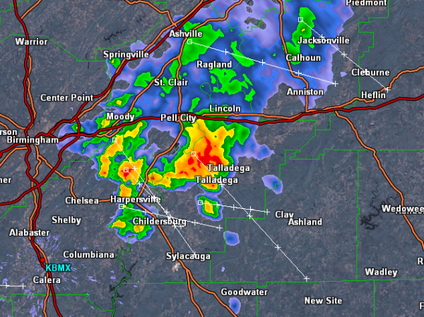
Another day with strong thunderstorms impacting portions of Alabama. Currently there is a strong thunderstorm dropping south across eastern portions of the state. The worst of the activity is to the south of Interstate 20 and is impacting areas of Shelby and Talladega Counties and is heading towards Clay County. Frequent lightning, torrential rain, gusty […]

Read More

Watch for Flooding in Blount County

Watch for Flooding in Blount County

| July 24, 2013 @ 10:37 am

Heavy rainfall is falling across portions of Blount County this morning as showers and thunderstorms track southeast across the county. The NWS has issued an Areal Flood Advisory for the county until 11:30 AM. Saturated grounds are allowing for maximum run-off and this could allow for creeks and streams to flood easily. Use caution and […]

Read More

Tropical Storm Dorian has formed in the Atlantic

Tropical Storm Dorian has formed in the Atlantic

| July 24, 2013 @ 9:29 am

This morning, tropical depression 4 has been upgraded to a tropical storm. We now have Dorian in the far eastern Atlantic. Over the last 24 hours this system has become very well organized and the latest satellite image shows and well developed and impressive center of circulation. Dorian is still a long way out and […]

Read More

Thunderstorms Over North Central Alabama

Thunderstorms Over North Central Alabama

| July 24, 2013 @ 9:20 am

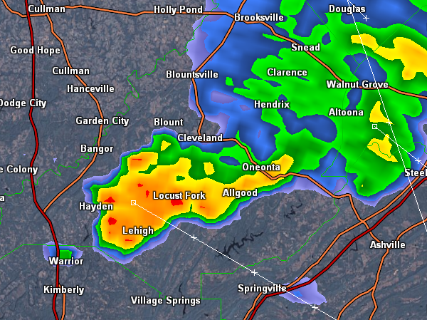
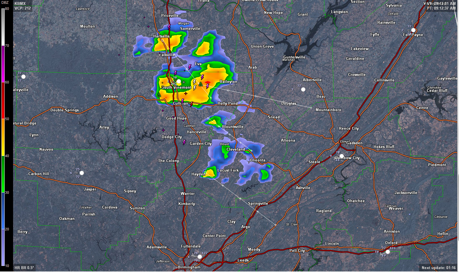
Thunderstorms have developed this morning over North Central Alabama. They are currently affecting extreme southern Morgan and northern Cullman Counties, with some showers over Blount County. Here is the radar at 9:16: The activity is moving southeast and will affect areas from the City of Cullman over to Holly Pond down to Hanceville, Blountsville and […]

Read More

More Showers/Storms Later Today

More Showers/Storms Later Today

| July 24, 2013 @ 6:27 am

An all new edition of the ABC 33/40 Weather Xtreme video is available in the player on the right sidebar of the blog. You can subscribe to the Weather Xtreme video on iTunes by clicking here. RADAR CHECK: It is a fairly quiet morning across Alabama; we note a few showers near Montgomery, and a […]

Read More