Alabama 811 | Know What's Below.

Archive for January 5th, 2014

Good News

Good News

| January 5, 2014 @ 10:09 pm

The Winter Weather Advisory has been cancelled since the precipitation is ending before temperatures get to critical levels and roads seem to be drying nicely. Having said that, there will still be places with standing water on roadways overnight that will freeze into dangerous black ice, which is hard to prepare for if you are […]

Read More

8:35 p.m. Quick Notes

8:35 p.m. Quick Notes

| January 5, 2014 @ 8:34 pm

Light snow sticking to grassy areas in Winston Co according to Michael G as of 8:30. This snow will probably work into Cullman County where we have seen a report of 32F. Richard Viola in Lake View reports 42F with temperature falling at 9 degrees per hour. The back edge of the precip extends from […]

Read More

Winds Gust to 45 mph at BHM

Winds Gust to 45 mph at BHM

| January 5, 2014 @ 7:58 pm

Winds gusted to 45 mph at the Birmingham Airport at around 7:42 p.m. as the front arrived. There have been a few isolated reports of trees down as the high winds passed. Be alert to that possibility. John Talbot reports power is out in parts of the Virginia Mines area. Steven Mizelle in Warrior reports […]

Read More

Quick Reports

Quick Reports

| January 5, 2014 @ 7:05 pm

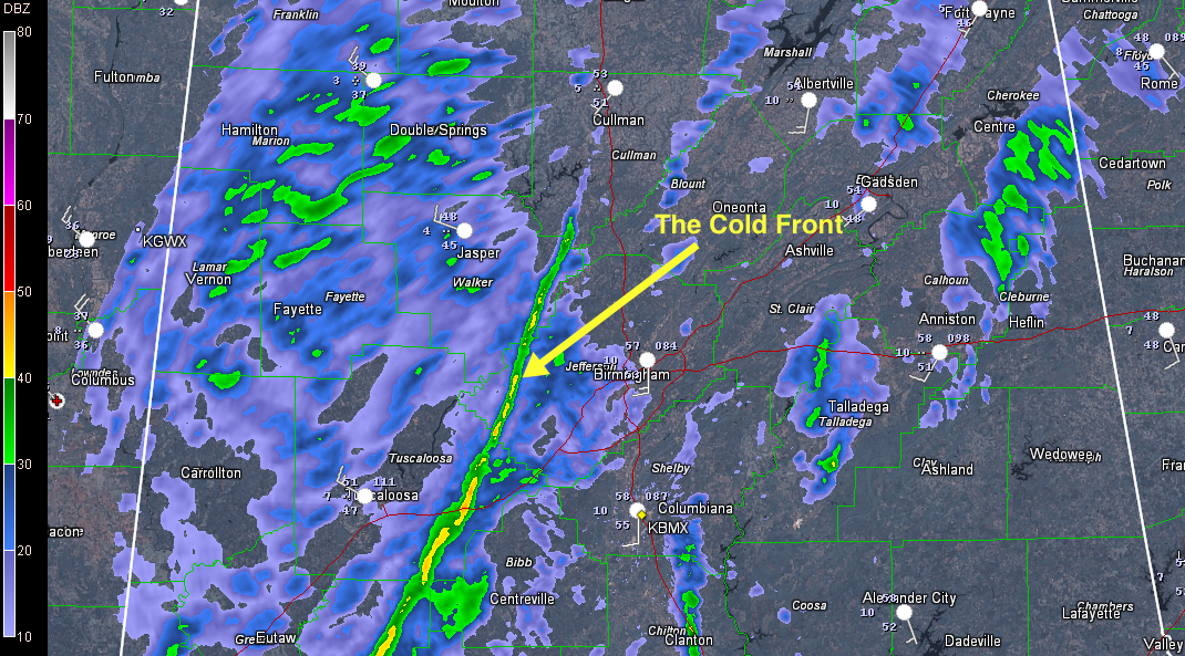
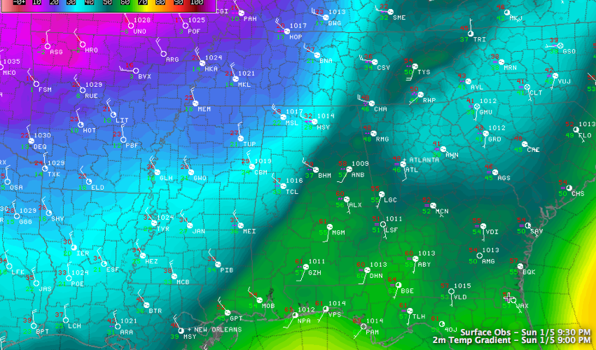
Our front has passed Jasper and Tuscaloosa as of 6:45. Ryan Stinnett reports that he just had FROPA at 7:02 (fancy meteorologist talk for frontal passage) with intense wind and rain burst followed by howling winds. He is located near Bull City in western Jefferson County. The wind gusted to 43 mph at the Tuscaloosa […]

Read More

Front Into Alabama

Front Into Alabama

| January 5, 2014 @ 6:05 pm

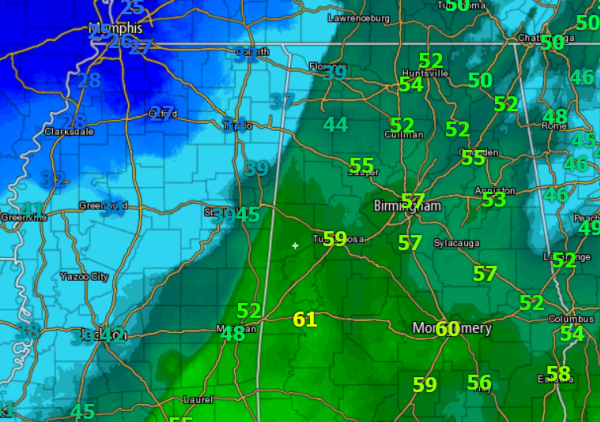
The front we have been waiting on is now moving into the state. Temperatures are falling on this side of the state line and freezing temps are not that far away. The edge of the cold air is approaching Tuscaloosa, Berry, Jasper, Double Springs, and Moulton. The 30s are into the state now, and those […]

Read More

Checking on our Front

Checking on our Front

| January 5, 2014 @ 4:14 pm

It’s not hard to find our cold front this afternoon. It has crossed over the Mississippi River in western Mississippi. It has passed Greenwood and is approaching Tupelo at this hour. It is now about 60 miles west of Marion and Lamar Counties. It is pushing southeast at 20-25 mph. It should arrive in Hamilton […]

Read More

This Week in Weather History: Back in 2009…

This Week in Weather History: Back in 2009…

| January 5, 2014 @ 3:30 pm

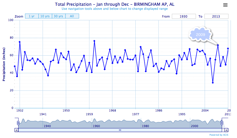
With all the talk about the upcoming wintry weather event, I thought we might shift gears for a moment and look back at some weather history that doesn’t involve cold and that happened on this date. Back in 2009, heavy rains fell across North Central Alabama between January 5-7. The most rain fell from Walker […]

Read More

A Few National Notes On Our Storm

A Few National Notes On Our Storm

| January 5, 2014 @ 2:45 pm

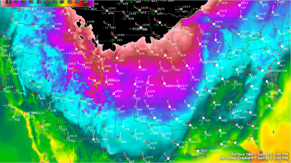
You know it’s bad when your graphic doesn’t have a color for the temperatures being experienced over the Northern Plains and Upper Midwest. All that area colored in black represents temperatures less than -10F. Our winter storm is affecting a wide area with storm and dangerously cold wind chills. Wind chill values may touch -65F […]

Read More

The Waiting Game

The Waiting Game

| January 5, 2014 @ 2:33 pm

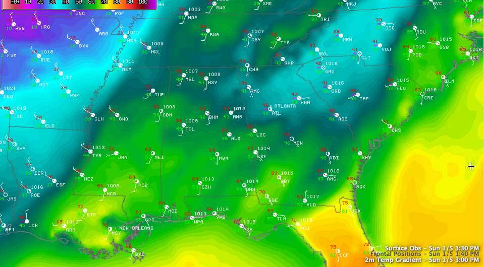
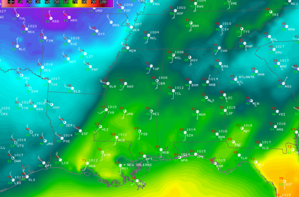
As we wait on the Arctic front and air mass to make its way into Alabama, I believe we are not the only ones taking precautions and preparing for the Arctic blast. First a quick update on the front’s location. Looking for the temperature gradient, it appears the front is crossing the Mississippi River now. […]

Read More

Watching It Happen

Watching It Happen

| January 5, 2014 @ 1:47 pm

For several days, we’ve been telling people about the extreme cold that was coming our way. Now we can really watch it unfold. To see how dramatic the temperature change is – and will be for us – just look upstream at the weather observations. The front passed through Memphis between 11:54 am and 12:54 […]

Read More

No Change in the Thinking

No Change in the Thinking

| January 5, 2014 @ 1:34 pm

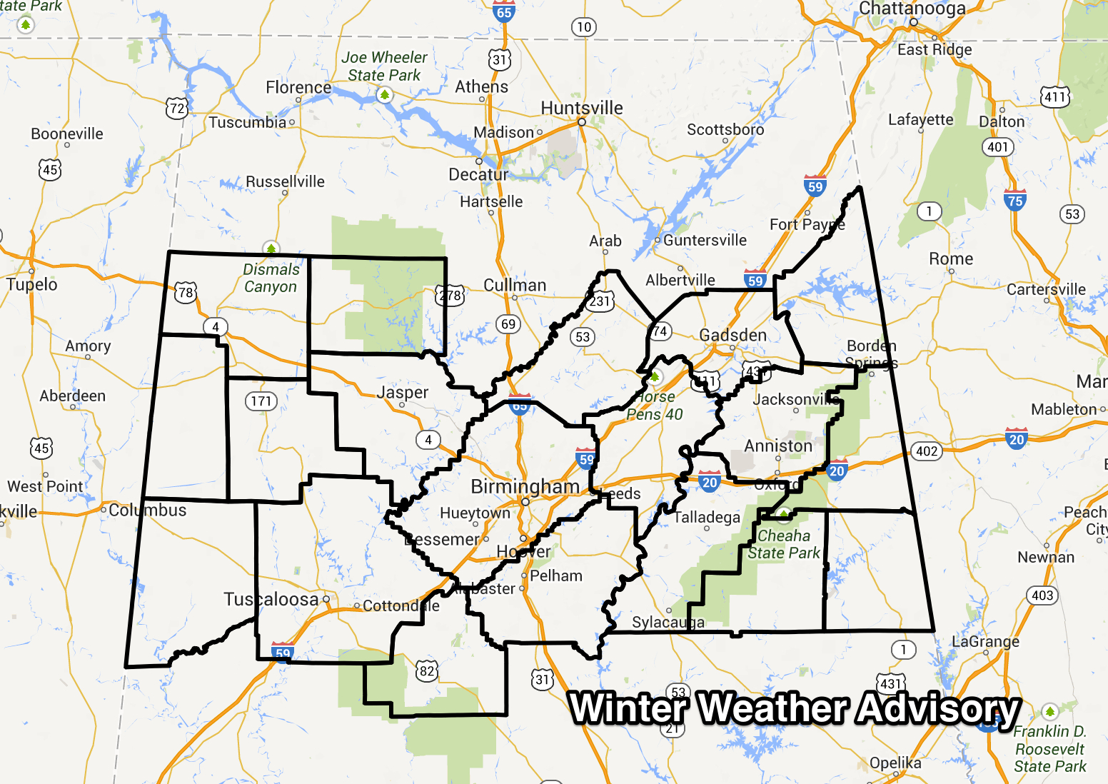
Wow. The blog has taken it’s biggest pounding in terms of viewership since the April 27th outbreak today. It should stay stable the remainder of the event in this high traffic mode. No real changes in the forecast based on the morning model runs. The NWS in Birmingham has posted a Winter Weather Advisory starting […]

Read More

Note For Cullman County

Note For Cullman County

| January 5, 2014 @ 10:39 am

As has been the case for a number of years, I hear of those complaining that we “ignore Cullman County” because they are not under a watch, warning, advisory when Winston County (to the immediate west) and Blount County (to the immediate east) are under one. Today, Cullman County is not under a winter weather […]

Read More

Arctic Front Getting Closer

Arctic Front Getting Closer

| January 5, 2014 @ 8:59 am

Quick update on the Arctic front. The best way to see the current location of the front is to look at the surface temperature map across the U.S. As we do this, we can see the extent of the cold air behind the front. Temperatures across the Midwest are well below zero this morning. Some […]

Read More

Brutally Cold Weather Just Ahead

Brutally Cold Weather Just Ahead

| January 5, 2014 @ 8:15 am

An all new edition of the ABC 33/40 Weather Xtreme video is available in the player on the right sidebar of the blog. You can subscribe to the Weather Xtreme video on iTunes by clicking here. The brutal cold weather that we’ve been talking about is getting set to start later today. The storm system […]

Read More