Alabama 811 | Know What's Below.

Archive for February 4th, 2014

Strong Storm Moving Through Central Alabama

Strong Storm Moving Through Central Alabama

| February 4, 2014 @ 11:03 pm

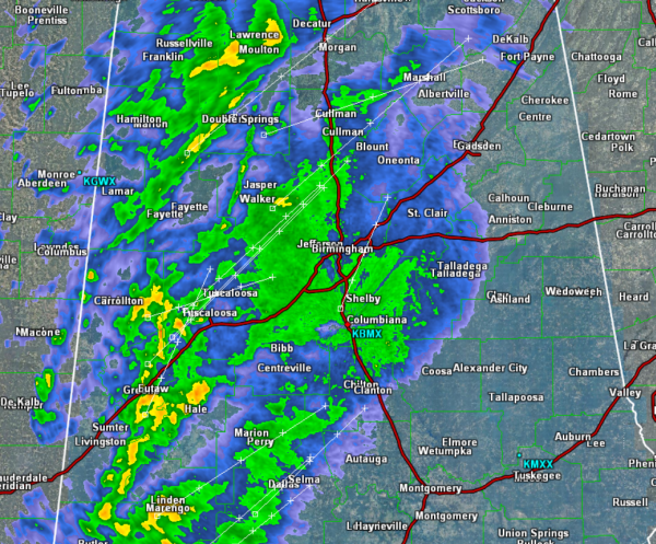
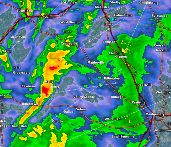
A non-severe thunderstorm is moving across Perry and Dallas Counties. This storm will be impacting Marion, Selma, Valley Grande and Orrville. Travel could be impacted along U.S. 80 & 82. Gusty winds and very heavy rainfall are the main concerns with this thunderstorm as it travels east. …SIGNIFICANT WEATHER ADVISORY FOR PERRY AND NORTHERN DALLAS […]

Read More

Quick Radar Check

Quick Radar Check

| February 4, 2014 @ 10:06 pm

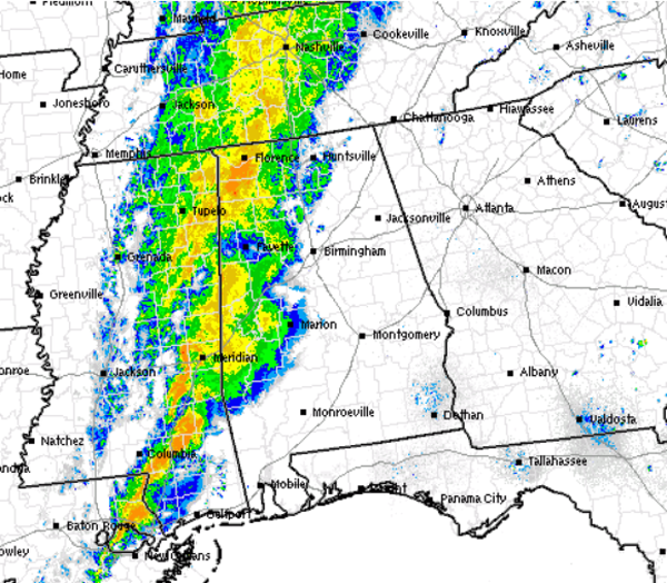
Heavy rain and gusty winds continue to move from west to east across Central Alabama. There are a few thunderstorms embedded within the rain area. The showers and storms will continue to move east through the state the next few hours. Though we are seeing a few strong storms, severe weather is not expected. There […]

Read More

Heavy Rain Approaching I-65

Heavy Rain Approaching I-65

| February 4, 2014 @ 8:55 pm

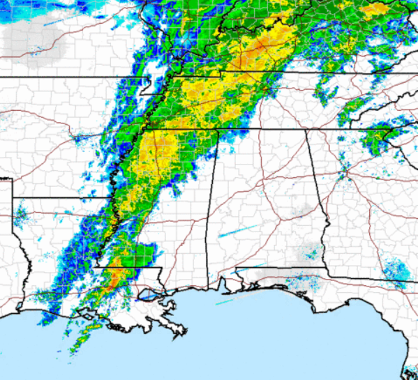
Moderate to heavy rain has made it into Alabama this evening. All our counties in West-Central Alabama are seeing the rain currently, and it continues to spread east. It is raining in Tuscaloosa, Jasper, Demopolis, Sulligent and Hamilton. It will begin to impact the Interstate 65 corridor within the hour. There have been a few […]

Read More

Rain Approaching from the West

Rain Approaching from the West

| February 4, 2014 @ 6:03 pm

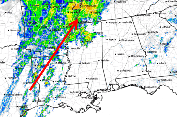
The leading edge of the rain is now making its way into the extreme northwestern counties of the state. Rain is beginning to impact portions of Marion, Franklin, Colbert, and Lauderdale Counties. Over the next few hours we will see the rain shield over northern Mississippi continue to move east into the state. Once the […]

Read More

Good Soaking Tonight; Drier Tomorrow

Good Soaking Tonight; Drier Tomorrow

| February 4, 2014 @ 3:37 pm

An all new edition of the ABC 33/40 Weather Xtreme video is available in the player on the right sidebar of the blog. You can subscribe to the Weather Xtreme video on iTunes by clicking here. RADAR CHECK: Scattered showers are over North Alabama this afternoon, associated with a northward moving warm front. Heavier showers […]

Read More

Midday Update

Midday Update

| February 4, 2014 @ 11:27 am

Showers and a few thunderstorms continue off to our west. The individual cells are lifting northeast as the whole system slowly shifts east today. We are starting to see a few showers enter into northwestern Alabama in Lamar and Marion Counties, while the rest of the state remains cloudy, misty and cool. We are seeing […]

Read More

Another Soaking Ahead For Alabama

Another Soaking Ahead For Alabama

| February 4, 2014 @ 5:58 am

An all new edition of the ABC 33/40 Weather Xtreme video is available in the player on the right sidebar of the blog. You can subscribe to the Weather Xtreme video on iTunes by clicking here. COMPLEX, ACTIVE PATTERN: No dull moments in the weather office with a fast, wavy zonal flow sets up across […]

Read More

WeatherBrains 419:  Talking Snow Forecasting Busts

WeatherBrains 419: Talking Snow Forecasting Busts

| February 4, 2014 @ 5:15 am

3, 2014). If you are crazy about weather, this is THE netcast audio program for you! This week the WeatherBrains gang tackles the events of a week ago in the Southeast US in which two major cities, Atlanta and Birmingham, were crippled by winter storms. Our guests include Dr. John Scala, Meteorologist with WGAL, Harrisburg, […]

Read More

January 2014 – One Of Our Coldest On Record

January 2014 – One Of Our Coldest On Record

| February 4, 2014 @ 4:48 am

From the NWS Birmingham…. JANUARY 2014 RANKED IN THE TOP 5 COLDEST MONTHS FOR BIRMINGHAM, MONTGOMERY, TUSCALOOSA, AND ANNISTON. THESE NUMBERS ARE BASED ON THE AVERAGE TEMPERATURES. HERE ARE THE TOP 10 COLDEST MONTHS FOR THESE SITES… COLDEST MONTHS IN BIRMINGHAM 1 30.6 1/31/1940 2 31.6 1/31/1977 3 33.5 1/31/1978 4 35.5 1/31/1985 5 36.1 […]

Read More