Alabama 811 | Know What's Below.

Archive for February 9th, 2014

GFS Data In

GFS Data In

| February 9, 2014 @ 11:29 pm

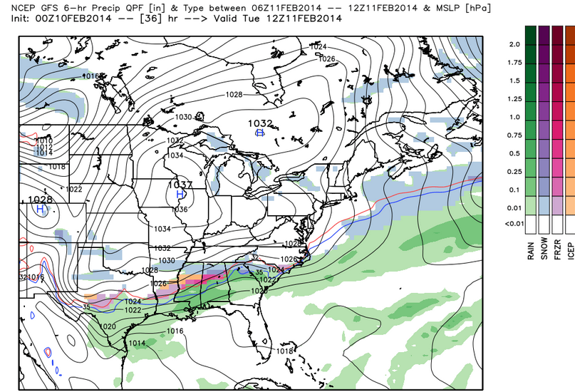
The 0z run of the GFS is in and it still shows strong indications of a decent icing event in the I-20 corridor Tuesday morning with a decent accumulating snow just to the north. Here is the precipitation type output from the GFS between midnight and 6 a.m. Tuesday morning: It could begin as a […]

Read More

First Look at Early Model Data

First Look at Early Model Data

| February 9, 2014 @ 9:14 pm

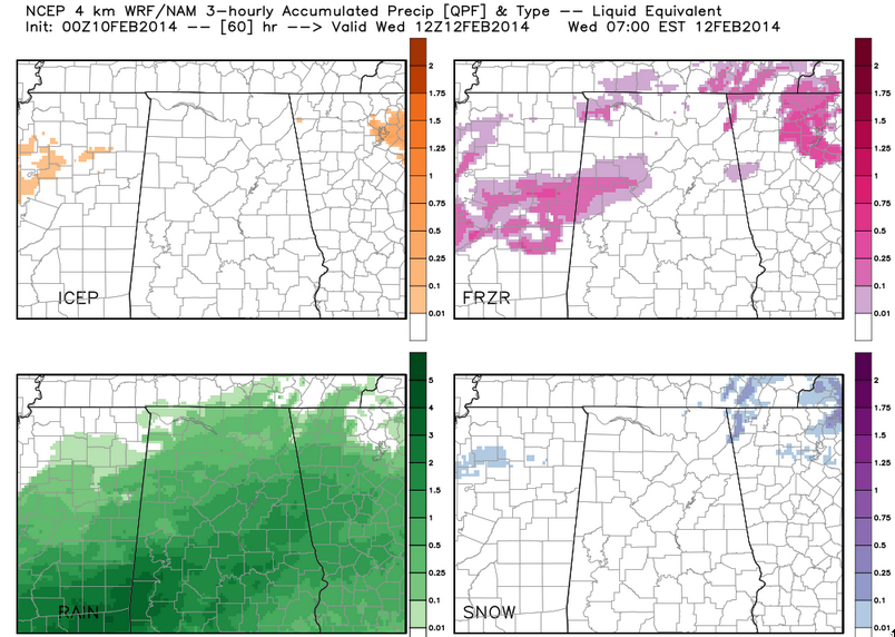
We continue to refine our forecasts in preparation for a significant winter storm that will affect parts of Alabama beginning today. The 6 p.m. run of the NAM depicts a much stronger wave of surface lo pressure developing along the Texas coast late tomorrow night and moving into South Alabama by Wednesday morning. This would […]

Read More

Afternoon Forecast Notes

Afternoon Forecast Notes

| February 9, 2014 @ 4:42 pm

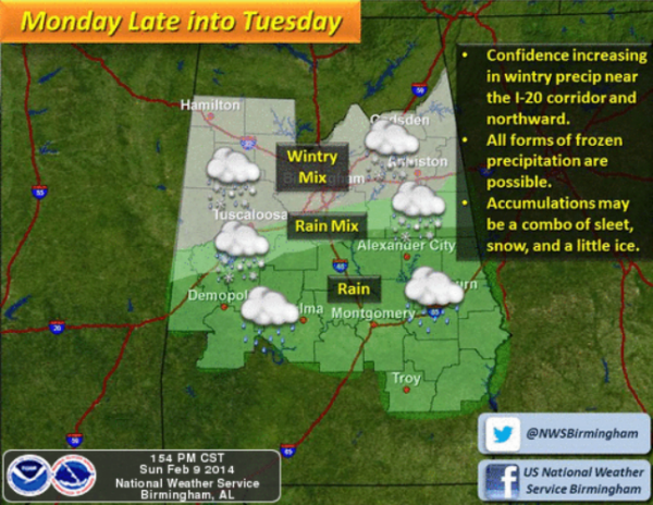
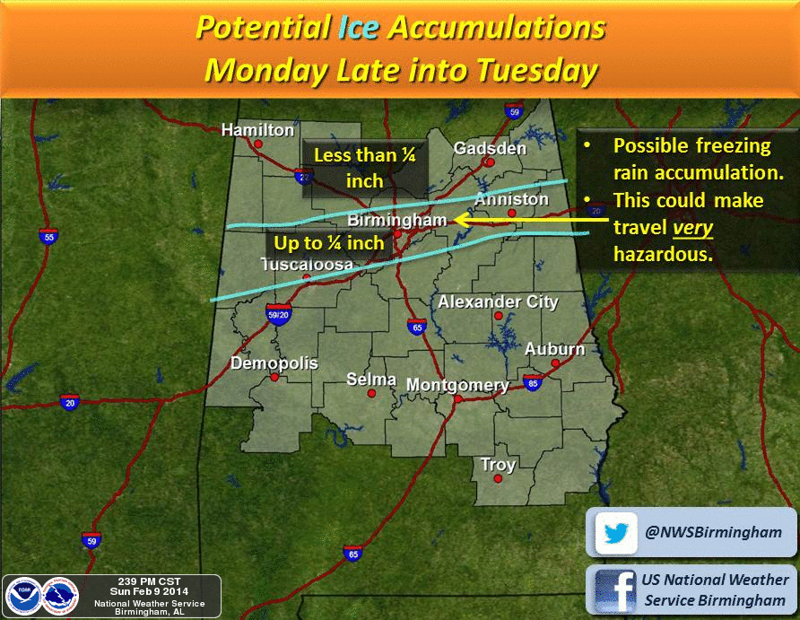
Please scroll down for a detailed meteorological discussion and impact maps for the winter weather event expected in Alabama late tomorrow night into Tuesday. These are the important bullet points for the event. *TIMING: The main initial impact will come from 6:00 p.m. tomorrow through 12:00 p.m. Tuesday. There is some risk wintry precipitation could […]

Read More

Interesting Forecast Ahead

Interesting Forecast Ahead

| February 9, 2014 @ 4:04 pm

THE SETUP: Another area of high pressure is moving out of Canada today and bringing with it more cold air. We have an upper-level low over the Great Lakes today. It will be sending a cold front south and that cold air will begin to move in overnight. You will notice the cooler temps tomorrow. […]

Read More

Quick Update

Quick Update

| February 9, 2014 @ 3:04 pm

Not much change in the overall thinking. A significant winter storm will impact North Alabama late tomorrow night into Tuesday morning. The main threat for the I-20 cities (Birmingham, Tuscaloosa, Anniston) is from ice accumulation due to a wintry mix of freezing rain, sleet, and some snow. The greater snow totals will be around the […]

Read More

A Nice Afternoon Ahead of the Storm

A Nice Afternoon Ahead of the Storm

| February 9, 2014 @ 1:32 pm

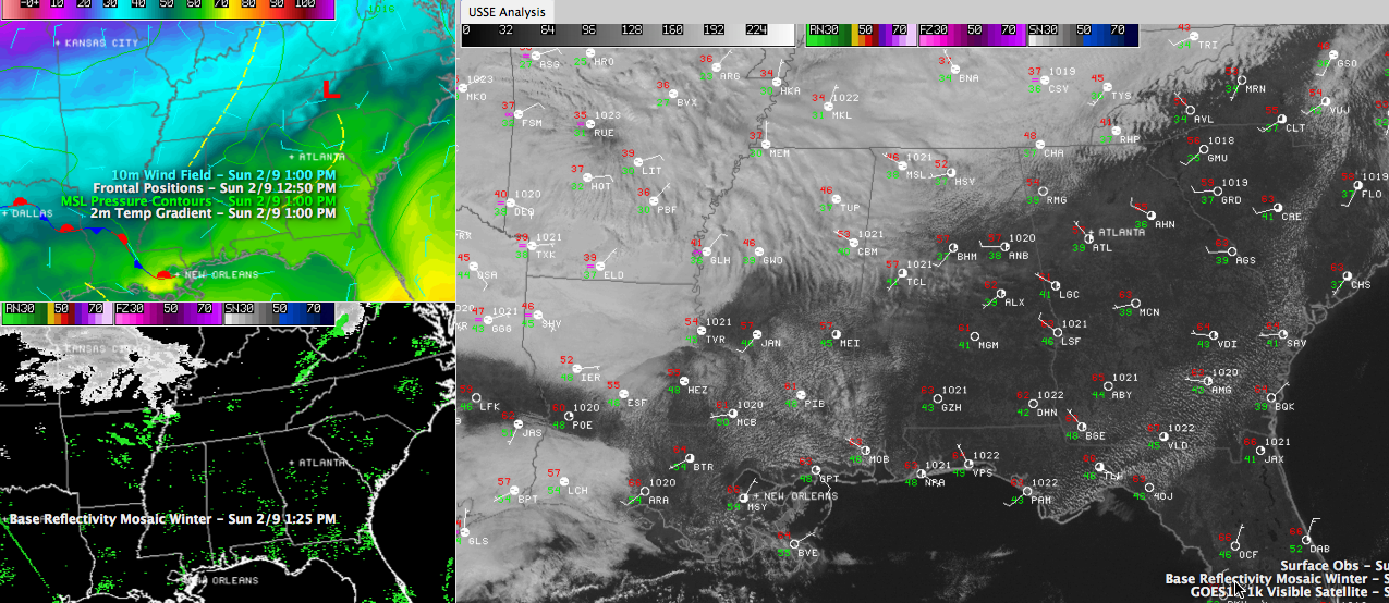
Lost in the shuffle with all the talk about the impending winter storm event is the fact that a beautiful day is in progress across MUCH of Central and South Alabama. Areas along and south of I-59 have abundant sunshine and temperatures well into the 50s and 60s. At 1 p.m., it was 58F at […]

Read More

GFS Data

GFS Data

| February 9, 2014 @ 11:09 am

A quick couple of notes on the new GFS data: …Shows the 32F surface temperature lined up ominously along the I-59 corridor with fairly significant precipitation (0.10-0.25) inches through the corridor and even higher amounts spreading in from the southwest. …This reinforces the theme of a significant icing threat along and either side of I-59 […]

Read More

Model Sounding Data

Model Sounding Data

| February 9, 2014 @ 11:05 am

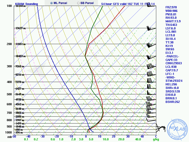
Weather professionals and enthusiasts alike are scrambling to get a look at the latest model runs. Just like many, I’ve been glued to my computer anxiously awaiting the latest data based on the morning upper air soundings and latest observations. It takes awhile to digest all of it, and Bill Murray has already been doing […]

Read More

New NAM Model Data

New NAM Model Data

| February 9, 2014 @ 10:25 am

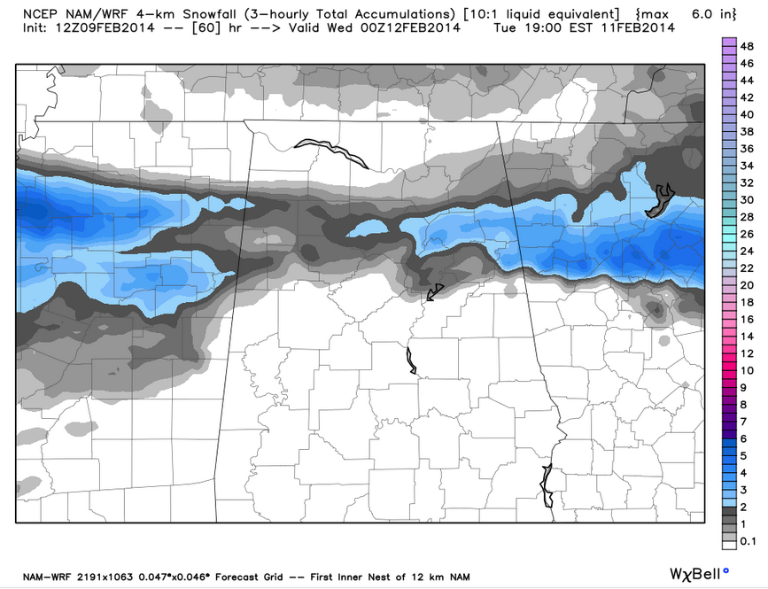
The morning run of the North American Mesoscale model is in and here are some notes: …shows best snow accumulations 1/2-2 inches with some 2-4 inch amounts in a 40-50 mile wide band stretching south from Russellville to Hartselle to Scottsboro southward to a line from Millport to Adamsville to Leeds to south of Oxford. […]

Read More

Potentially Serious Winter Weather Ahead

Potentially Serious Winter Weather Ahead

| February 9, 2014 @ 7:59 am

An all new edition of the ABC 33/40 Weather Xtreme video is available in the player on the right sidebar of the blog. You can subscribe to the Weather Xtreme video on iTunes by clicking here. Before I start this forecast discussion, let me be clear on one extremely important fact. This discussion is NOT […]

Read More

Winter Storm Threat For North Alabama

Winter Storm Threat For North Alabama

| February 9, 2014 @ 6:16 am

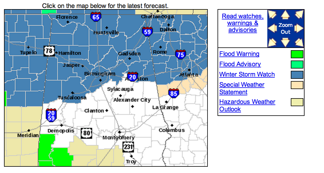
Brian will be along in a bit with the regular Sunday morning discussion and Weather Xtreme video. This is a look at the winter storm potential for Alabama tomorrow night into Tuesday morning. A Winter Storm Watch is in effect for areas generally along and north of I-20. The watch includes Tuscaloosa, Birmingham, Anniston, and […]

Read More