Alabama 811 | Know What's Below.

Archive for February 10th, 2014

11 p.m. Update

11 p.m. Update

| February 10, 2014 @ 11:03 pm

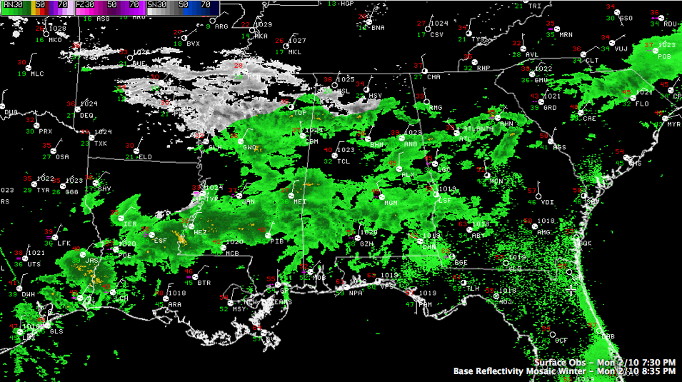
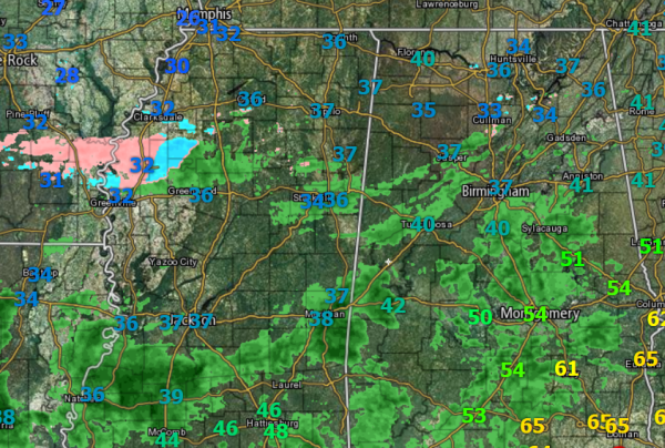
We have been receiving lots of reports tonight of sleet and some snow in North Alabama generally in the US-278 corridor across Marion, Winston, Cullman, Blount and Etowah Counties. Light to moderate sleet in Cullman has changed over to large snowflakes says Huntsville TV met Jennifer Watson. Temperatures now in that area are in the […]

Read More

Update at 8:45 p.m.

Update at 8:45 p.m.

| February 10, 2014 @ 8:46 pm

Many of you have been watching James and Brian on the special live broadcast on the web or on the digital subchannel. Come join us at 8:30 for WeatherBrains. You can see the show live at live.bigbrainsmedia.com. SKYCAM READINGS (Temperature/dewpoint) Birmingham 36/32 Cullman 33/25 Wind: N 7 They will go freezing shortly. Inverness 35/33 Trussville […]

Read More

The Waiting Game

The Waiting Game

| February 10, 2014 @ 5:34 pm

We are still a few hours out from the onset of quite the winter weather event across Central Alabama and the Southeast. More moisture continues to stream in and we are seeing evidence of this as showers have gone from isolated to scattered to now numerous. Light to moderate rain is coming down across many […]

Read More

Messy Winter Storm Ahead

Messy Winter Storm Ahead

| February 10, 2014 @ 3:28 pm

An all new edition of the ABC 33/40 Weather Xtreme video is available in the player on the right sidebar of the blog. You can subscribe to the Weather Xtreme video on iTunes by clicking here. COMPLEX WINTER FORECAST: A challenging forecast for the northern half of Alabama through Wednesday. We have two distinct waves […]

Read More

Winter Storm Warning Issued for Tonight

Winter Storm Warning Issued for Tonight

| February 10, 2014 @ 2:37 pm

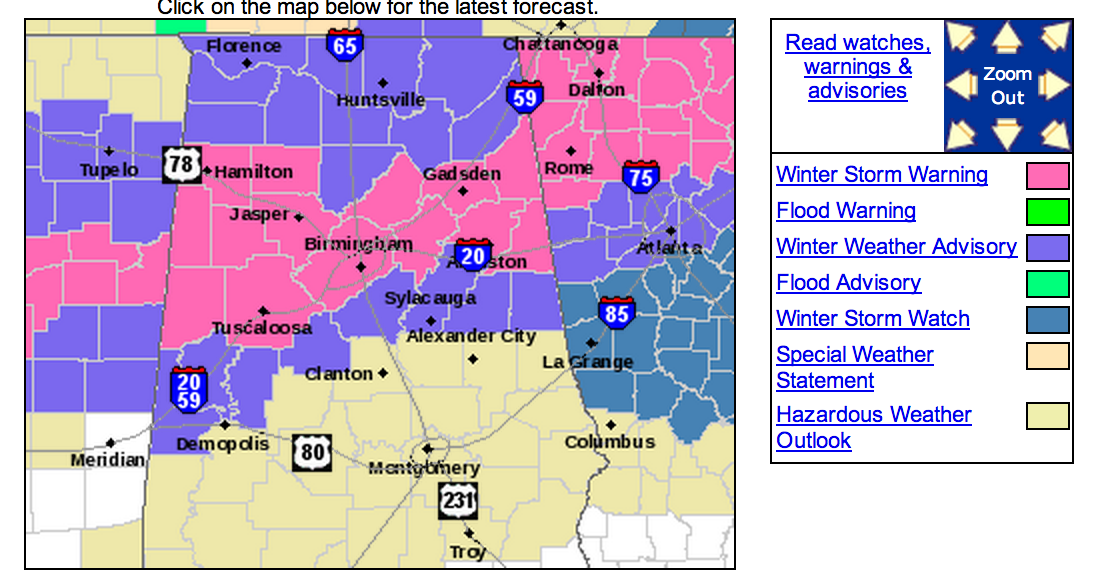
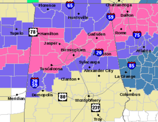
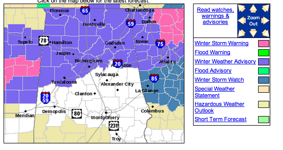
As expected, the National Weather Service has upgraded to a Winter Storm Warning for tonight. All counties there were under the previous Winter Weather Advisory have now been upgraded to the warning. This includes areas along and north of the Interstate 20 corridor and the cities of Tuscaloosa, Birmingham and Anniston. All counties outlined in the […]

Read More

Early Afternoon Notes

Early Afternoon Notes

| February 10, 2014 @ 1:12 pm

A few quick notes… *A little light freezing rain and sleet is over North Alabama at midday. This precipitation is very light, but temperatures are below freezing in a few spots, so a little patchy ice on bridges is not totally out of the question over the next few hours. But, no widespread problems are […]

Read More

Possible Upgrade to a Winter Storm Warning for Tonight

Possible Upgrade to a Winter Storm Warning for Tonight

| February 10, 2014 @ 12:08 pm

The National Weather Service is currently deciding whether or not to upgrade the Winter Weather Advisory for Central Alabama to a Winter Storm Warning. They have also expressed interest in expanding a Winter Weather Advisory to the south one row of counties. This would most likely include Shelby, Talladega, Clay, Randolph, Bibb, Greene, and Hale […]

Read More

Quick Radar Check

Quick Radar Check

| February 10, 2014 @ 11:52 am

Much of Central Alabama remains dry, just socked in with clouds and cool temperatures. We are now in the waiting game and we are watching a few radar returns to our north as large snowflakes, sleet, freezing rain and rain are being reported along areas of U.S. 278. We are seeing descent radar returns over […]

Read More

Morning Update

Morning Update

| February 10, 2014 @ 9:17 am

As we wait for this winter weather system to develop and begin to impact the area, we are still pouring over model data. The 0Z runs of the models came in drier and were the main reason some accumulation totals were brought down a bit. The 6Z data, came in a tad bit wetter. We […]

Read More

New Model Data

New Model Data

| February 10, 2014 @ 8:29 am

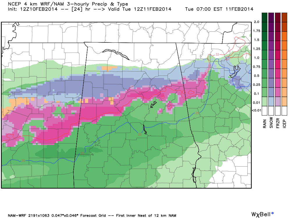
The 12Z high resolution NAM is in… and it confirms the threat of freezing rain and some snow across North/Central Alabama late tonight and tomorrow morning. This is the output valid at 6:00 a.m. Scroll down for the complete morning discussion. Mostly ice for the I-20 corridor, mostly snow for the U.S. 278 corridor.

Read More

Winter Weather Advisory For North Alabama

Winter Weather Advisory For North Alabama

| February 10, 2014 @ 6:16 am

An all new edition of the ABC 33/40 Weather Xtreme video is available in the player on the right sidebar of the blog. You can subscribe to the Weather Xtreme video on iTunes by clicking here. MESSY WINTER WEATHER PATTERN: We will have two waves of precipitation across the Deep South this week, as a […]

Read More