Alabama 811 | Know What's Below.

Archive for February 12th, 2014

Snow Totals from Central Alabama

Snow Totals from Central Alabama

| February 12, 2014 @ 11:23 pm

Bill Murray and I spent the last few hours tracking down overall snow totals. We have included most everyone we could find and their location. Reports are via NWS chat as well as social media. Roads in the areas that have received snow tonight are snowpacked and dangerous. If your roads are snowcovered, stay off […]

Read More

A Few Snow Showers Persist

A Few Snow Showers Persist

| February 12, 2014 @ 10:05 pm

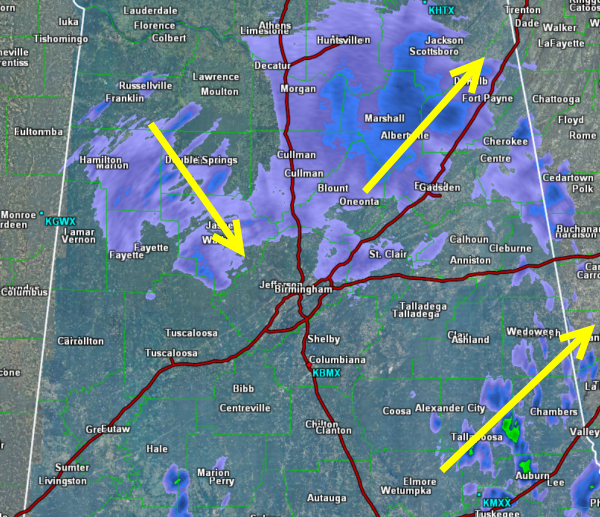
We still continue to monitor snow showers across Central Alabama tonight. Depending on your location these showers are moving in different directions. West of I-65, a few light showers are heading towards the southeast. They are impacting areas around Jasper, Hamilton, and Double Springs. These will likely move into Jefferson and Tuscaloosa counties and could […]

Read More

Snow Depth Tweets!

Snow Depth Tweets!

| February 12, 2014 @ 9:47 pm

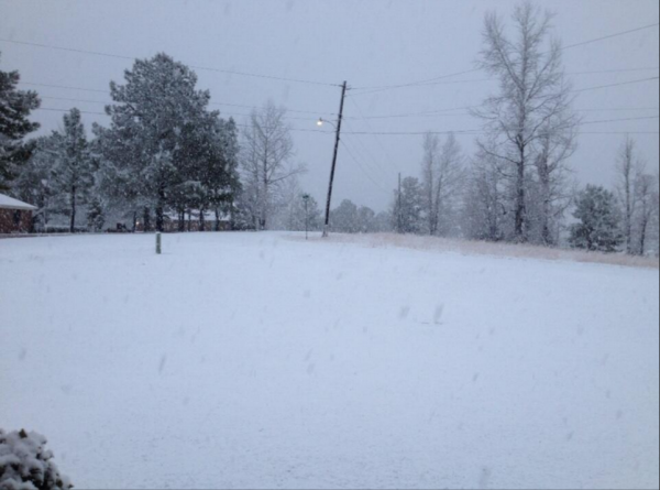
Here are some representative snow depths (and a couple of cool pictures) from tonight’s show across Central Alabama taken from the @spann Twitter feed or using the #ALWX hashtag.

Read More

Heaviest Snow Lifting Northeast

Heaviest Snow Lifting Northeast

| February 12, 2014 @ 9:09 pm

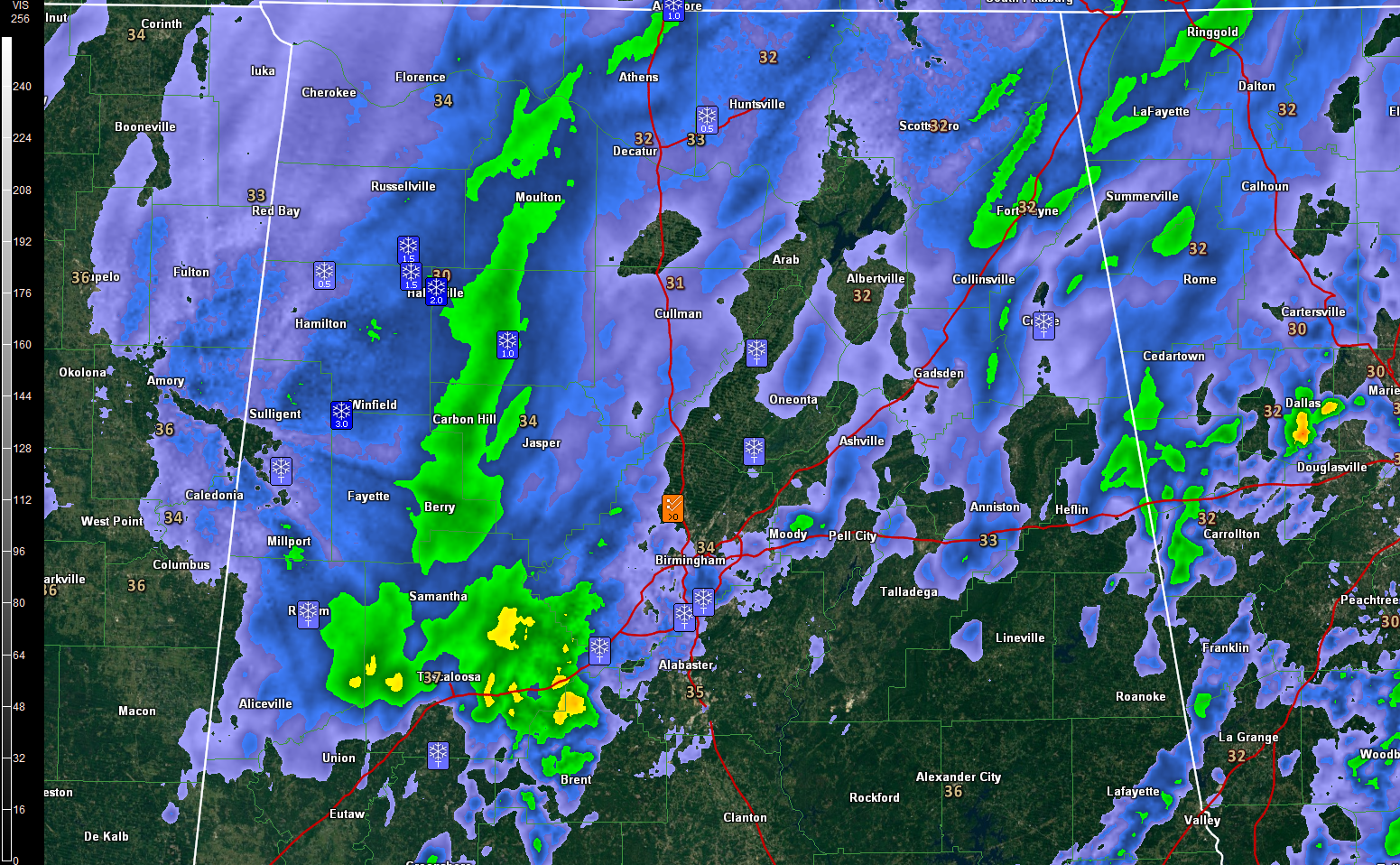
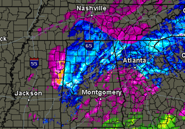
It sure did get pretty exciting across Central Alabama this afternoon and evening. Once the rain started transitioning to snow, it happened quick and spread very rapidly. The heaviest band of snow developed over western portions of the state and moved east along the I-20 corridor where it produced convective snow burst. Intense snowfall rates […]

Read More

Heaviest Snow Impacting Birmingham Metro

Heaviest Snow Impacting Birmingham Metro

| February 12, 2014 @ 7:54 pm

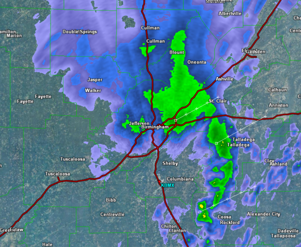
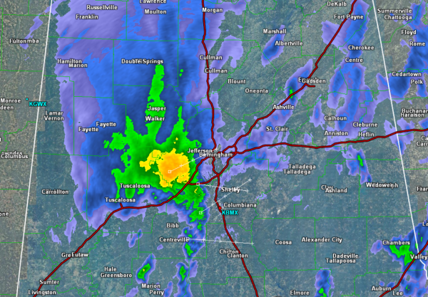
Quite the snow burst affecting Greater Birmingham. Reports across the city and metro area of rapid snow fall accumulations. Snow depths range from 1.5-4 inches throughout the area. Everything is covered in snow, including roadways and bridges. Travel is hazardous at this time and only emergency vehicles are asked to be on the roads. This […]

Read More

Civil Emergency Message for Central Alabama

Civil Emergency Message for Central Alabama

| February 12, 2014 @ 7:25 pm

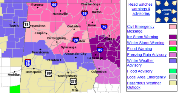
THE FOLLOWING MESSAGE IS TRANSMITTED AT THE REQUEST OF THE COUNTY EMERGENCY MANAGEMENT AGENCIES IN MARION…WINSTON… BLOUNT…ETOWAH…LAMAR…FAYETTE…WALKER…JEFFERSON…AND ST. CLAIR COUNTIES. NUMEROUS ROADWAYS…BOTH MAJOR THROUGH FARES AND LESSER TRAVELED ROADWAYS…ARE EXTREMELY HAZARDOUS AND IN SOME CASES IMPASSABLE. THESE CONDITIONS WILL PERSIST THROUGH THE OVERNIGHT HOURS. THESE COUNTY EMERGENCY MANAGEMENT AGENCIES REQUEST THAT TRAVEL BE LIMITED TO […]

Read More

Heavy Snow Approaching Birmingham

Heavy Snow Approaching Birmingham

| February 12, 2014 @ 6:29 pm

Heaviest snow band is moving into western Jefferson County now. Very large and heavy snow is falling just to the west of the city and will be moving into the city shortly. Road conditions are deteriorating where the heavier snow is currently falling. Numerous reports of snow covered and icy road conditions across western portions […]

Read More

Excellent Nowcast by NWS

Excellent Nowcast by NWS

| February 12, 2014 @ 5:44 pm

Excellent nowcast from the NWS Birmingham just a couple of minutes ago: PICKENS…LAMAR…MARION…THE HEAVIEST WINTER PRECIPITATION WILL SLOWLY END BETWEEN 6 AND 8 PM. AFTER 800 PM…ADDITIONAL SNOW SHOWERS ARE POSSIBLE BUT WILL BE MUCH MORE SPORADIC IN NATURE. SURFACE TEMPERATURES WILL BE VERY CLOSE TO FREEZING AND SOME OF THE WINTRY PRECIPITATION MAY REMAIN […]

Read More

Storm Reports

Storm Reports

| February 12, 2014 @ 5:36 pm

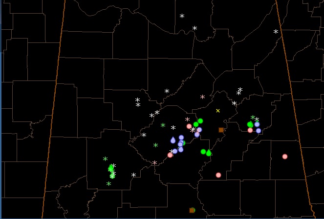
The Winter Storm is well underway across Alabama this evening. The transition to snow is now approaching Interstate 20 in Jefferson County. Where the transitions has occurred already, it happened very rapidly at locations across our northwestern counties. To begin with is was taking about an hour for the transitions to occur. The last few […]

Read More

Snow line at 5:20 is basically I-20

Snow line at 5:20 is basically I-20

| February 12, 2014 @ 5:21 pm

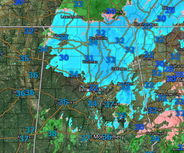
Based on Ping data, social media and skycams … the snow line is south of Columbus , MS  and to the city of Tuscaloosa and Birmingham and then to Anniston …. so basically HWy 82 to Tuscaloosa and then I-20 to the state line.  

Read More

Snow Line at 4:55

Snow Line at 4:55

| February 12, 2014 @ 4:58 pm

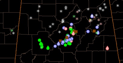
Based on Ping data and social media the snow line at 4:55 runs from north of Gordo to just north of the Birmingham metro area to Anniston… late report from Brookwood of snow now falling… switchover in Birmingham metro and Tuscaloosa is imminent…    

Read More

Snow Here, Tornado Warnings in Florida!

Snow Here, Tornado Warnings in Florida!

| February 12, 2014 @ 4:58 pm

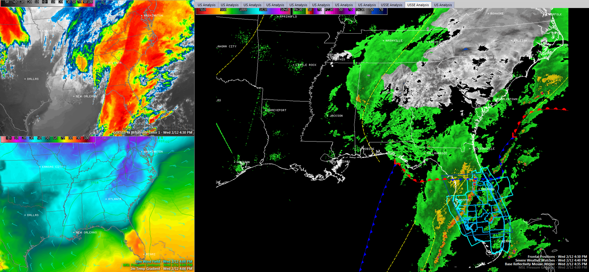
To show you the dynamic nature of this powerful winter storm, there is now a severe thunderstorm watch, two severe thunderstorm warnings and a tornado warning in Florida. Please click on the images to enlarge them. Here is the latest composite radar from GREarth with temperatures, the watch and the warnings. Here is a SimuAWIPS […]

Read More

Snow Line at 4:30

Snow Line at 4:30

| February 12, 2014 @ 4:32 pm

Based on Ping reports from the last 20 minutes the snow line at 4:30 appears to be from Columbus , MS to just south of Jasper to Warrior to Anniston

Read More

Rapid Changes

Rapid Changes

| February 12, 2014 @ 4:17 pm

Reports are coming in so fast that they are hard to keep up with, but needless to say conditions and changing quickly. A majority of our northern counties are seeing the snow fall. Along the I-20 corridor, we are seeing more reports of a rain/sleet mixture. This mixture will be short-lived as a continued transition […]

Read More