Alabama 811 | Know What's Below.

Archive for April 24th, 2014

Strong Storms Affecting West Alabama

Strong Storms Affecting West Alabama

| April 24, 2014 @ 11:25 pm

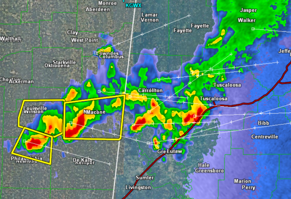
A few strong, non-severe storms are moving through West Alabama tonight. Though these storms are strong, producing heavy rainfall, frequent lightning, small hail, and gusty winds, they remain below severe limits. Portions of Tuscaloosa, Greene, Hale, Pickens, and Sumter Counties are being impacted. Interstate 20/59, and Highways 11, 43, and 82 will be impacted along […]

Read More

Strong Storm for Pickens County

Strong Storm for Pickens County

| April 24, 2014 @ 10:36 pm

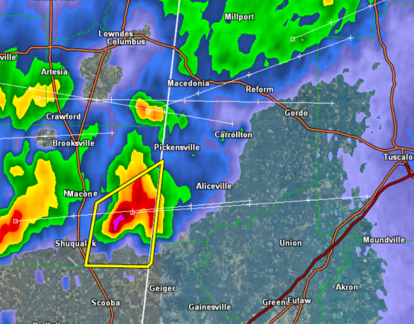
Showers and storms are now moving into the state. Even though this cell has been severe, it continues to weaken as it moves east. The NWS in Birmingham has decided not to issue a warning for this storm at this time. It will be producing gusty winds and some hail, and these should stay below […]

Read More

Strong Storms Approaching West Alabama

Strong Storms Approaching West Alabama

| April 24, 2014 @ 9:12 pm

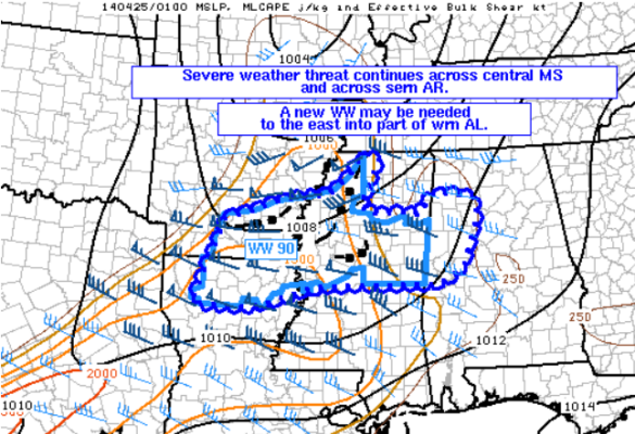
Strong and a few severe storms continue to move across northern Mississippi this evening. These storms will be entering into Alabama over the new couple of hours. The storms are moving-in a few hours earlier than originally forecast and are maintaining some very strong updrafts. This could allow for some of the storms to maintain […]

Read More

Evening Update

Evening Update

| April 24, 2014 @ 8:01 pm

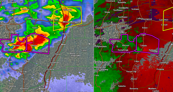
First off there is a very dangerous tornado warned storm moving across Central Mississippi. The NWS in Jackson is tracking a confirmed tornado well north of Jackson and northeast of Yazoo City. The storm currently is in Holmes County near the town of Lexington as is approaching Interstate 55. This storm continues to move off […]

Read More

Showers Early Tomorrow; Very Warm Weekend Ahead

Showers Early Tomorrow; Very Warm Weekend Ahead

| April 24, 2014 @ 2:27 pm

An all new edition of the ABC 33/40 Weather Xtreme video is available in the player on the right sidebar of the blog. You can subscribe to the Weather Xtreme video on iTunes by clicking here. RADAR CHECK: Nothing on radar over Alabama this afternoon; the sky is partly sunny and temperatures are generally in […]

Read More

Risk for Severe Weather for Parts of NW Alabama

Risk for Severe Weather for Parts of NW Alabama

| April 24, 2014 @ 1:18 pm

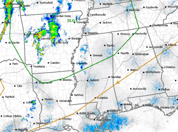
The SPC maintains a risk for severe weather across much of the Lower Mississippi Valley today. The risk area does come as far east as Alabama and includes much of the northwestern portion of the state, which has been outlined in green. The risk is valid until 7 AM Friday morning. We are seeing some […]

Read More

Update on Birmingham Weather Radio

Update on Birmingham Weather Radio

| April 24, 2014 @ 12:08 pm

The National Weather Service has been working diligently to repair serious equipment with the Birmingham NOAA Weather Radio broadcasting from Red Mountain overlooking downtown Birmingham. Through some extraordinary measures, they have been able to get the broadcast back on the air on a limited basis. I’ve posted their statement below for all the information. -Brian- […]

Read More

Showers Late Tonight/Early Tomorrow

Showers Late Tonight/Early Tomorrow

| April 24, 2014 @ 6:35 am

An all new edition of the ABC 33/40 Weather Xtreme video is available in the player on the right sidebar of the blog. You can subscribe to the Weather Xtreme video on iTunes by clicking here. BIG WARM-UP: We are starting off this day with some upper 30s over Northeast Alabama… Fort Payne reports 37, […]

Read More