Alabama 811 | Know What's Below.

Archive for September 15th, 2014

Active Storms Moving Across Alabama

Active Storms Moving Across Alabama

| September 15, 2014 @ 3:47 pm

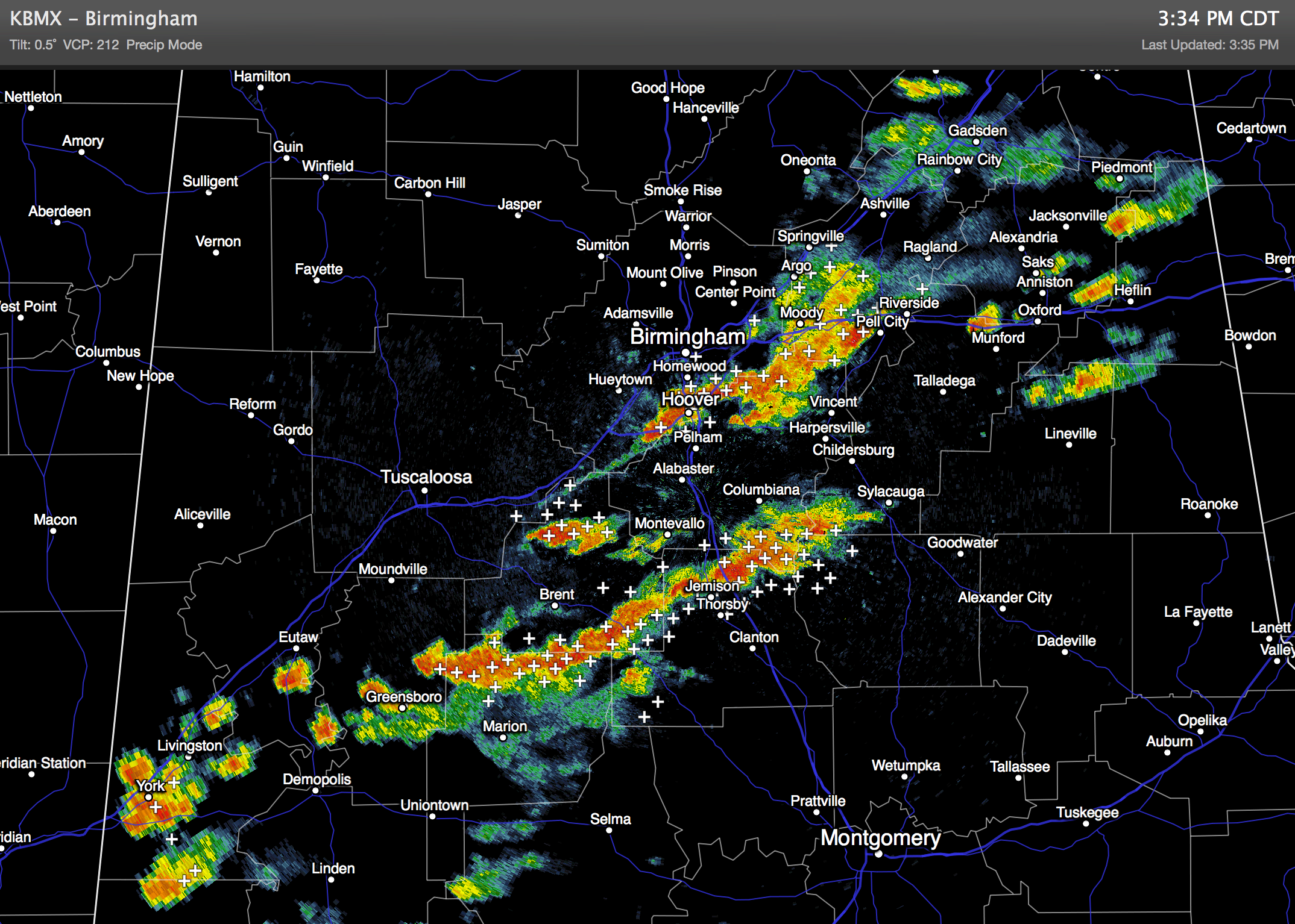
An all new edition of the ABC 33/40 Weather Xtreme video is available in the player on the right sidebar of the blog. You can subscribe to the Weather Xtreme video on iTunes by clicking here. RADAR CHECK: A number of strong storms are in progress over the North/Central part of Alabama this afternoon… heavier […]

Read More

Strong Storms Over Southern Shelby and Northern Chilton

Strong Storms Over Southern Shelby and Northern Chilton

| September 15, 2014 @ 3:25 pm

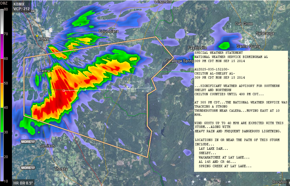
Strong storms are over southern Shleby and northern Chilton Counties where the NWS has posted a Significant Weather Alert for lightning, heavy rain and gusty winds. Storms are strongest from north of Jemsion to west of Talladega Springs. They are moving east at 10 mph.

Read More

Strong Storms over Jefferson, Shelby, St. Clair

Strong Storms over Jefferson, Shelby, St. Clair

| September 15, 2014 @ 2:38 pm

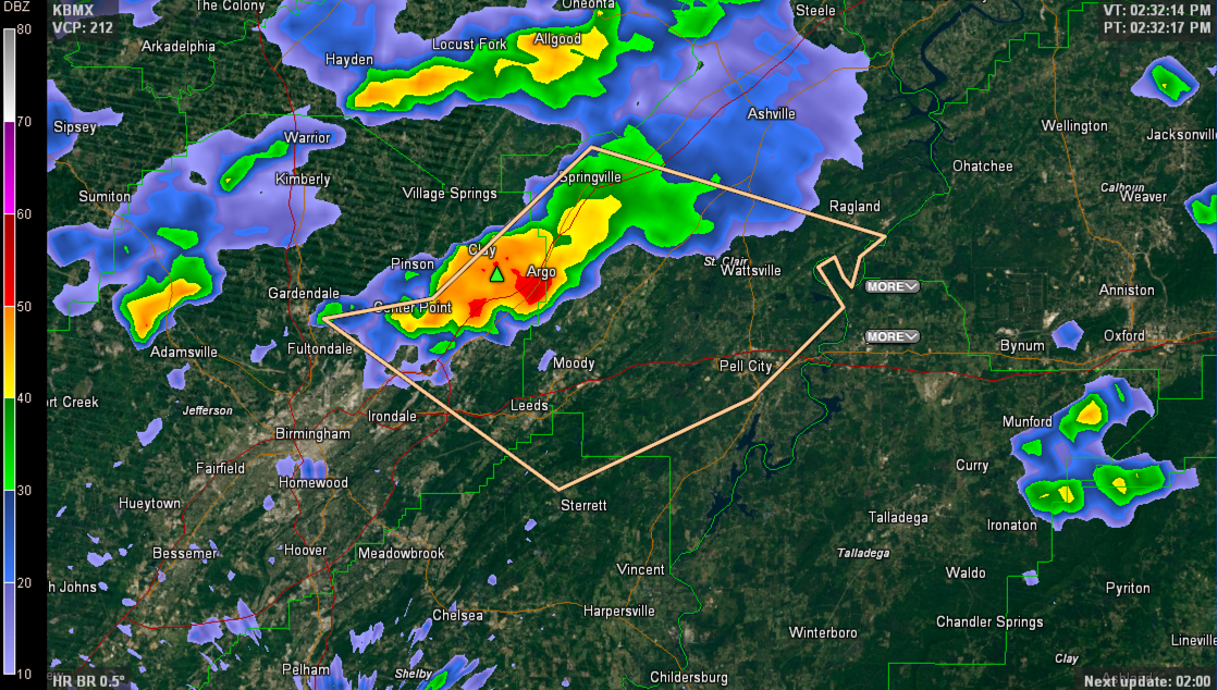
UPDATE AT 2:50 PM The NWS has added an Areal Flood Advisory for parts of Jefferson and St. Clair Counties as well. Communities include Pinson, Center Point, Trussville, Argo and Branchville. A wide area has received at least an inch of rain in a short time between the above communities. ORIGINAL POST Strong thunderstorms are […]

Read More

Moist Air Returns To Alabama

Moist Air Returns To Alabama

| September 15, 2014 @ 6:25 am

An all new edition of the ABC 33/40 Weather Xtreme video is available in the player on the right sidebar of the blog. You can subscribe to the Weather Xtreme video on iTunes by clicking here. SHOWERS/STORMS LATER TODAY: Nothing on the radar at daybreak across Alabama; temperatures are in the low 60s over the […]

Read More