Alabama 811 | Know What's Below.

Archive for December 23rd, 2014

Flash Flood Warning

Flash Flood Warning

| December 23, 2014 @ 9:49 pm

This is the text of a severe warning from the National Weather Service for part of the AlabamaWX.com coverage area. Standby for more details to be added to this post by our meteorologists. WGUS54 KBMX 240348 FFWBMX ALC075-240700- /O.NEW.KBMX.FF.W.0016.141224T0348Z-141224T0700Z/ /00000.0.ER.000000T0000Z.000000T0000Z.000000T0000Z.OO/ BULLETIN – EAS ACTIVATION REQUESTED FLASH FLOOD WARNING NATIONAL WEATHER SERVICE BIRMINGHAM AL 948 PM […]

Read More

Watch County Notification

Watch County Notification

| December 23, 2014 @ 9:49 pm

This is the text of a severe warning from the National Weather Service for part of the AlabamaWX.com coverage area. Standby for more details to be added to this post by our meteorologists. WWUS64 KBMX 240348 WCNBMX WATCH COUNTY NOTIFICATION FOR WATCH 561 NATIONAL WEATHER SERVICE BIRMINGHAM AL 948 PM CST TUE DEC 23 2014 […]

Read More

Watch County Notification

Watch County Notification

| December 23, 2014 @ 8:36 pm

This is the text of a severe warning from the National Weather Service for part of the AlabamaWX.com coverage area. Standby for more details to be added to this post by our meteorologists. WWUS64 KBMX 240235 WCNBMX WATCH COUNTY NOTIFICATION FOR WATCH 561 NATIONAL WEATHER SERVICE BIRMINGHAM AL 835 PM CST TUE DEC 23 2014 […]

Read More

Watch County Notification

Watch County Notification

| December 23, 2014 @ 7:59 pm

This is the text of a severe warning from the National Weather Service for part of the AlabamaWX.com coverage area. Standby for more details to be added to this post by our meteorologists. WWUS64 KBMX 240158 WCNBMX WATCH COUNTY NOTIFICATION FOR WATCH 561 NATIONAL WEATHER SERVICE BIRMINGHAM AL 758 PM CST TUE DEC 23 2014 […]

Read More

Several Flash Flood Warnings

Several Flash Flood Warnings

| December 23, 2014 @ 6:51 pm

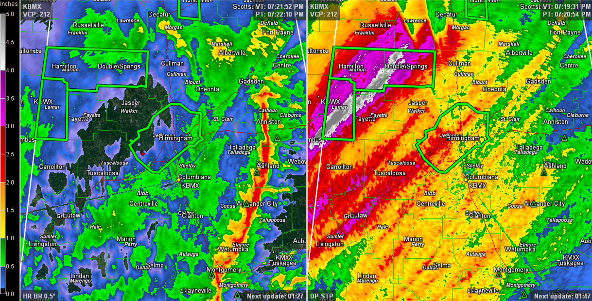
Heavy rain continues across much of Alabama east of I-65 north of Birmingham and I-59 southwest of Birmingham. Rainfall amounts have been heavy, as evidenced by the storm total rainfall amounts displayed on the right side of the radar image below. Some of the heaviest amounts have been across Lamar, Fayette, Marion and Winston Counties […]

Read More

Tornado Warning and a Severe Thunderstorm Warning

Tornado Warning and a Severe Thunderstorm Warning

| December 23, 2014 @ 6:02 pm

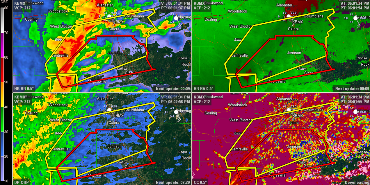
Possible tornado indicated on radar heading toward Jemison. It is passing just northwest of Maplesville at this time. THE NATIONAL WEATHER SERVICE IN BIRMINGHAM HAS ISSUED A * TORNADO WARNING FOR… SOUTHEASTERN BIBB COUNTY IN ALABAMA… NORTHERN CHILTON COUNTY IN ALABAMA… NORTHEASTERN PERRY COUNTY IN ALABAMA… * UNTIL 645 PM CST * AT 558 PM […]

Read More

It Was A Dark and Stormy Night…

It Was A Dark and Stormy Night…

| December 23, 2014 @ 5:32 pm

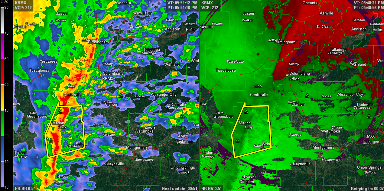
…so Snoopy used to start all of his novels sitting atop his doghouse in the Charles Schultz cartoons. It is an appropriate way to start this blog post tonight here in Central Alabama as well with widespread rain and storms now covering an area encompassing about 80 percent of the northern half of the state. […]

Read More

Severe Thunderstorm Warning for Sumter County til 530 p.m.

Severe Thunderstorm Warning for Sumter County til 530 p.m.

| December 23, 2014 @ 4:24 pm

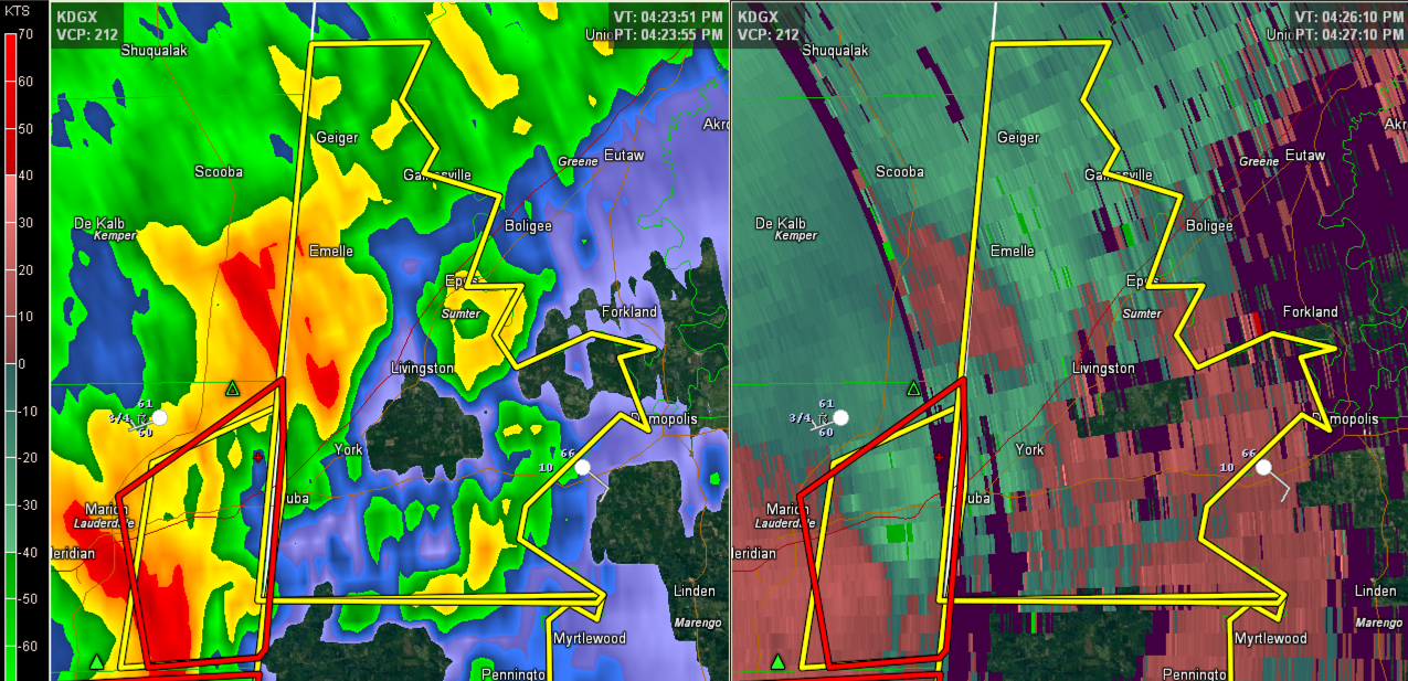
The long lived storm that has produced tornado damage across parts of southern Mississippi, including numerous injuries, is approaching Sumter County, Alabama at this hour. The tornadic circulation is less than 15 minutes away from Cuba, AL in Sumter County. The NWS in Birmingham has posted a severe thunderstorm warning for Sumter County. Some of […]

Read More

Late Afternoon Update

Late Afternoon Update

| December 23, 2014 @ 3:11 pm

**No afternoon Weather Xtreme video today; weather is a bit too active to produce one** SEVERE WEATHER POTENTIAL: A tornado watch is in effect until 11p CT for much of Central and South Alabama… This watch is basically along and south of I-20; it does not include Anniston or Gadsden, but it does include Birmingham […]

Read More

Tornado Watch Until 11 p.m. for All of Central Alabama

Tornado Watch Until 11 p.m. for All of Central Alabama

| December 23, 2014 @ 2:48 pm

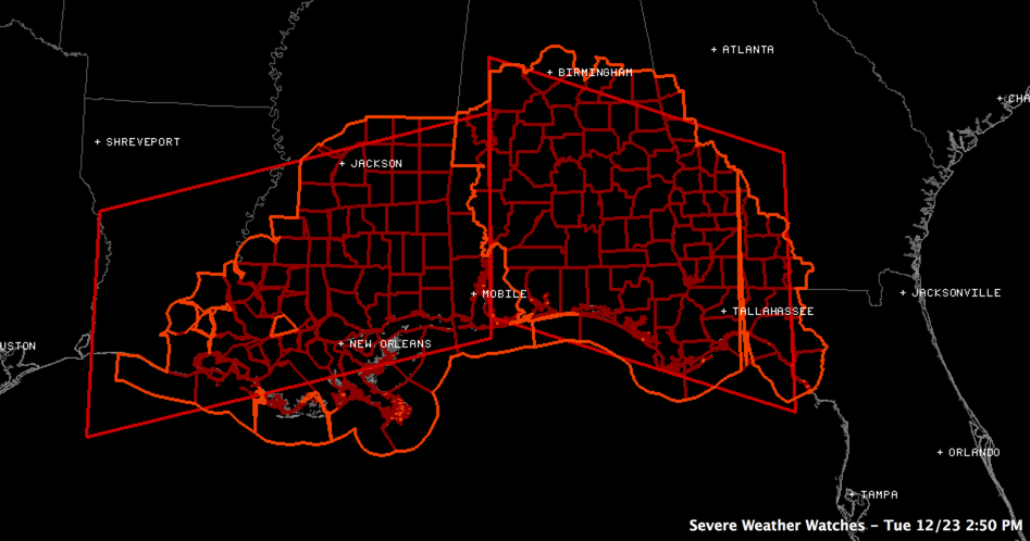
The northward movement of the warm front is placing a larger part of Central Alabama in the warm sector for this afternoon and evening and the Storm Prediction center has issued a tornado watch now for a large part of Central Alabama. Counties included are: Autauga, Barbour, Bibb, Bullock, Chambers, Chilton, Clay, Coosa, Dallas, Elmore, […]

Read More

Large and Dangerous Tornado Near Columbia MS

Large and Dangerous Tornado Near Columbia MS

| December 23, 2014 @ 2:40 pm

…AT 233 PM CST…A CONFIRMED LARGE AND EXTREMELY DANGEROUS TORNADO WAS LOCATED NEAR IMPROVE…AND MOVING NORTHEAST AT 50 MPH. The NWS in Jackson is calling it a particular dangerous situation. The tornado debris signature is at 10,000 feet which indicates large tornado. Debris is falling from the sky. The storm is moving in the general […]

Read More

Severe Thunderstorm Warning for Etowah County

Severe Thunderstorm Warning for Etowah County

| December 23, 2014 @ 1:22 pm

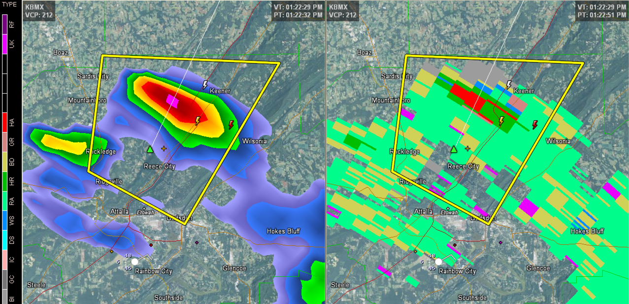
A strong thunderstorm has rapidly developed in Etowah County. It was just northeast of Reece City, moving to the northeast. It is passing between Sardis City and Keener. This warning does not affect the city of Gadsden. THE NATIONAL WEATHER SERVICE IN BIRMINGHAM HAS ISSUED A * SEVERE THUNDERSTORM WARNING FOR… NORTH CENTRAL ETOWAH COUNTY […]

Read More

Severe Thunderstorm Warning for Fayette/Lamar, Pickens Canceled

Severe Thunderstorm Warning for Fayette/Lamar, Pickens Canceled

| December 23, 2014 @ 12:08 pm

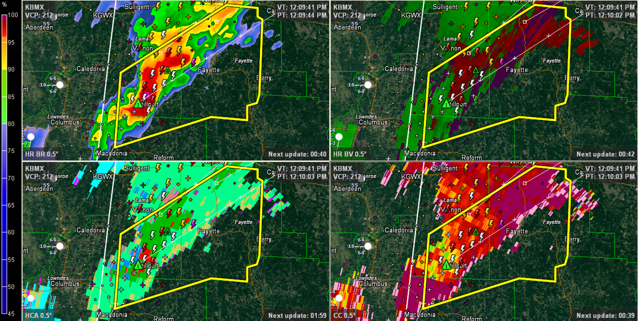
Large hail is falling at Millport most likely. This hail core will move toward Fayette. Hail to the size of quarters is possible. Winds of 60 mph or greater also. Attention is shifting to the west now where storms will intensify ahead of an approaching cold front. There is an area of slight instability over […]

Read More

Severe Thunderstorm Warning for Etowah County

Severe Thunderstorm Warning for Etowah County

| December 23, 2014 @ 11:10 am

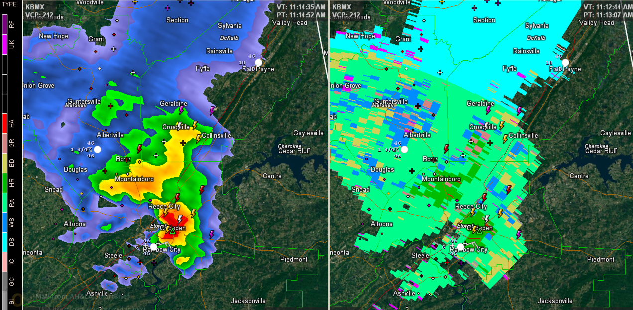
I spoke a little too soon about our storm weakening. It intensified over Etowah County and prompted the NWS to issue a severe thunderstorm warning. The left side of the image is the base reflectivity you are used to. The right side is the Hydrometeor Classification Algorithm, which shows precip type. The storm is now […]

Read More