Alabama 811 | Know What's Below.

Archive for February 14th, 2015

Saturday Evening Post

Saturday Evening Post

| February 14, 2015 @ 8:47 pm

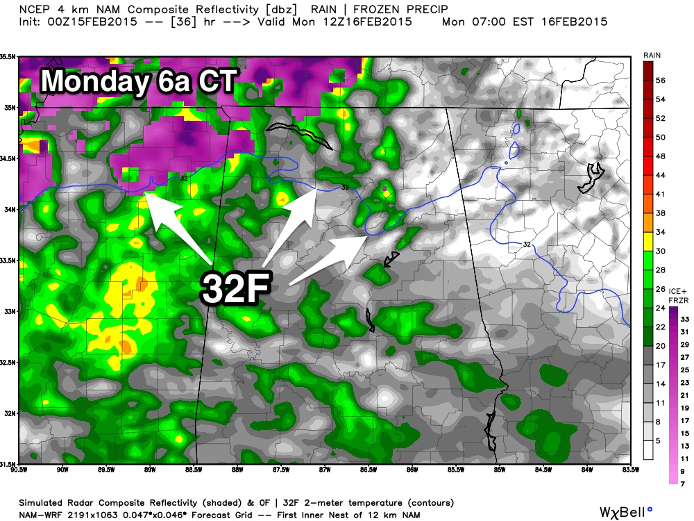
Just a few notes; my next full discussion will be posted around 6:00 a.m. tomorrow. *The new 00Z model data is rolling in. The NAM has come in a bit warmer, suggesting the freeze line will be north of Birmingham Monday morning as precipitation moves in. Let me caution you that at this phase of […]

Read More

Pickens County Added to Winter Storm Watch

Pickens County Added to Winter Storm Watch

| February 14, 2015 @ 4:39 pm

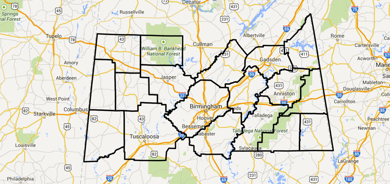
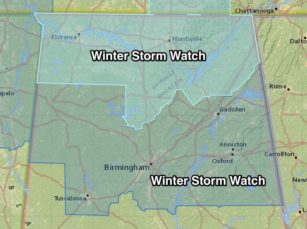
As a minor point of order, the NWS Birmingham has extended the Winter Storm Watch to include Pickens County. Counties already under the Winter Storm Watch include Blount, Calhoun, Cherokee, Clay, Cleburne, Etowah, Fayette, Jefferson, Lamar, Marion, Randolph, Shelby, St. Clair, Talladega, Tuscaloosa, Walker and Winston. All of the counties to the north are in […]

Read More

Evening  Update

Evening Update

| February 14, 2015 @ 4:11 pm

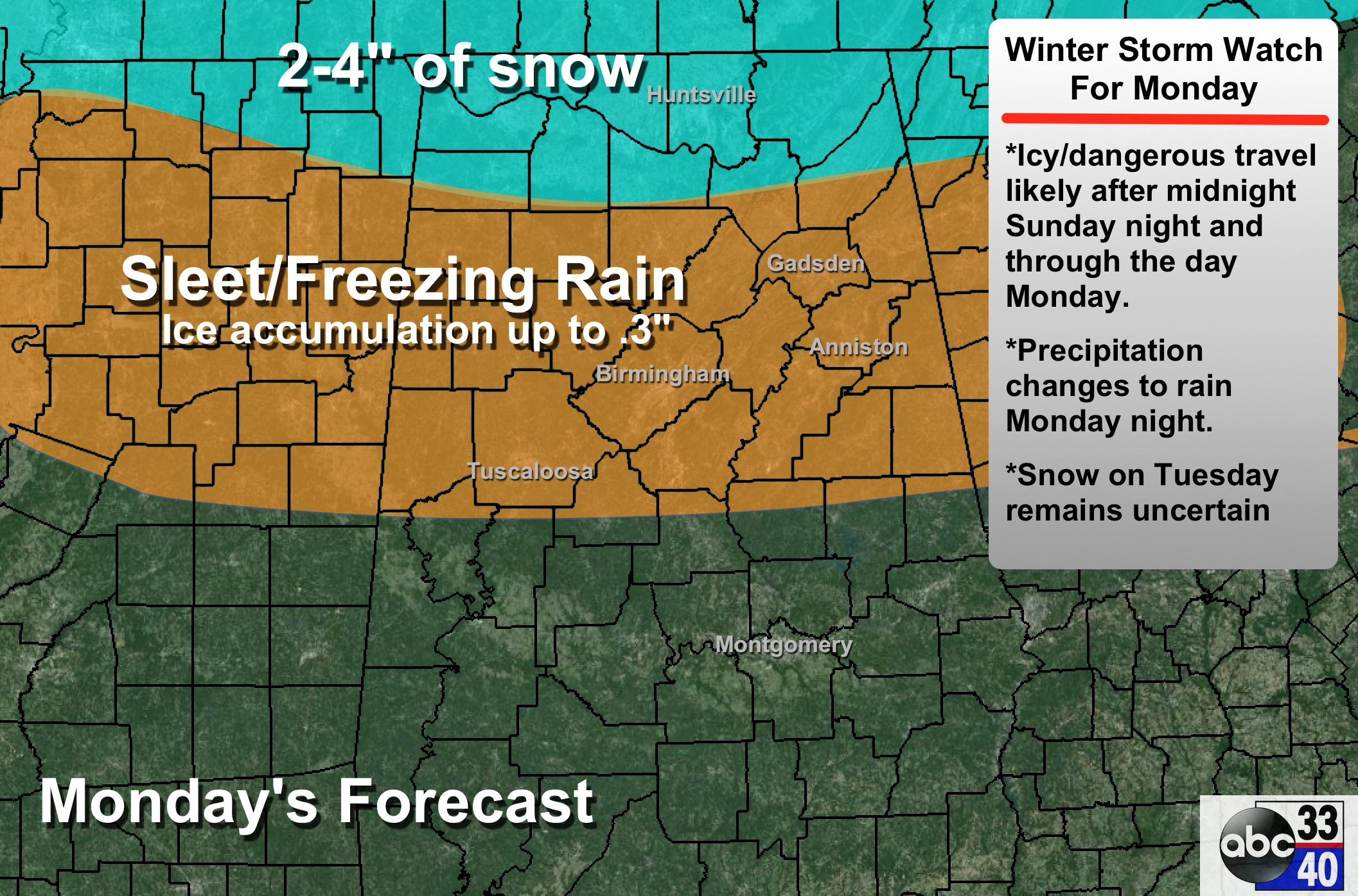
Here some some quick notes this evening on the potential for a winter storm across Alabama Monday. PRECIPITATION TYPE/ACCUMULATION: Main chance of snow will come over the Tennessee Valley of far North Alabama, where 2 to 4 inches are possible in spots. To the south, freezing rain and sleet are likely for places like Birmingham, […]

Read More

Presidents’ Day Storm Travel Nightmares – Southern Edition

Presidents’ Day Storm Travel Nightmares – Southern Edition

| February 14, 2015 @ 2:37 pm

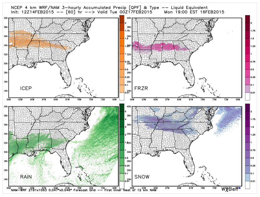
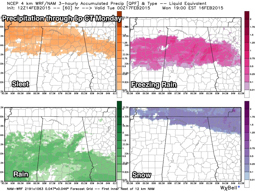
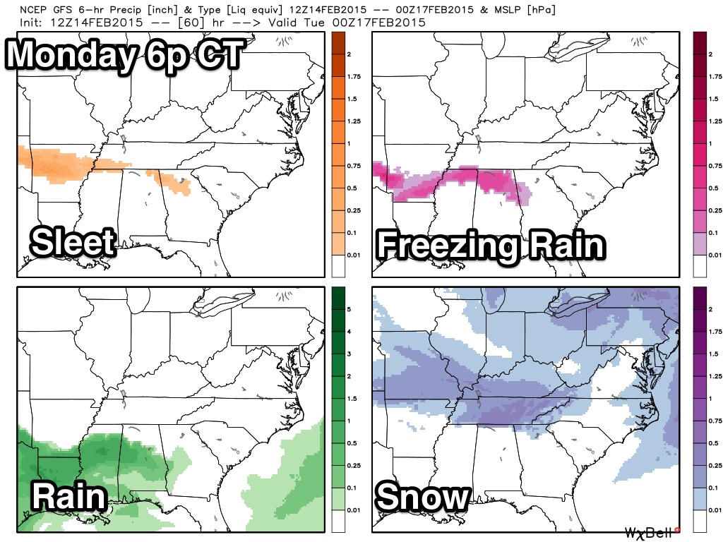
Many folks will be traveling on the Presidents’ day holiday Monday. Let’s go area by area in the affected region across the South to put the travel impacts in perspective. Here is the 4 km NAM depiction of the four types of precipitation that can be expected between now and 6 p.m. Monday: Checking in […]

Read More

The Warm Before the Cold

The Warm Before the Cold

| February 14, 2015 @ 2:32 pm

Well, it’s supposed to be a take off on the calm before the storm. Today is turning out to be a gorgeous February day for Central Alabama with a crystal clear sky and temperatures topping out between 60 and 65 degrees. But don’t let this beautiful day fool you. A cold front was poised just […]

Read More

Who Gets What?

Who Gets What?

| February 14, 2015 @ 1:31 pm

That is always a difficult question to answer during any winter storm, but I think this model graphic is on target… from the high resolution NAM model… Mostly freezing rain/ice for Birmingham, Tuscaloosa, Birmingham, Gadsden… best chance of snow north of the Tennessee River. Icy/very dangerous travel possible after midnight tomorrow night into Monday north […]

Read More

Late Morning Notes

Late Morning Notes

| February 14, 2015 @ 11:18 am

The new 12Z model runs are in… The trend is toward more freezing rain and sleet over North Alabama with less snow. But, understand this is just one set of model data, and you don’t make big changes. GFS: You can see the trend toward more freezing rain… NAM: Again, freezing rain and sleet is […]

Read More

Ten Things To Know About Winter Weather Forecasts

Ten Things To Know About Winter Weather Forecasts

| February 14, 2015 @ 10:15 am

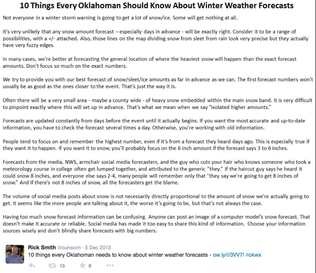
This is a great piece from Rick Smith, one of our WeatherBrains hosts, who is also the Warning Coordination Meteorologist (WCM) for the National Weather Service in Norman, Oklahoma. He wrote this for those that live in Oklahoma, but it is also applicable for people in Alabama. Thought it would be very appropriate to post […]

Read More

Ice Potential Monday Morning

Ice Potential Monday Morning

| February 14, 2015 @ 9:55 am

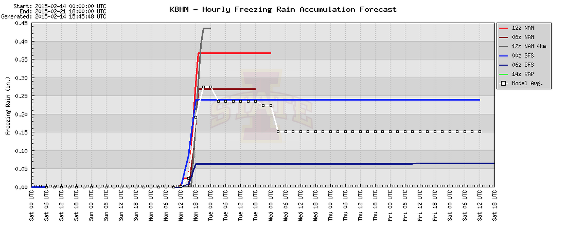
This post concerns potential for ice accumulation across North/Central Alabama late Sunday night and Monday morning. See this post for a detailed overview of the entire winter storm event that will impact Alabama. The new morning run of the NAM model suggests potential ice accumulation of 0.35″ to 0.40″ at Birmingham between midnight tomorrow night […]

Read More

Beautiful Followed by Ugly

Beautiful Followed by Ugly

| February 14, 2015 @ 7:35 am

An all new edition of the ABC 33/40 Weather Xtreme video is available in the player on the right sidebar of the blog. You can subscribe to the Weather Xtreme video on iTunes by clicking here. ALABAMA POWER IS READY, ARE YOU? Our friends at Alabama Power are monitoring the forecast closely, ready to deploy […]

Read More

Winter Storm Watch Issued

Winter Storm Watch Issued

| February 14, 2015 @ 5:57 am

**Brian Peters will be along with the regular morning discussion and Weather Xtreme video shortly** ENJOY TODAY: We expect a sunny sky today with a high around 60 degrees… but much colder air blows in here tomorrow, and things go downhill quickly after midnight Sunday night. WINTER STORM WATCH: NWS offices in Huntsville and Birmingham […]

Read More