Alabama 811 | Know What's Below.

Archive for June 30th, 2015

Mix Of Sun And Storms

Mix Of Sun And Storms

| June 30, 2015 @ 3:44 pm

RADAR CHECK: Most of the really active weather has shifted down into far South Alabama and the Florida Panhandle this afternoon; the morning storms have stabilized the atmosphere over the northern half of the state, and the weather around here is pretty quiet with only a few isolated showers at mid-afternoon over the Tennessee Valley. […]

Read More

Cullman Storms Moving into Blount

Cullman Storms Moving into Blount

| June 30, 2015 @ 9:01 am

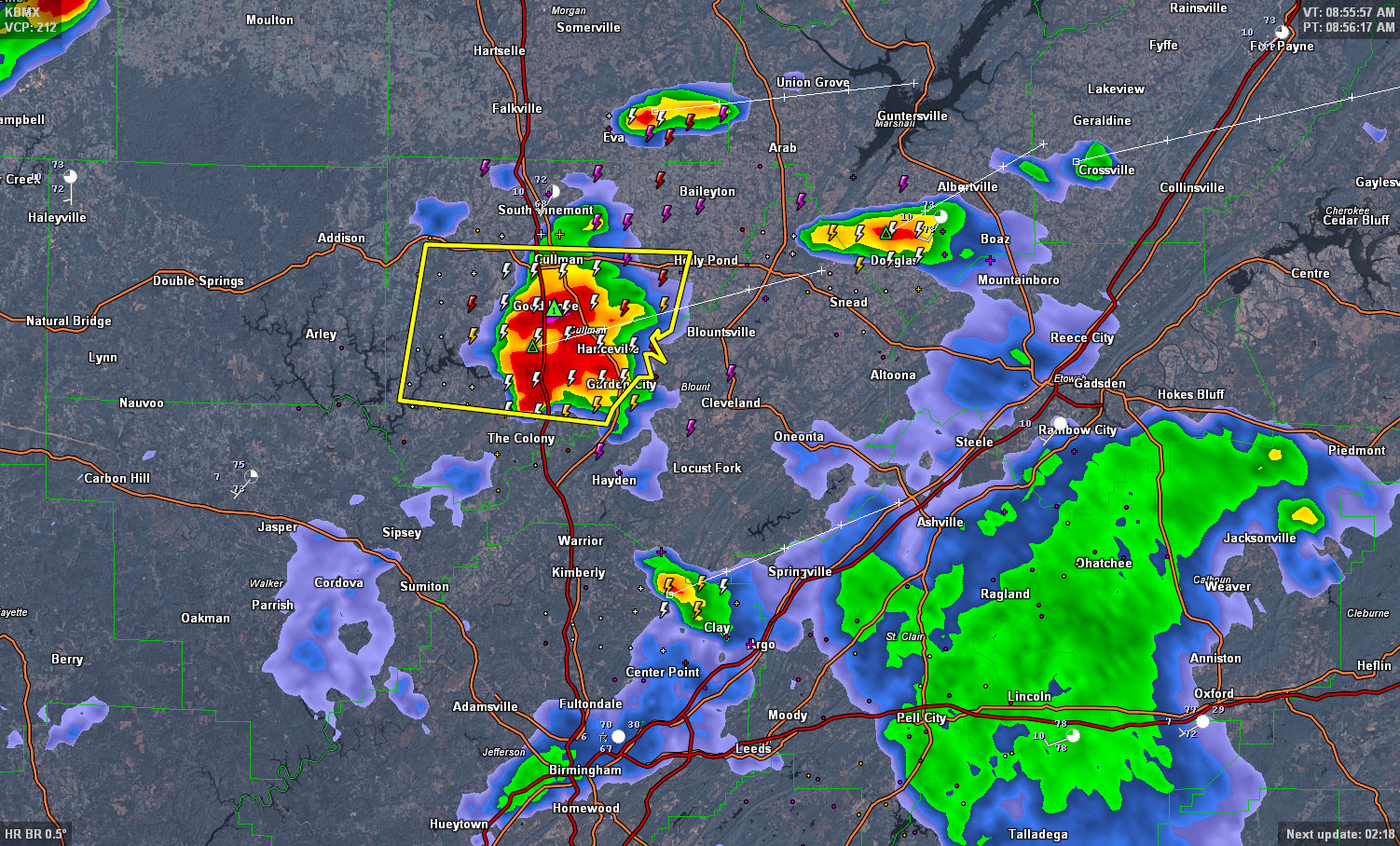
The NWS in Birmingham has issued a Significant Weather Alert for northern Blount County for the warned storm that is moving across Cullman County. It will bring winds up to 50 mph, deadly lightning, torrential rains and hail to the siz e of nickles as it moves into Blount County. Areas from Garedn City to […]

Read More

Severe Thunderstorm Warning for Cullman County

Severe Thunderstorm Warning for Cullman County

| June 30, 2015 @ 8:38 am

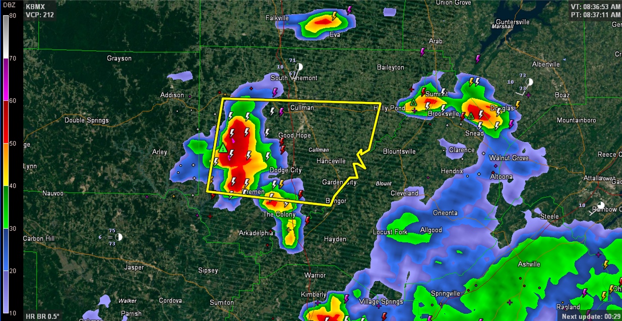
The National Weather Service in Huntsville has issued a Severe Thunderstorm Warning for Cullman County. There is likely hail with the storms moving into Cullman County. Storms have rapidly weakened as they passed east of Birmingham. There are reports of trees down in Vestavia, Homewood, and Mountain Brook. Despite the fact that activity is weakened, […]

Read More

Severe Thunderstorm Warning for St. Clair, Talladega and NE Shelby

Severe Thunderstorm Warning for St. Clair, Talladega and NE Shelby

| June 30, 2015 @ 7:48 am

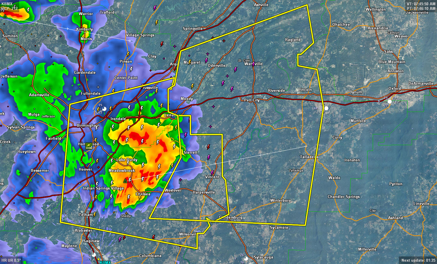
Storms that have produced scattered reports of hail and even some wind damage in the Birmingham Metro are moving into the St. Clair and Talladega Counties at this time. There are reports of trees down across Vestavia Hills, Homewood and Mountain Brook, with some damage to homes. Expect deadly lightning, torrential rain, strong winds and […]

Read More

Severe Thunderstorm Warning for Birmingham Metro

Severe Thunderstorm Warning for Birmingham Metro

| June 30, 2015 @ 7:16 am

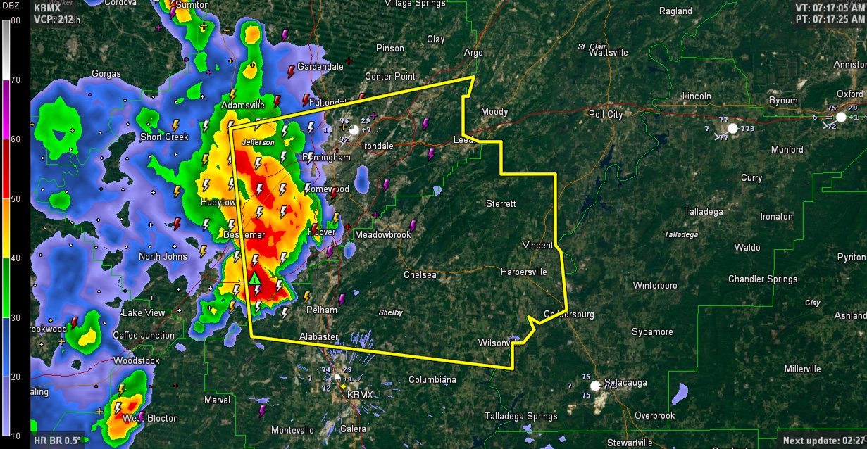
LATE REPORT 7:29 John Talbot reports via scanner that there is a tree down on a power line at Oxmoor Road and Seminole Drive in Homewood. Pea sized hail in Inverness as the storms approach the US-280 corridor. Hail was also reported in Hoover. ORIGINAL POST Strong thunderstorms are moving across the Birmingham Metro just […]

Read More

Showers/Storms Return

Showers/Storms Return

| June 30, 2015 @ 6:44 am

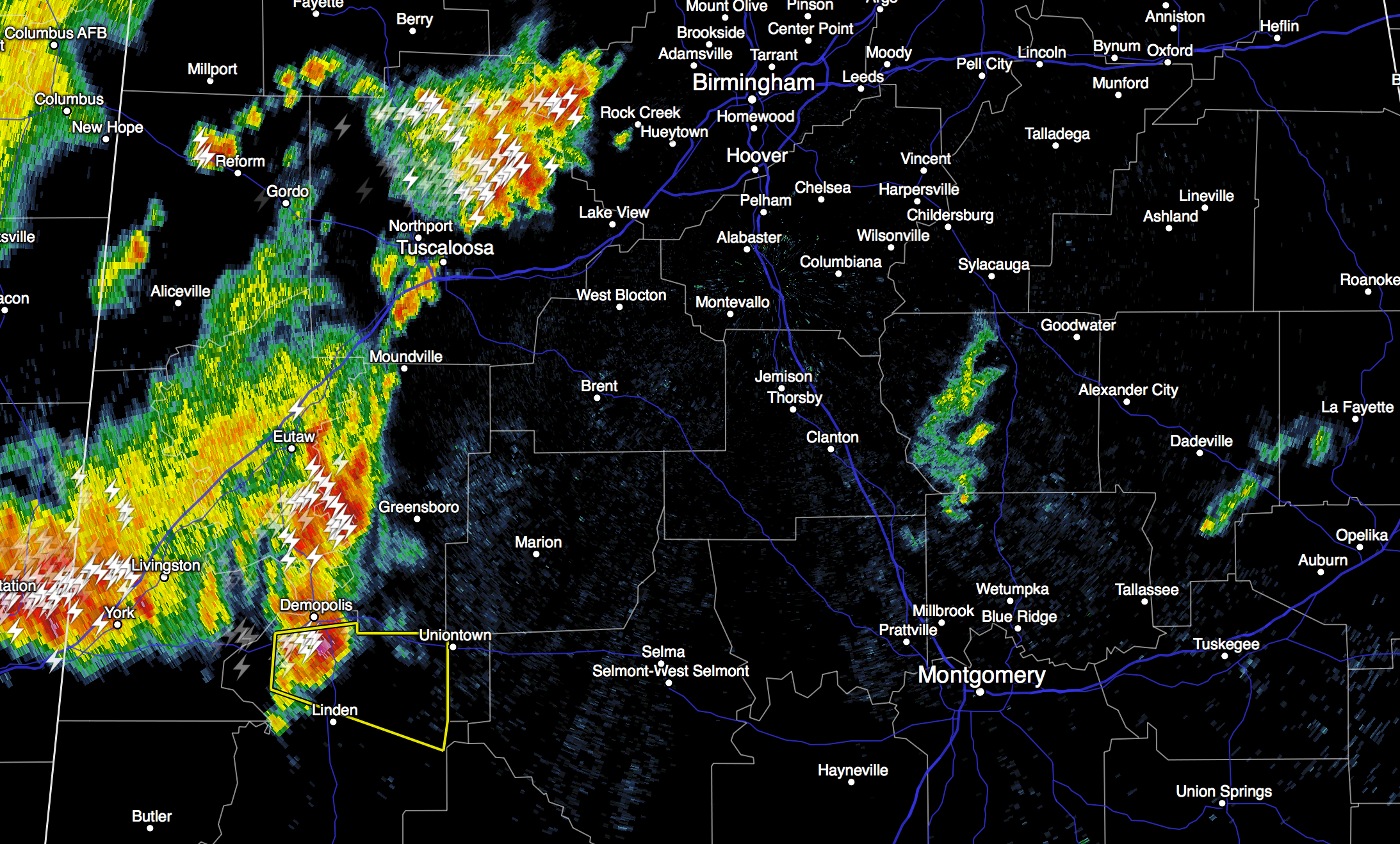
RADAR CHECK: As expected, moist air has returned to Central Alabama this morning, and the radar is pretty active just after daybreak. Some of the heavier storms are north of Tuscaloosa, and near Demopolis… and are producing heavy rain, frequent lightning, and some small hail as they move east. The NWS in Birmingham has just […]

Read More

Severe Thunderstorm Warning – North Marengo County

Severe Thunderstorm Warning – North Marengo County

| June 30, 2015 @ 6:30 am

WUUS54 KBMX 301129 SVRBMX ALC091-301215- /O.NEW.KBMX.SV.W.0094.150630T1129Z-150630T1215Z/ BULLETIN – IMMEDIATE BROADCAST REQUESTED SEVERE THUNDERSTORM WARNING NATIONAL WEATHER SERVICE BIRMINGHAM AL 629 AM CDT TUE JUN 30 2015 THE NATIONAL WEATHER SERVICE IN BIRMINGHAM HAS ISSUED A * SEVERE THUNDERSTORM WARNING FOR… NORTHEASTERN MARENGO COUNTY IN SOUTHWESTERN ALABAMA… * UNTIL 715 AM CDT * AT 629 AM […]

Read More

WeatherBrains 492:  Spritz Yourself ! !

WeatherBrains 492: Spritz Yourself ! !

| June 30, 2015 @ 5:15 am

WeatherBrains Episode 492 is now online (June 29, 2015). If you are crazy about weather, this is THE netcast audio program for you! Tonight’s Guest Panelist is the mastermind behind tonight’s show. He is a regular listener and commenter and is a meteorology student at York University in Canada. Elie Morrison, welcome to Weatherbrains. It […]

Read More