

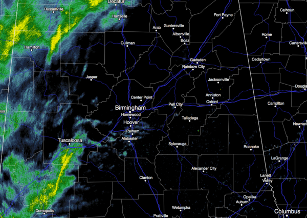
Most Widespread Rain Over West Alabama
RADAR CHECK: Rain is falling in spots over West Alabama this morning around sunrise… the eastern counties are generally dry.
Only three counties in Alabama are under a flash flood watch…Choctaw, Washington, and Mobile (down in the southwest corner of the state). Many counties and parishes in Mississippi and Louisiana are under flash flood warnings.
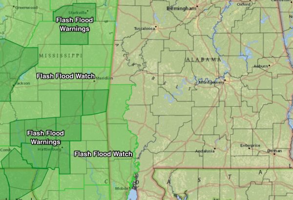
While a few showers are certainly possible over East Alabama today and tonight… the most widespread and heaviest rain will stay over the western counties, generally west of I-65. No severe weather or major flooding issues are expected over the northern half of the state; but flooding is a very real possibility for far Southwest Alabama, where the flash flood watch is in effect.
Bottom line… if you are in places like Tuscaloosa, Haleyville, Fayette, Greensboro, or Demopolis, today will be pretty wet, but if you are in Anniston, Gadsden, Ashland, or Talladega, just a few scattered showers. The high today should be in the mid 70s.
THE ALABAMA WEEKEND: The upper low, now over far South Texas, will lift out. Most guidance still suggests a decent part of the day tomorrow will be dry, at least during the morning. Understand, we do expect showers, but the most widespread rain remains west of the state. Then, coverage of showers and storms should increase late tomorrow afternoon and tomorrow night as dynamic support increases.
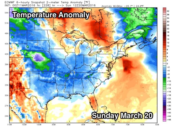
Showers and storms should end Sunday from west to east as the upper trough pulls away from Alabama. The sky will remain cloudy, and afternoon temperatures reach the 70s again.
NEXT WEEK: Only a small risk of a shower Monday, and Tuesday looks warm and dry with a high around 80 degrees. Forecast confidence in the mid-week period is lower than usual due to inconsistent model output; the latest GFS runs are now showing no rain for Wednesday night/Thursday. Still looks like considerably cooler air will arrive toward the end of the week. See the Weather Xtreme video for maps, graphics, and more details.
AT THE BEACH: Rain and storms are likely today for Dauphin Island, Gulf Shores, and Pensacola Beach, with showers more scattered in nature down toward Destin and Panama City Beach. A risk of showers/storms will continue into part of the weekend… See a very detailed Gulf Coast forecast here.
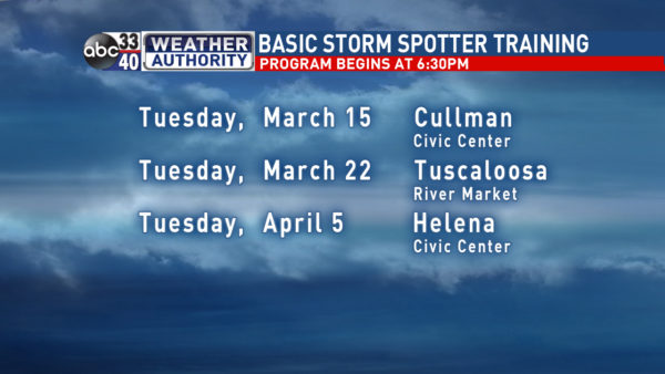
STORM SPOTTER TRAINING: We are offering basic SKYWARN training at several locations across North/Central Alabama in March, followed by the big event, Storm Spotter Xtreme on Saturday, April 9 at the BJCC from 9am to 2pm. This will feature both the basic and advanced SKYWARN classes, along with a session from Kevin Laws of the Birmingham NWS office. And, if you come, you get free admission to the Alabama International Auto Show, going on at the BJCC that same day. There is no cost and no need to register. Just show up with a curious mind. Kids 10 and older will also enjoy this if they love weather and want to learn more. Please help us make the severe weather warning process better!
We will be in Cullman Tuesday evening.
WEATHER BRAINS: Don’t forget you can listen to our weekly 90 minute netcast anytime on the web, or on iTunes. This is the show all about weather featuring many familiar voices, including our meteorologists here at ABC 33/40.
CONNECT: You can find me on all of the major social networks…
Facebook
Twitter
Google Plus
Instagram
I have a weather program today at Myrtlewood Elementary in Tuscaloosa County… look for the next Weather Xtreme video here by 4:00 this afternoon. Enjoy the day!
Category: Alabama's Weather
About the Author (Author Profile)
James Spann is one of the most recognized and trusted television meteorologists in the industry. He holds the AMS CCM designation and television seals from the AMS and NWA. He is a past winner of the Broadcast Meteorologist of the Year from both professional organizations.Subscribe
If you enjoyed this article, subscribe to receive more just like it.


