

Frost Advisories and Freeze Warnings Issued

Frost advisories have been issued for tonight for all of Central Alabama with a freeze warning for Marion and Winston Counties in Northwest Alabama, as well as the rest of the Tennessee Valley.
A late season cold snap will deliver frost and some freezing temperatures to a large part of the area by morning. Any one with vulnerable plants should prepare them for the cold tonight.
CHILLY START: It was a chilly beginning to the day across Central Alabama. Lows were in the middle 30s across the northwestern and northern parts of the area, with a smattering of readings around freezing. Upper 30s populated the I-59 Corridor with readings closer to 40F over southeastern parts of the area. Despite a mix of sun and clouds today, it will be cool with highs in the middle and upper 50s. A brisk northwesterly wind will make it feel even colder.
Click image to enlarge.
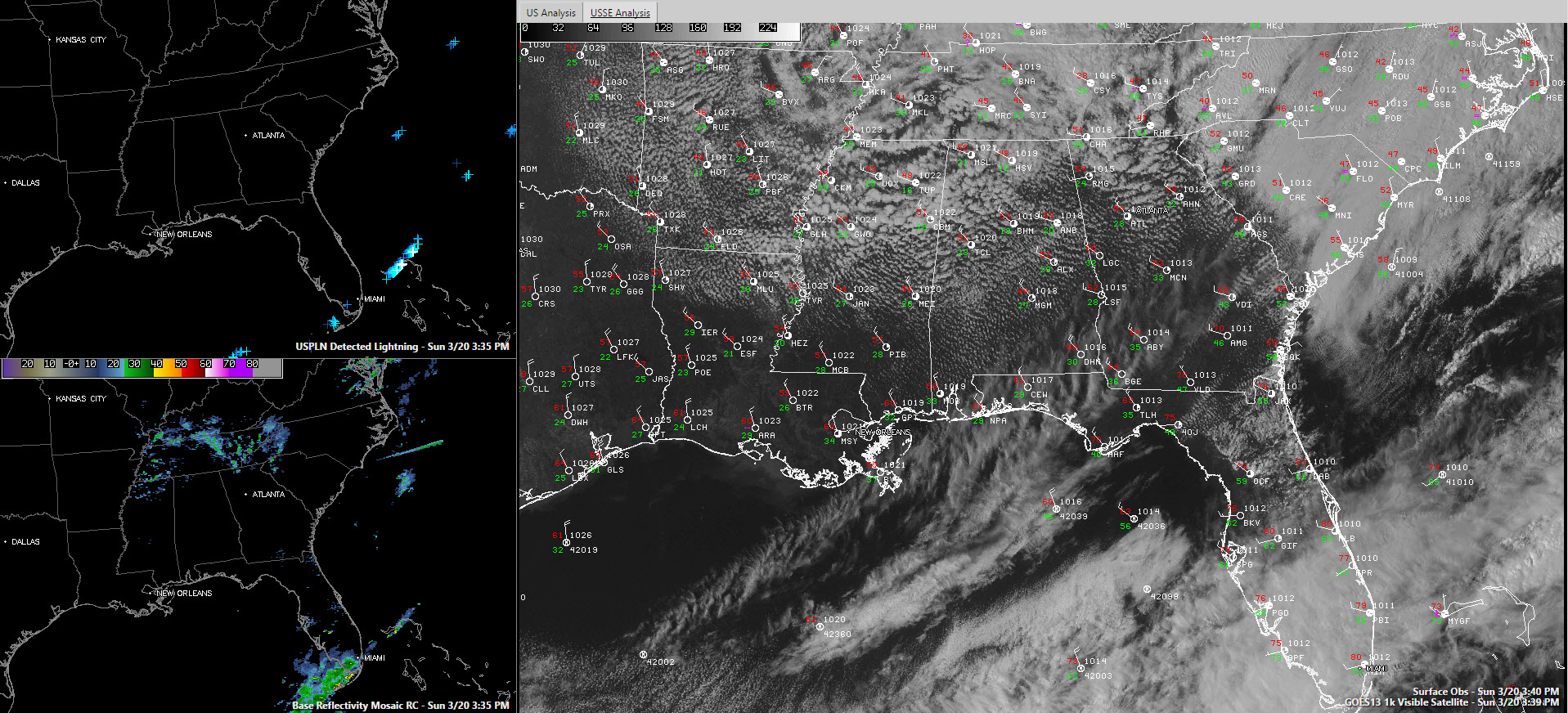
CURIOUS SATELLITE: It is easy to see the distinctive swirl of low pressure on visible satellite imagery early this afternoon over Missouri, Illinois, Kentucky, Arkansas, Tennessee and Alabama. But that low is not at the surface, but rather in the mid-levels of the atmosphere. The clouds associated with it are caused by cold air aloft and spin associated with the upper low.
PRECIPITATION: There could be a few sprinkles today across Alabama, emanating from the stratocumulus clouds that are being fueled by instability from really cold air aloft. To the north, a shield of mostly rain, with some embedded light snow, extends from St. Louis to Chattanooga. There could even be some thunder across parts of Kentucky and much of Tennessee. Winter weather advisories are in effect for tonight and early Monday for the Smokies and northern Georgia, where 1-3 inches of snow may fall at elevations above 2,000 feet and a dusting into the valleys.
WIDESPREAD FROST: Temperatures tonight will bottom out in the 32-35F range. It would be colder, but surface winds will not completely relax and those stratocumulus clouds will act like a bit of a blanket. Still, there will be widespread frost and a few places will record a damaging freeze. If you have vulnerable plants, you will want to protect them tomorrow night. Monday won’t be much better than today, with highs only managing to reach 55-60F under partly cloudy skies.
FOR YOUR MONDAY: Monday won’t be much better than today, with highs only managing to reach 55-60F under partly cloudy skies.
SLOWLY MODERATING: After another chilly start Tuesday morning, with lows in the 30s, highs will return to the 60s by afternoon. 70s should be the rule by Wednesday and Thursday. Things should be mostly dry until Thursday afternoon.
STRONG STORMS THURSDAY: It appears that thunderstorms will arrive during the afternoon hours on Thursday, giving them a little better chance to be strong. The GFS trended a little quicker this morning, bringing them in during the morning hours Thursday, but we still have to resolve the timing and intensity issues.
Category: Alabama's Weather, Winter Weather
About the Author (Author Profile)
Bill Murray is the President of The Weather Factory. He is the site's official weather historian and a weekend forecaster. He also anchors the site's severe weather coverage. Bill Murray is the proud holder of National Weather Association Digital Seal #0001 @wxhistorianSubscribe
If you enjoyed this article, subscribe to receive more just like it.


