

Severe Weather Threat Not Materializing For North Central Alabama
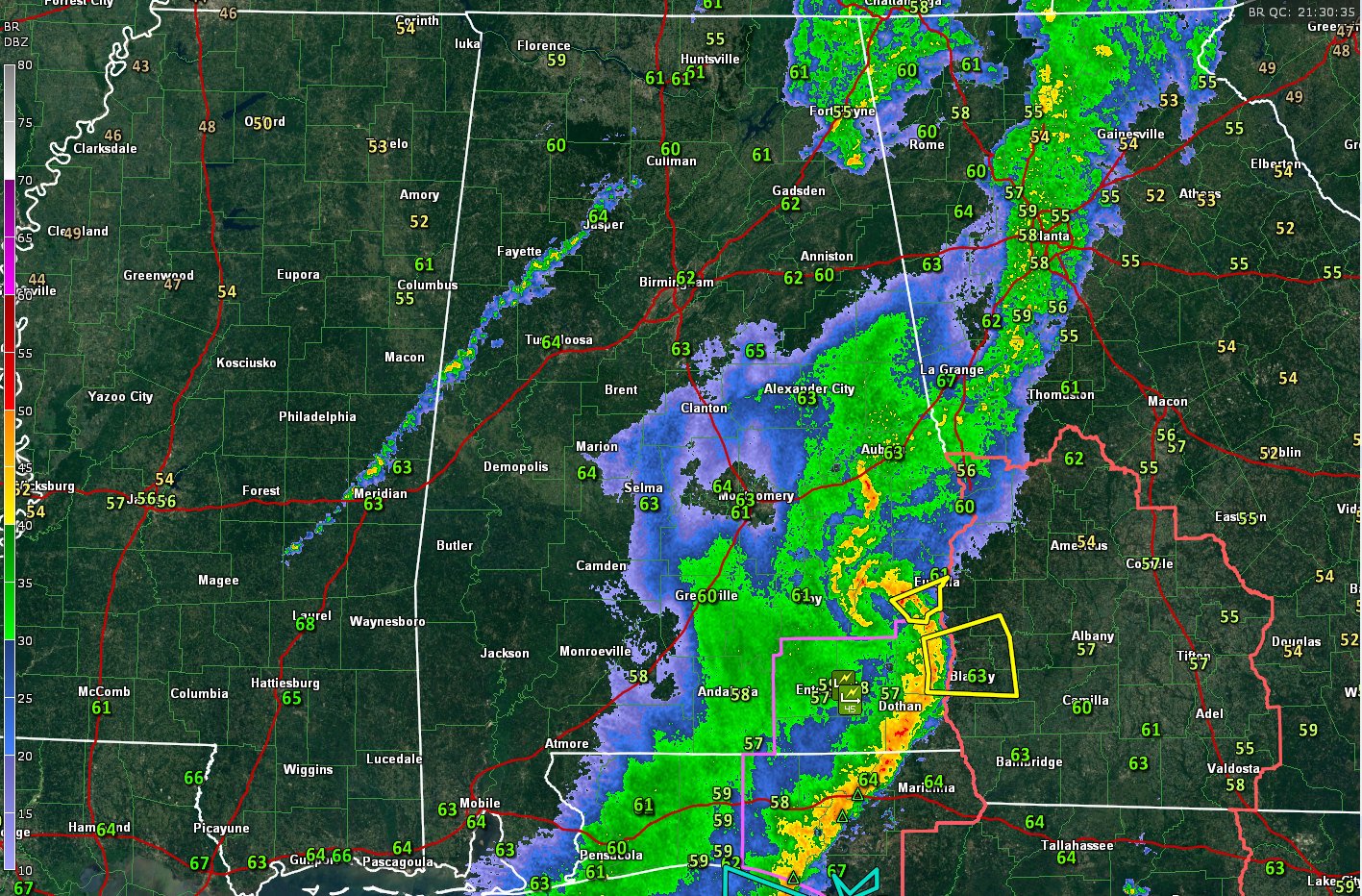
Current conditions across the state have most of the shower and thunderstorm activity over the southeastern corner of the state, with Severe Thunderstorm Warnings still in effect for Henry County until 4:30PM CDT, and Barbour County until 4:45PM CDT. There are light to moderate showers over the northeastern counties of the state, but no lightning has been detected.
A line of showers has developed over the western part of the state, stretching from Arley in Winston County, down to the southwest through Jasper, and Berry, and exiting the state through Panola in Sumter County.
Temperatures at this time have much of north and central Alabama in the mid 60s, with exception of the extreme southeastern corner of the state, where mid 70s can be found. The good news is that the cloud cover is starting to thin out over the northwestern corner of the state.
SEVERE WEATHER UPDATE
The indications of severe weather continue to diminish at least for the northern half of Alabama. The HRRR model continues to output less and less in the way of instability and storms with each run.
The thin line of showers over West Alabama right now may still grow into storms, but the chance of those storms becoming severe seems to be very small and isolated at best. The showers and storms should be southeast of a line from Hayden in Blount County to Brookwood in eastern Tuscaloosa County.
We could see storms in the Birmingham area between 630 p.m. and 8:30 p.m., pushing into East Alabama after that.
The storms should completely weaken by 10 p.m. and be out of Central Alabama by 2 a.m.
The Storm Prediction Center has areas south of a line from Mobile to Brewton to Greenville to Union Springs to Eufaula in a slight risk severe weather outlook through the evening. Areas north of the slight risk and up the western border counties with Mississippi are in a marginal risk for isolated severe storms until the cold front passes.
That cold front is extending from Tupelo to Jackson to Natchez, or generally along the Natchez Trace! It will sweep across the state overnight, putting an end to the rain and storms.
LATE REPORT FROM THE NWS TALLAHASSEE
There is a report of an overturned Greyhound bus on US-84 in Daleville in Southeast Alabama. Injuries are reported.
Category: Alabama's Weather, Severe Weather
About the Author (Author Profile)
Bill Murray is the President of The Weather Factory. He is the site's official weather historian and a weekend forecaster. He also anchors the site's severe weather coverage. Bill Murray is the proud holder of National Weather Association Digital Seal #0001 @wxhistorianSubscribe
If you enjoyed this article, subscribe to receive more just like it.


