

Dry but Rain/Storms Back on Sunday
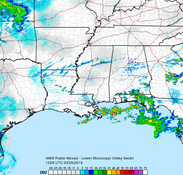
Alabama is starting out the last weekend of March with a mixture of sky cover ranging from clear skies along the Tennessee border to overcast skies with some passing showers in the souther counties and in Northwest Florida. Fog was also reducing visibility quite a bit over the southeast quadrant of the state wth some stations reporting values below a half mile. And there was quite a range in temperatures from the upper 30s in the Tennessee River Valley to the middle 60s in the Dothan area. Look for a mixture of sun and clouds today for Central and North Alabama while southern sections remain cloudy. Temperature should warm into the lower and middle 70s for North and Central Alabama.
The weather turns wet again on Sunday with the approach of an upper trough coming across Missouri with a cold front along the Mississippi River at midday. SPC has a slight risk area just to the northwest of Central Alabama which cuts across the extreme northwest corner of Alabama. The standard slight risk area covers much of the western half of Kentucky, northern Mississippi and West and Middle Tennessee. CAPE values appear strong enough for some thunder, but shear values are pretty low. With the stationary front along the Gulf Coast, this seems likely to develop much like the threat did on Thursday with the convection along the Gulf Coast cutting off the really good moisture. GFS MOS values show dew point reaching the lower 60s, again much like last Thursday, but no higher. Does look like the best chances for rain will come from midmorning on Sunday (Easter) through the early evening hours. Clouds are likely to keep temperatures down a bit with highs Sunday in the lower 70s.
Showers and storms never really left eastern portions of the Gulf Coast thanks to the stationary front. Showers and storms will be likely through Sunday, with a reprieve Monday and Tuesday before more showers and storms show up Wednesday into Thursday. Expect better conditions for next weekend. Highs along the immediate coast will be in the 60s, with 70s inland. See the complete Gulf Coast 7 Day Planner here.
That system quickly moves to the New England states as a weak ridge comes into play for Monday and Tuesday. Wednesday the ridge moves east along the East Coast as a fairly deep trough develops along the eastern slope of the Rockies. The main trough and best dynamics moves northeast into the Great Lakes area on Thursday as a cold front is again dragged into the Southeast US. Best rain chances will come Wednesday into Thursday as the front drags into the Southeast US. GFS brings CAPE and shear values up on Thursday, but the upper dynamics seem to be pretty far north. This will require a watchful eye on future model runs to get a better handle on the threat of severe weather for Alabama. SPC actually has an area outlooked for Day 5 over the Central Plains.
Friday into Saturday we see a substantial cool down as a deep trough takes shape over the eastern US. Looks like that deep trough will bottom out on Sunday as we move out into voodoo country. The deep trough will knock temperatures back next weekend with lows mainly in the 40s and highs in the 60s.
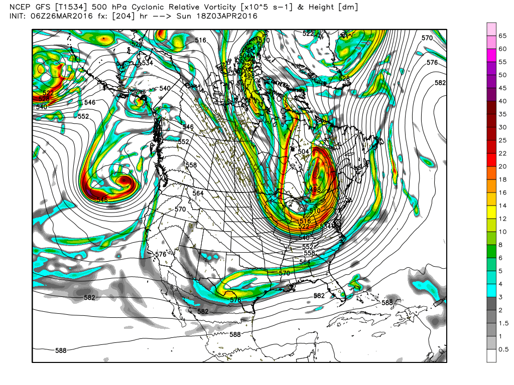
Week 2 remains fairly active. A nice ridge will warm things up nicely around the 5th and 6th of April. But the GFS is showing a good trough in the middle Mississippi River Valley on the 7th with another one around the 10th. So the pattern remains pretty active.
I will have the next Weather Xtreme Video posted here on Sunday morning, but it may be a little later than usual due to a social outing this evening. Enjoy the day an Godspeed.
-Brian-

Category: Alabama's Weather
About the Author (Author Profile)
Brian Peters is one of the television meteorologists at ABC3340 in Birmingham and a retired NWS Warning Coordination Meteorologist. He handles the weekend Weather Xtreme Videos and forecast discussion and is the Webmaster for the popular WeatherBrains podcast.Subscribe
If you enjoyed this article, subscribe to receive more just like it.


