

Latest Update on Tonight’s Event
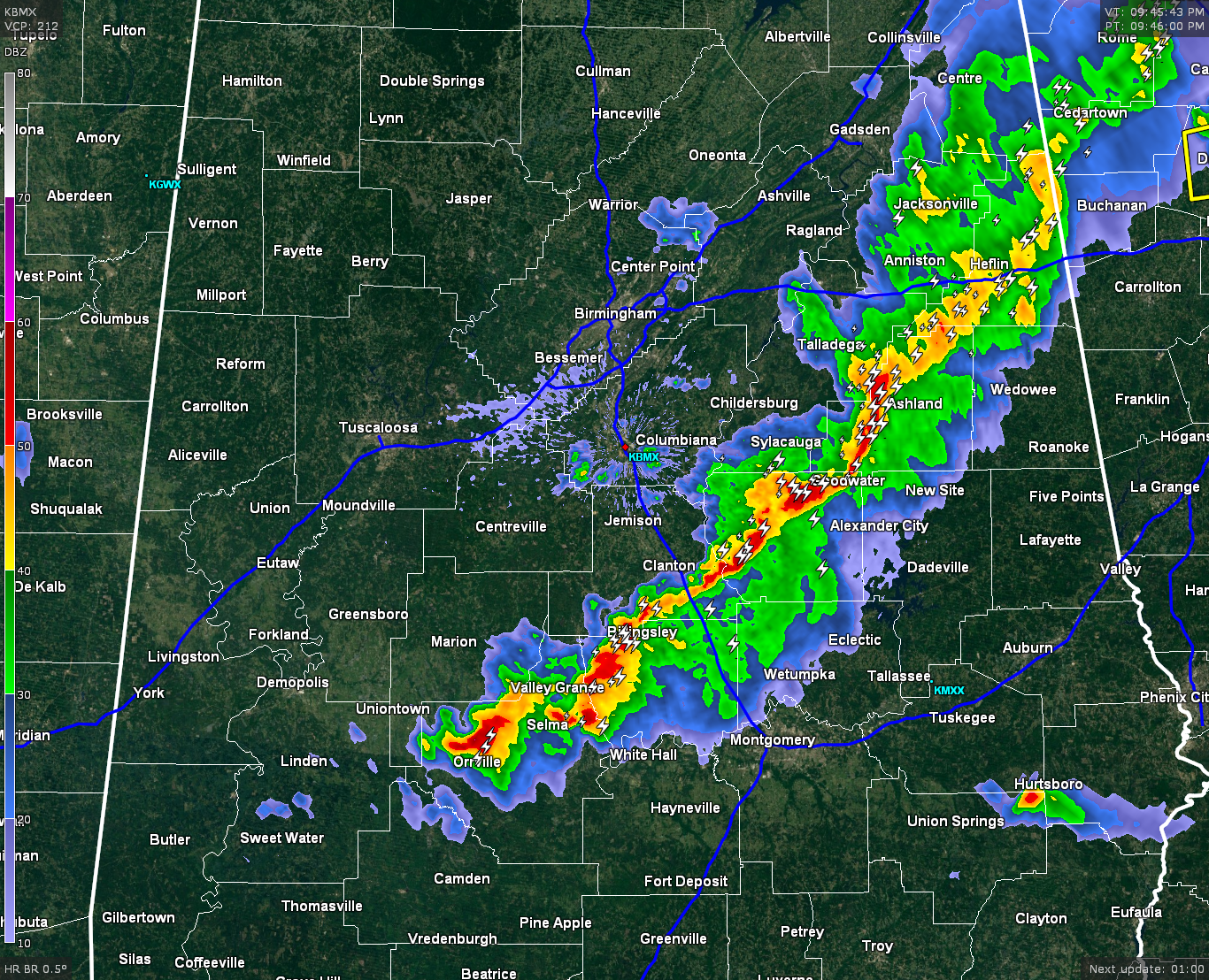
A line of strong thunderstorms currently stretches from extreme southeastern Cherokee county, back to the southwest through Calhoun and Cleburne, through Talladega and Clay, through Coosa and Chilton, through Autauga and Perry, and ending in Dallas county.
Temperatures have dropped behind the line, averaging in the 50s. Ahead of the line it was in the middle and upper 60s.
DAMAGE REPORTS: We won’t know of all of them until daylight, but there are already a few coming in. Multiple reports of trees down in the area, along with power lines down and fences reported to be blown over by the storms. Also there were several reports of pea-size to quarter-size hail with these storms.
POSSIBLE SEVERE STORM: There is a strong thunderstorm located in Bullock county that needs to be watched. There are signs of rotation with this storm. It is by itself and has no other storm to take energy away from it. If you are in the path of this storm, be prepared to take cover. Places in its path are Hurtsboro, Hatchechubbee Seale, and Pittsview.
WHAT’S AHEAD: Behind the line of thunderstorms, the weather has calmed drastically. Other than a few light showers showing up in northeastern Jefferson and southern Blount counties, the radar is dry back to the state line. So once the line passes you’re location, the event will be over for you.
CLEAR OF SEVERE: People west of a line from Linden, to Eutaw, to Tuscaloosa, to Birmingham, and up the I-59 corridor should be able to rest easy, as the severe threat has diminished for those places.
Category: Alabama's Weather, Severe Weather
About the Author (Author Profile)
Bill Murray is the President of The Weather Factory. He is the site's official weather historian and a weekend forecaster. He also anchors the site's severe weather coverage. Bill Murray is the proud holder of National Weather Association Digital Seal #0001 @wxhistorianSubscribe
If you enjoyed this article, subscribe to receive more just like it.


