

Tornado Warning – Lee County Until 12:00 AM CDT
A Tornado Warning has been issued until 12:00 AM CDT for southeastern Lee County. A severe thunderstorm capable of producing a tornado is located south of Auburn. Storm is moving to the east at 40 MPH. Locations in the path of this storm are listed below. If you are in the path of this storm, seek shelter immediately.
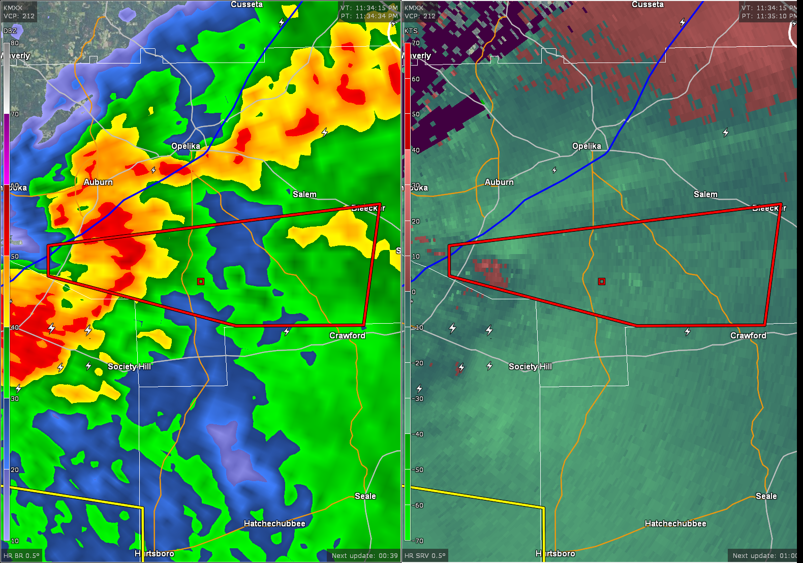
Debris has been indicated on radar by the NWS in Birmingham.
THE NATIONAL WEATHER SERVICE IN BIRMINGHAM HAS ISSUED A
* TORNADO WARNING FOR…
SOUTHEASTERN LEE COUNTY IN EAST CENTRAL ALABAMA…
* UNTIL MIDNIGHT CDT
* AT 1133 PM CDT…A SEVERE THUNDERSTORM CAPABLE OF PRODUCING A
TORNADO WAS LOCATED NEAR AUBURN…MOVING EAST AT 40 MPH.
HAZARD…TORNADO.
SOURCE…RADAR INDICATED ROTATION.
IMPACT…FLYING DEBRIS WILL BE DANGEROUS TO THOSE CAUGHT WITHOUT
SHELTER. MOBILE HOMES WILL BE DAMAGED OR DESTROYED.
DAMAGE TO ROOFS…WINDOWS…AND VEHICLES WILL OCCUR. TREE
DAMAGE IS LIKELY.
* LOCATIONS IMPACTED INCLUDE…
BEAUREGARD…BLEECKER…GRIFFEN MILL AND CHEWACLA STATE PARK.
Category: Alabama's Weather, Severe Weather
About the Author (Author Profile)
Subscribe
If you enjoyed this article, subscribe to receive more just like it.


