

After Midnight, The Storms Are Finally Moving Out

After Midnight, The Storms Are Finally Moving Out
That’s right, after a last minute hurrah of Tornado warnings, the event has finally winded down for Alabama. All of the thunderstorms have now pushed into Georgia, and the atmosphere in Alabama has settled down. There are a few pesky showers that are trailing behind the main line of storms, but these should just be rainmakers with a clap or two of thunder.
The Tornado Warning for Barbour County has been cancelled, as the storm responsible for the warning has now pushed over into Quitman and Clay counties in Georgia.
DAMAGE: Multiple reports of damage has come in from across the state. Power outages and trees are down with a possible tornado in Beauregard. Trees have been reported down in Jefferson, Walker, and Clay counties. Also there have been reports of cars damaged by fallen trees and fences blown over. Really won’t know the whole story until daybreak arrives.
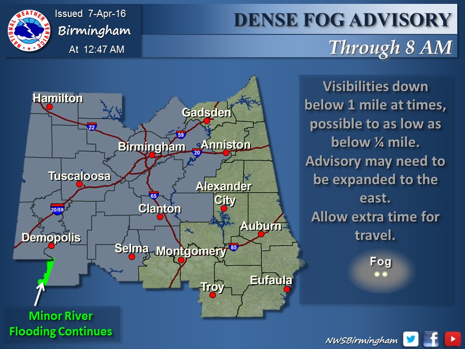
FOG MOVING IN: Skies will clear out, but visibility may be hindered by dense fog. Due to that, a Dense Fog Advisory has been issued until 8:00 AM CDT for much of the western two-thirds of the area.
RAIN TOTALS: Here are some rain totals from this event:
Birmingham Airport – 0.36 inches.
Tuscaloosa – 0.24 inches
Anniston – 0.62 inches
Gadsden – 0.33 inches
Shelby County Airport – 0.30 inches
OVERNIGHT: Once these pesky showers move out of the state, you should remain dry. Lows tonight should drop into the upper 40s for the northern half of the area, and lower to mid 50s for the southern half.
Category: Alabama's Weather, Severe Weather
About the Author (Author Profile)
Bill Murray is the President of The Weather Factory. He is the site's official weather historian and a weekend forecaster. He also anchors the site's severe weather coverage. Bill Murray is the proud holder of National Weather Association Digital Seal #0001 @wxhistorianSubscribe
If you enjoyed this article, subscribe to receive more just like it.


