

Wednesday Thoughts from Satellite Sheldon
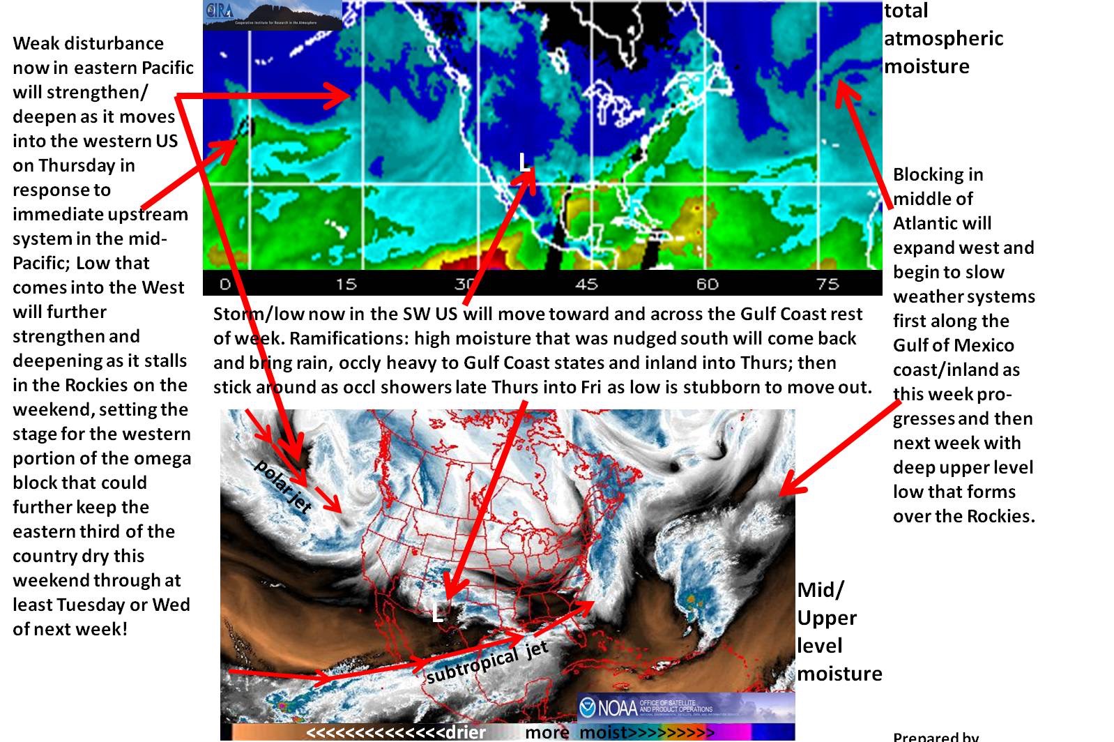
The attached satellite graphic gives analysis for current features that will play in Alabama’s weather over the next several days. Blocking in Atlantic expands/further develops west into the eastern CONUS, while a developing/deepening low comes out of the Eastern Pacific to form a deep low over the West/Rockies.
This will result in an Omega block. It is called that because the jetstream flow resembles the Greek letter Omega. This type of setup tends to slow the progress of weather systems down and leads to a stagnant weather pattern.
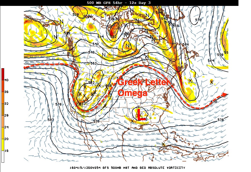
The good news is, it is spring, so these patterns don’t last too long. But if you are under the high for nice weather you will want it to last forever…if you are under the low, you will hope that it quickly moves away so spring can return.
Unfortunately, Alabama will be nuder the low through Friday and maybe into Saturday. But, as I always say: I hate drought, so we will take the rain!
Sheldon Kusselson is our Resident Satellite Expert, having retired after a fantastic career as a satellite meteorologist with NOAA’s National Environmental Satellite, Data, and Information Service. He occasionally sends us his wisdom to share with you!
Category: Alabama's Weather
About the Author (Author Profile)
Bill Murray is the President of The Weather Factory. He is the site's official weather historian and a weekend forecaster. He also anchors the site's severe weather coverage. Bill Murray is the proud holder of National Weather Association Digital Seal #0001 @wxhistorianSubscribe
If you enjoyed this article, subscribe to receive more just like it.


