

Showers and Storms Moving into West Alabama; Not Severe For Now
Showers and thunderstorms have moved into West Alabama this afternoon. They currently cover parts of Pickens, Sumter, Greene and Choctaw Counties. An arc of storms extends back through Columbus MS to near Houston MS and Tupelo. These storms will move into parts of Lamar, Fayette, Walker, Marion and Winston Counties over the next two-three hours.
Storms are more widespread and stronger over southeastern Mississippi south of Meridian. These storms will rotate up into Choctaw, Marengo, Hale and Perry Counties eventually.
The storms should grow in coverage and intensity as we get into the most intense heating of the day.
The storms are no severe at this time, but some of them could be quite strong. Instabilities are currently running 1,000-2,000 joules/kg across the northern half of the state, with the higher values to the south. Currently, wind shear values are very low, but that will change somewhat this afternoon as stronger winds at about 5,000 feet move in from Mississippi.
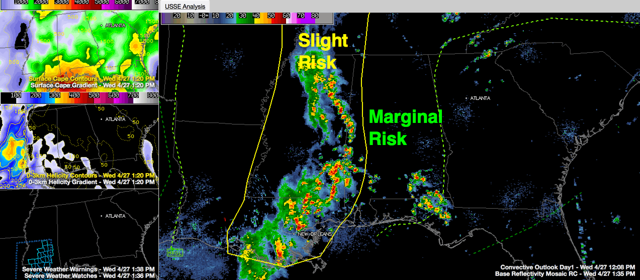
The SPC has the western tier of counties in their standard slight risk severe weather outlook, which means scattered severe storms are possible, including short lived and not widespread intense storms are possible. There is very low probability of a tornado in the slight risk counties, which include Marion, Lamar, Fayette, Pickens, Greene and Sumter.
The rest of the state is included in their marginal risk forecast, indicating isolated severe storms possible, but limited in duration, coverage and intensity.
So, there likely will be a few warnings, with the best chance over the western part of the state. A severe thunderstorm watch continues for southern Mississippi and Southeast Louisiana. This could be shifted over into our state as well, although that is not a certainty.
TIMING
The main storms should reach Tuscaloosa between 230-3 p.m.; Birmingham around 5 p.m.; Gadsden around 6 p.m. and Anniston around 6:30 p.m. Remember, your actual times may vary, so check back frequently and keep an eye on the radar.
We will be posting frequently throughout the afternoon as we keep an eye on the storms.
Category: Alabama's Weather, Severe Weather
About the Author (Author Profile)
Bill Murray is the President of The Weather Factory. He is the site's official weather historian and a weekend forecaster. He also anchors the site's severe weather coverage. Bill Murray is the proud holder of National Weather Association Digital Seal #0001 @wxhistorianSubscribe
If you enjoyed this article, subscribe to receive more just like it.


