

Radar Check for North/Central Alabama at 7:40 PM CDT
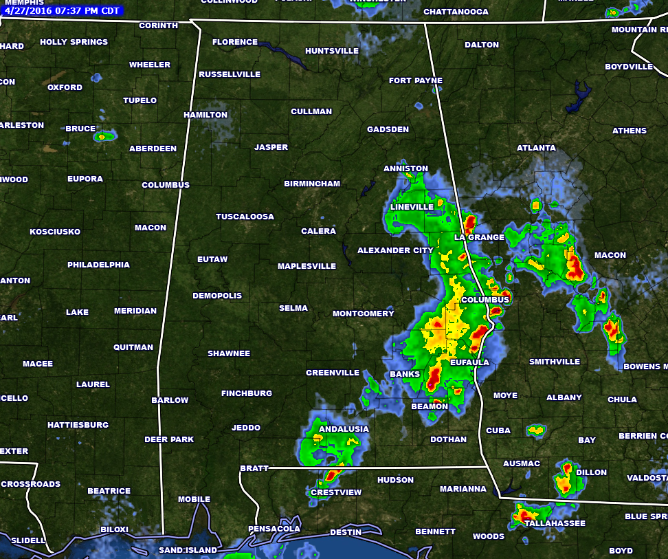
A line of showers and thunderstorms currently stretch from Anniston, to Eufala, back to the southwest to Andalusia, and into the panhandle or Florida through Covington County. Line has weekend as it has pushed to the east-northeast through southern Alabama. There is still plenty of lightning involved, so stay inside until the line has passed. The line of storms should be exiting the state during the 8-9 PM timeframe tonight.
Instability levels have dropped considerably, with CAPE values mostly at 300-1,000 J/kg for much of the state, except for a few places in south Alabama where values are at 2,000 J/kg.
Latest runs of both the high-resolution NAM and the HRRR models have some redevelopment over the area during the late night and overnight hours. The NAM is a little more aggressive with the redevelopment. The HRRR is trending with a more drier solution. Therefore, I’ll say a few isolated showers and thunderstorms could develop over the area during tonight through the pre-dawn hours.
Most of the state remains under a “Marginal Risk” for severe storms through 7 AM Thursday morning. So, small hail and gusty winds could be possible. As instability and helicity values continue to drop tonight, the likelihood of severe weather happening is minimal.
Category: Alabama's Weather, Severe Weather
About the Author (Author Profile)
Scott Martin is an operational meteorologist, professional graphic artist, musician, husband, and father. Not only is Scott a member of the National Weather Association, but he is also the Central Alabama Chapter of the NWA president. Scott is also the co-founder of Racecast Weather, which provides forecasts for many racing series across the USA. He also supplies forecasts for the BassMaster Elite Series events including the BassMaster Classic.Subscribe
If you enjoyed this article, subscribe to receive more just like it.


