

Radar Check For North/Central Alabama at 9:00 PM CDT
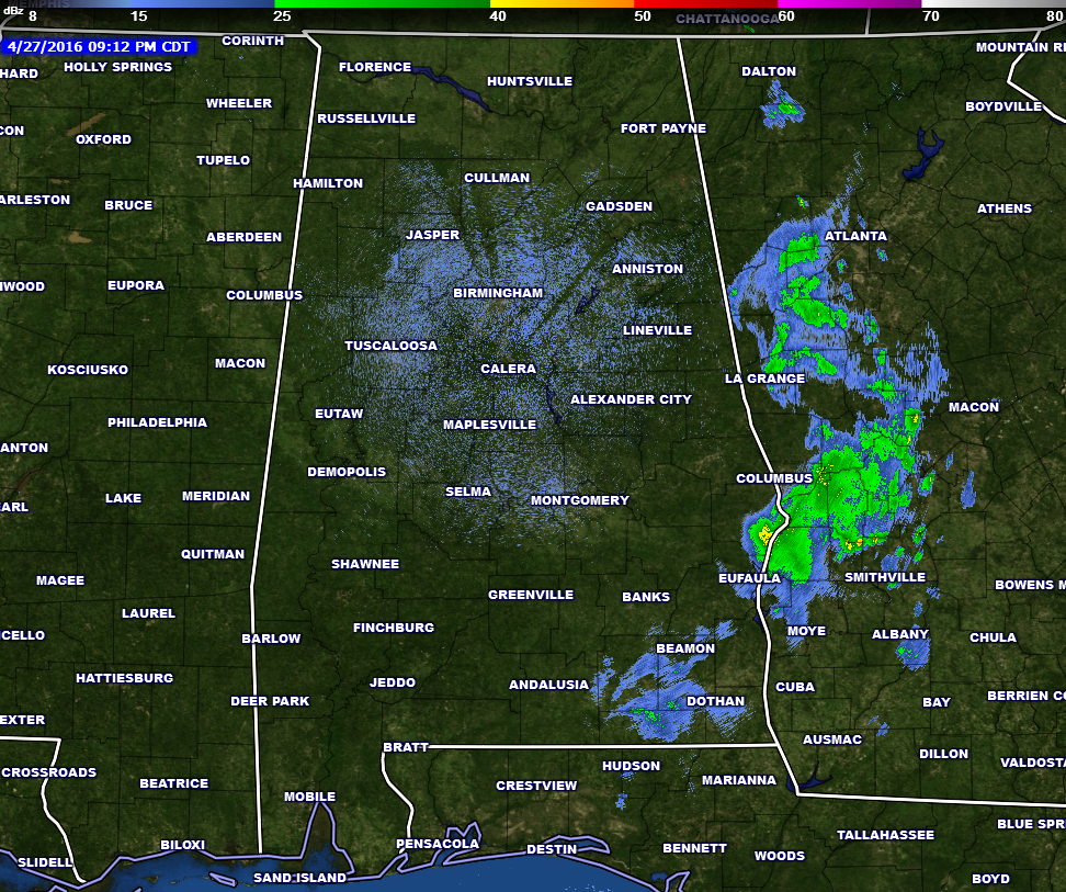
At 9:00 PM, nearly all of the rain from the line of storms have now pushed into western Georgia. It is still raining in parts of Russell and Barbour counties, but they will be completely out of the state by 9:30 PM.
Fortunately, there were very few reports of damage across the state. The only reports came from Butler County, where severe thunderstorm winds blew trees down on Cahaba Road and at Wildforks Road. Only one other report of a tree and some power lines down in Crenshaw County.
SPC has dropped the severe risks for the whole state, as helicity and instability values continue to drop, and will do so throughout the overnight hours.
The rest of tonight and into tomorrow will mainly be dry. There is a risk for isolated showers or thunderstorms to develop across the area throughout the overnight hours. Even though some of these could be strong, the overall severe threat is minimal. Otherwise, skies will be partly to mostly cloudy across the area. Overnight temperatures will only fall to the upper 60s to near 70.
Rain totals for this system tonight have ranged from no measurable rainfall at the Birmingham Airport, to 0.68 inches at Montgomery, to 0.26 inches at Mobile, and to 0.05 at Alexander City.
Category: Alabama's Weather, Severe Weather
About the Author (Author Profile)
Scott Martin is an operational meteorologist, professional graphic artist, musician, husband, and father. Not only is Scott a member of the National Weather Association, but he is also the Central Alabama Chapter of the NWA president. Scott is also the co-founder of Racecast Weather, which provides forecasts for many racing series across the USA. He also supplies forecasts for the BassMaster Elite Series events including the BassMaster Classic.Subscribe
If you enjoyed this article, subscribe to receive more just like it.


