

Thursday Midday Nowcast For North/Central Alabama
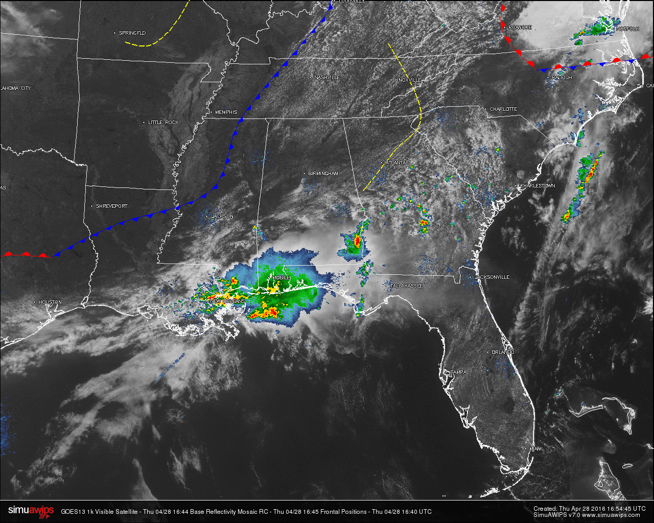
A mix of clouds and sun are gracing the skies across North/Central Alabama at this time, but showers and thunderstorms are affecting the southeastern and southwestern corners of the state.
A thunderstorm is currently producing heavy rainfall across Henry county, especially for the communities of Lawrenceville, Creamer, Capps, and especially around the Abbeville Municipal Airport. Light to moderate rain is currently falling over the Gulf Coast of Alabama, and well up in central Mobile and Baldwin counties. Another small but heavy shower is moving into Choctaw County. Communities of Paragon, Hodgewood, and Riderwood are about to receive a decent shower.
TEMPERATURES AT 12PM: Temperatures are well up into the 70s for most communities across the area. Here is a list of temperature readings from across the state at this time:
Birmingham 77
Tuscaloosa 72
Muscle Shoals 78
Huntsville 79
Anniston 76
Alexander City 73
Montgomery 78
Dothan 76
Mobile 72
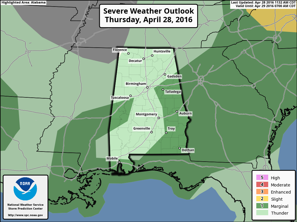
TODAY & TONIGHT: A mix of sun and clouds for the rest of today, with shower and thunderstorm activity staying well to the south today. SPC has areas south of the I-20 and I-59 corridors under a “Marginal Risk” for severe storms today, except for areas along and a little west of the I-65 corridor. Afternoon highs will reach the low to mid 80s across North/Central Alabama, with clearing skies tonight and overnight lows at or near 60.
TOMORROW: Dry and very warm weather is the story for North/Central Alabama, we reach the mid to upper 80s with a partly to mostly sunny sky. Any showers will be confined to the far southwest counties of the state.
TALADEGA SUPERSPEEDWAY: Tomorrow will be mostly sunny and warm at the Superspeedway with a high between 85 and 88 degrees. On Saturday, a decent part of the day will be dry, but we can’t rule out a passing shower or two. The weather stays warm with a high in the low to mid 80s. I don’t think there will be many problems running the Sparks Energy 300. On Sunday there should be an increase in the number of showers and storms across the state, but this won’t be a wash-out, and again I think there is a good chance the GEICO 500 will run, although a delay is certainly possible. Sunday’s high will be close to 80 degrees.
APRIL 27 2011 SPECIAL: You can watch our one hour special here. It was on this date five years ago that 62 tornadoes killed 252 people in our state during a generational tornado outbreak.
WEATHERBRAINS: Don’t forget you can listen to our weekly 90 minute netcast anytime on the web, or on iTunes. This is the show all about weather featuring many familiar voices, including our meteorologists here at ABC 33/40. You can find it here.
Category: Alabama's Weather
About the Author (Author Profile)
Scott Martin is an operational meteorologist, professional graphic artist, musician, husband, and father. Not only is Scott a member of the National Weather Association, but he is also the Central Alabama Chapter of the NWA president. Scott is also the co-founder of Racecast Weather, which provides forecasts for many racing series across the USA. He also supplies forecasts for the BassMaster Elite Series events including the BassMaster Classic.Subscribe
If you enjoyed this article, subscribe to receive more just like it.


