

A Quick Update at 6:55 PM CDT
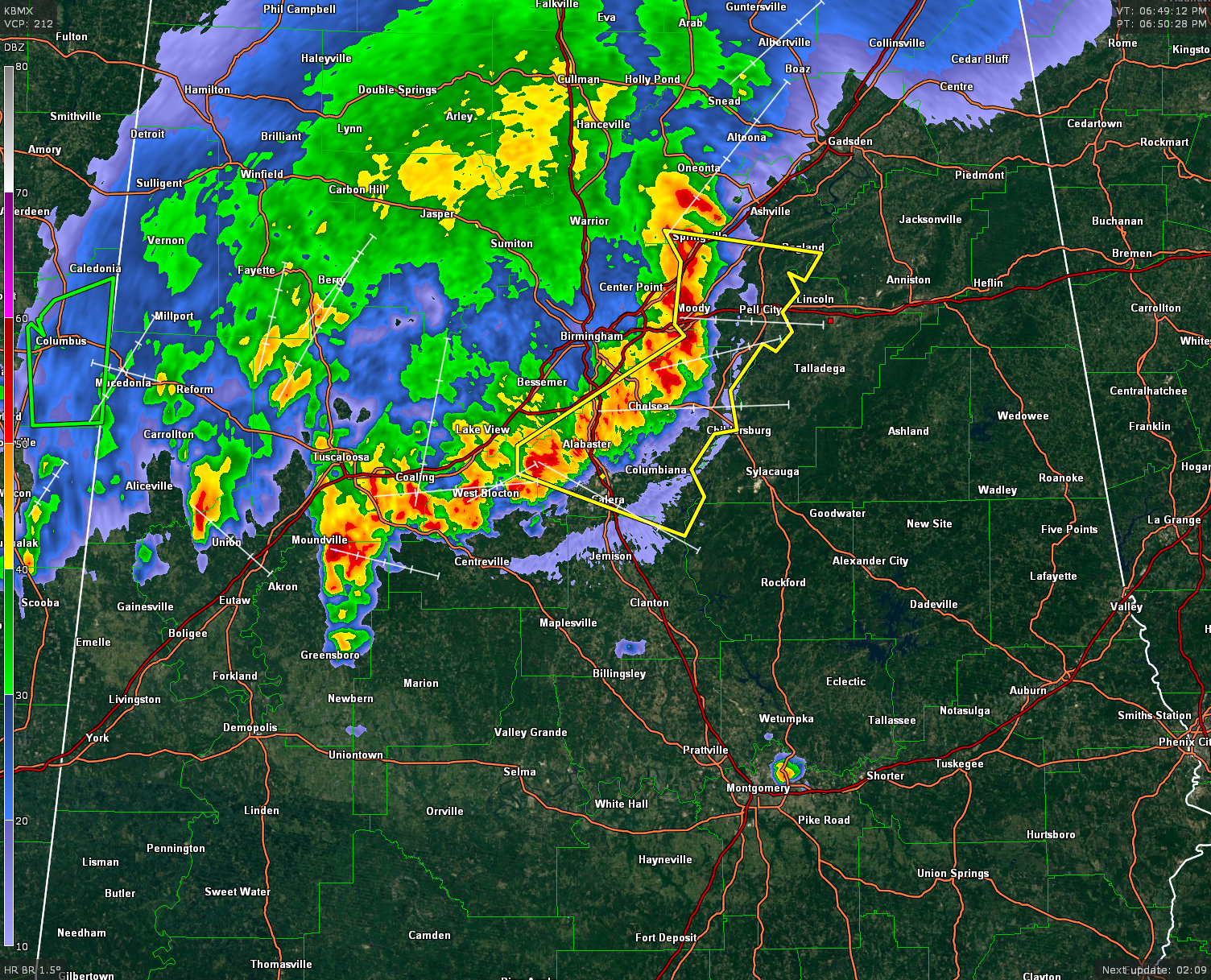
A line of storms that have developed a well-defined bow echo is pushing its way across much of North/Central Alabama. The strongest part of the line stretches from Oneonta, to Springville, to Moody, to Chelsea, to Alabaster, to West Blocton, back to Moundville. This line is moving to the southeast at 35 MPH. A Severe Thunderstorm Warning is currently in effect for St. Clair and Shelby Counties until 7:00 PM CDT.
People at Talladega Superspeedway are directly in the path of the storm, and need to find a place of safety until the line passes the track and surrounding areas. Winds in excess of 60 MPH, dangerous cloud-to-ground lightning, and quarter-size hail are possible with these storms.
Hail reports are coming in from storms that currently have Severe Thunderstorm Warnings on them. Penny size hail was reported 2 miles southeast of Tuscaloosa at 6:27 PM, with dime-size hail falling at the time of report along McFarland Blvd. Pea-size hail was covering the ground at Elder Street in Birmingham. Quarter size hail was reported in Kimberly at 6:21 PM.
Category: Alabama's Weather, Severe Weather
About the Author (Author Profile)
Scott Martin is an operational meteorologist, professional graphic artist, musician, husband, and father. Not only is Scott a member of the National Weather Association, but he is also the Central Alabama Chapter of the NWA president. Scott is also the co-founder of Racecast Weather, which provides forecasts for many racing series across the USA. He also supplies forecasts for the BassMaster Elite Series events including the BassMaster Classic.Subscribe
If you enjoyed this article, subscribe to receive more just like it.


