

Showers Developing
The air mass over Alabama remains unstable and quite moist as evidenced by dew points running in the upper 60s in Central Alabama and middle 60s in North Alabama. The morning sounding at the Shelby County Airport this morning showed precipitable water values around 1.30 inches.
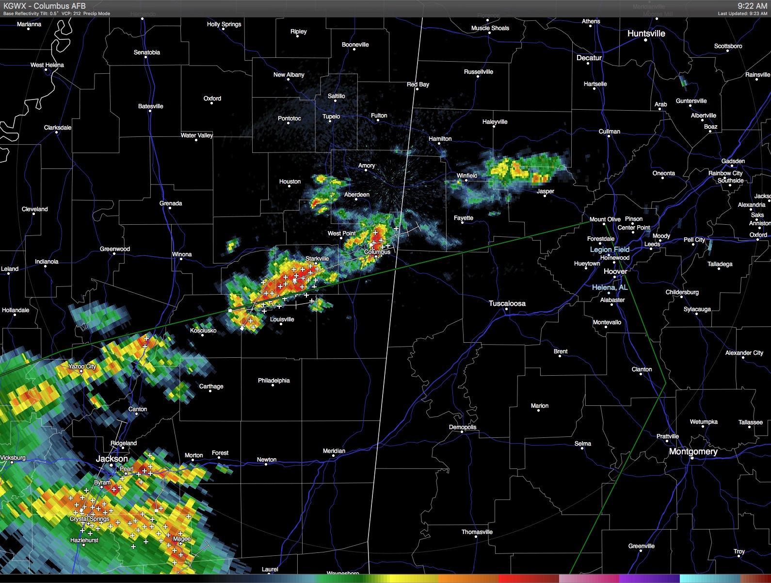
Radar as seen below showed a small cluster of showers over northern Walker County and southern Winston County moving toward Cullman County. Other showers were occurring from just east of Columbus, MS, southwestward into Southwest Mississippi. A large area of storms was also shown over Southwest Mississippi and a large portion of southern Louisiana. All of these storms were moving northeastward around 25 mph.
As James noted below, rain delays at Talladega Superspeedway today are possible. The GEICO 500 is scheduled to get underway at noon, and based on current radar and the anticipated trends for the next several hours, it’s very likely that the race will be able to start on time. There is also a very good chance that the race will be able to run to the finish unless additional showers develop well ahead of the rain areas we already have on radar. Staying up on the latest radar information will be the best way to stay ahead of any developing weather.
-Brian-
Category: Alabama's Weather
About the Author (Author Profile)
Brian Peters is one of the television meteorologists at ABC3340 in Birmingham and a retired NWS Warning Coordination Meteorologist. He handles the weekend Weather Xtreme Videos and forecast discussion and is the Webmaster for the popular WeatherBrains podcast.Subscribe
If you enjoyed this article, subscribe to receive more just like it.


