

Weather Update at 11:05 am
The weather continued to be wet for some and dry for others this morning. The Columbus, MS, Doppler radar continued to show thunderstorms moving into Alabama across portions of Lamar, Pickens, Fayette, Walker, and Marion counties. The motion of the storms was toward the northeast at 20 to 25 mph.
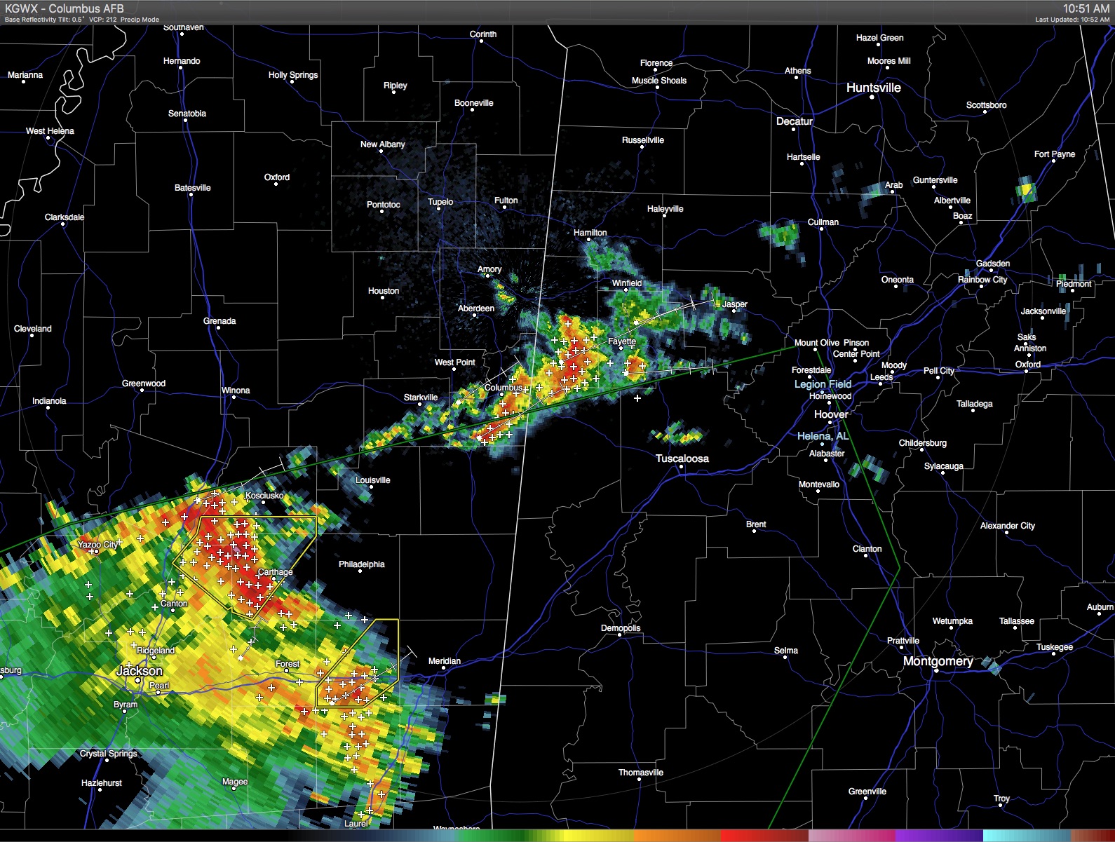
For those at the Talladega Superspeedway, the radar remained clear for the speedway itself, but several small showers have developed in the last hour and quickly dissipated, a couple of those near the super speedway. Unless additional showers develop in the vicinity of the track, the GEICO 500 should get off to a dry start at noon today. The race may get completed without any rain delays, but we’ll need to keep a close eye on radar since the atmosphere is quite moist and relatively unstable, conditions that could see additional showers develop at any time.
A large mass of thunderstorms was located across much of southern Mississippi at 11 am and continue to move northeast. The NWS in Jackson, MS, had issued several severe thunderstorm warnings along the leading edge of this large cluster. It should take at least two hours for this cluster to move into Alabama. When it does, it will affect the counties of Sumter, Greene, Pickens, and Choctaw counties.
All areas of thunderstorms were showing a tremendous amount of lightning. Please don’t take any chances when lightning is occurring. Heed the rule – when thunder roars, go indoors! We don’t want anyone to become a statistic as a lightning fatality. Automobiles also offer safe places to be, just keep your hands away from all metal.
-Brian-
Category: Alabama's Weather
About the Author (Author Profile)
Brian Peters is one of the television meteorologists at ABC3340 in Birmingham and a retired NWS Warning Coordination Meteorologist. He handles the weekend Weather Xtreme Videos and forecast discussion and is the Webmaster for the popular WeatherBrains podcast.Subscribe
If you enjoyed this article, subscribe to receive more just like it.


