

Storms Heating Up around Birmingham, Heads Up Lamar and Pickens
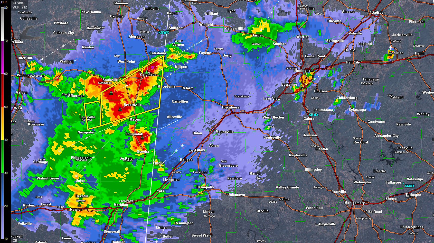
An area of rain and storms is pushing northeastward across East Central Mississippi early this afternoon. Severe thunderstorm warnings are in effect for Lowndes, Noxubee, Oktibbeha and Winston Counties in eastern Mississippi. No reports of damage so far, and the NWS Birmingham is not planning on issuing severe thunderstorm warnings unless they intensify.
Tons of lightning in the storms between Columbus MS and Brooksville down to Scooba.
There is a threat for severe thunderstorms with winds to 60 mph with storms today. The threat of tornadoes is very very small, if not zero.
They will push into Alabama’s northern Pickens and Lamar Counties by 1 p.m. There are already storms over southern Lamar County around Millport and Kennedy.
In the Birmingham Metro, storms are forming from Homewood to Hoover and back to Bessemer. Just saw the first lightning stroke near Vestavia.
There is a storm northwest of Oxford. This storm brought a shower to the Talladega Superspeedway right befor ethe green flag at the Geico 500.
Showers along highway 280 in northern Shelby County may threaten the track within the hour.
Category: Alabama's Weather, Severe Weather
About the Author (Author Profile)
Bill Murray is the President of The Weather Factory. He is the site's official weather historian and a weekend forecaster. He also anchors the site's severe weather coverage. Bill Murray is the proud holder of National Weather Association Digital Seal #0001 @wxhistorianSubscribe
If you enjoyed this article, subscribe to receive more just like it.


