

Monday Midday Nowcast for North/Central Alabama
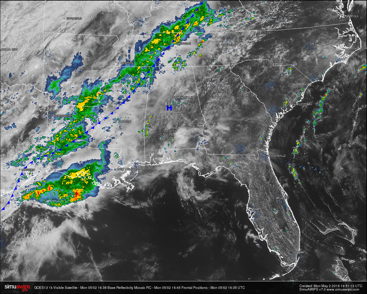
Most of the rain activity in the United States is located in Central Kentucky, West/Central Tennessee, Northern Mississippi, Southeastern Arkansas, much of Louisiana, and West/Central Texas. Other areas of rain across the country are located in the northeastern U.S., and on the state line of the Dakotas. No severe watches or warning were in effect at this time.
Much of North/Central Alabama is covered with mostly cloudy skies, with less coverage in clouds over parts of East/Central Alabama stretching back to the southwest. Rainfall has already started pushing into northwestern corner of the state, with thunder associated with the same rain mass back into northeastern Mississippi. A heavier shower is over extreme Northwestern Limestone County and much of Northern Madison County. Both are moving off to the northeast at 25-30 MPH.
More showers have developed across the central and southwestern parts of the state. A heavy shower is moving into southwestern Shelby County and moving over Montebello and Wilton. A small shower has developed in Southern Talladega County just northeast of Sylacauga. More spotty showers have developed over parts of Sumter, Choctaw, and Washington Counties.
Even with the cloud cover, temperatures across much of the area are up into the 70s. Here is a list of temperature readings from across the state at this time:
Birmingham 73
Tuscaloosa 70
Huntsville 74
Anniston 77
Alexander City 78
Montgomery 79
Dothan 79
Mobile 80
TODAY & TONIGHT: With another Omega Block Pattern that has set up over the country, the cold front will take a little longer moving across the state. A good chance of showers and thunderstorms will persist throughout the day as the cold front starts to slowly make its way into the state. With the heating of the day, some of the storms could become strong, with dangerous lightning and gusty winds being the main threats.
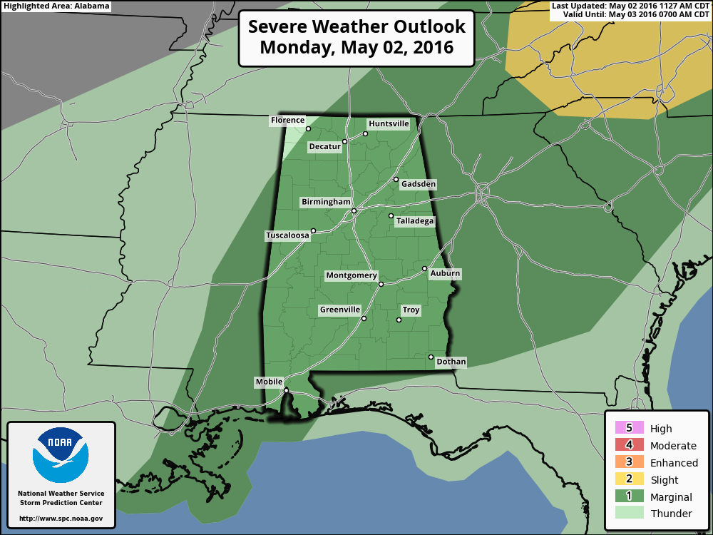
The SPC has much of the state in the “Marginal Risk” for severe storms for today, except for the extreme northwest corner of the state. Instability values (CAPE) will be at or just over 2,000 J/kg, and lapse rates over 7 C/km, but chances for severe development will be low due to low shear and mid-level lapse rates. After the sun sets, instability rates will drop rapidly and rain will be the only issue. Afternoon highs will reach the upper 70s, with overnight lows at or near 60.
TUESDAY: As the cold front starts to make its exit out of Alabama, we’ll keep rain chances in the forecast until the mid-afternoon hours. Otherwise, a mix of sun and clouds for the remainder of the day. Afternoon highs will reach the mid 70s.
WEATHERBRAINS: Don’t forget you can listen to our weekly 90 minute netcast anytime on the web, or on iTunes. This is the show all about weather featuring many familiar voices, including our meteorologists here at ABC 33/40. You can find it here.
Category: Alabama's Weather
About the Author (Author Profile)
Scott Martin is an operational meteorologist, professional graphic artist, musician, husband, and father. Not only is Scott a member of the National Weather Association, but he is also the Central Alabama Chapter of the NWA president. Scott is also the co-founder of Racecast Weather, which provides forecasts for many racing series across the USA. He also supplies forecasts for the BassMaster Elite Series events including the BassMaster Classic.Subscribe
If you enjoyed this article, subscribe to receive more just like it.


