

Tuesday Midday Nowcast for North/Central Alabama
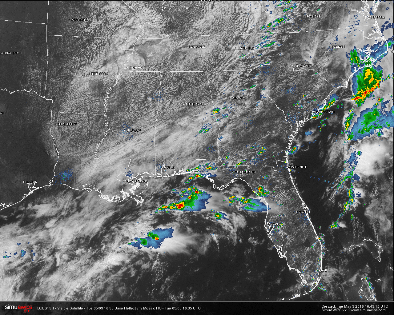
Cooler and drier air is moving into the northwestern parts of the state, and is making its way into Central Alabama. Temperatures at this hour are already cooler compared to the last few days. Cloud cover is starting to break up for North/Central Alabama, and most of the clouds are lined up with the cold front that is currently pushing through the state.
A few scattered showers are showing up on radar ahead of the cold front. One large shower is currently moving into Georgia from Randolph and Chambers Counties. A few smaller scattered showers are showing up in Lee, Macon, Bullock, and Montgomery Counties.
TEMPERATURES: A difference in temperatures can be felt in the air across Alabama today, as a cold front is currently draped across the southeastern parts of the state. Cooler temperatures are behind the front, with warmer temperatures ahead of it. Here is a list of temperature readings from across the state at this time:
Birmingham 69
Tuscaloosa 70
Muscle Shoals 64
Huntsville 68
Anniston 69
Alexander City 67
Montgomery 72
Dothan 76
Mobile 76
TODAY & TONIGHT: Expect a mix of sun and clouds for the remainder of the day for North/Central Alabama. There is a very small chance of a shower, but with drier air already moving in, it will be very hard to find one in the area. The best chance for showers and thunderstorms will come ahead of the cold front in South Alabama.
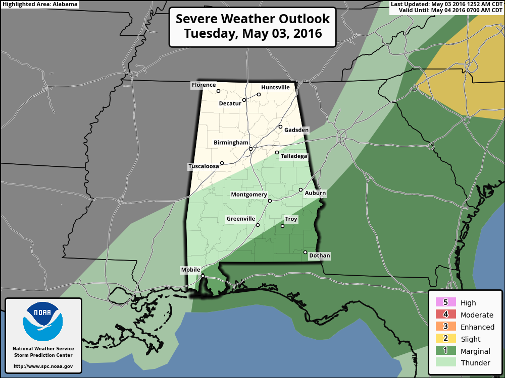
The SPC has defined communities south of a line from Mobile to Troy to Phenix City under a “Marginal Risk” for severe storms through the day. Daytime highs will reach the mid 70s in most communities, with overnight lows reaching the upper 40 to near 50.
WEDNESDAY: The daytime hours will be dry, as we begin the day with sunny skies during the morning. An Alberta Clipper will bring clouds in during the latter part of the day, with a band of showers passing through the area around the 5PM to 9PM time frame. Rain totals for tomorrow should be generally under 1/4 inch, and severe weather is not expected. Daytime highs will reach the mid 70s.
WEATHERBRAINS: Don’t forget you can listen to our weekly 90 minute netcast anytime on the web, or on iTunes. This is the show all about weather featuring many familiar voices, including our meteorologists here at ABC 33/40. You can find it here.
Category: Alabama's Weather
About the Author (Author Profile)
Scott Martin is an operational meteorologist, professional graphic artist, musician, husband, and father. Not only is Scott a member of the National Weather Association, but he is also the Central Alabama Chapter of the NWA president. Scott is also the co-founder of Racecast Weather, which provides forecasts for many racing series across the USA. He also supplies forecasts for the BassMaster Elite Series events including the BassMaster Classic.Subscribe
If you enjoyed this article, subscribe to receive more just like it.


