

Wind Gusts to 40 mph Possible with Line of Showers
A line of strong showers is dropping into Central Alabama late this afternoon.
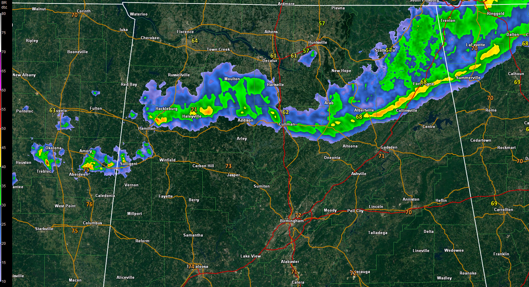
It extends from northern Marion County into northern Winston to near Cullman, then into northern Blount County, and on to near Albertvlle and Fort Payne.
It has a history of producing strong wind gusts and even brought down some trees and power lines southeast of the City of Madison in Madison County, west of Huntsville.
Winds gusted to 40 mph at Huntsville International Airport and 30 mph at Decatur and Muscle Shoals.
Winds will gust in excess of 40 mph as this line drops south, especially over Blount and Etowah Counties.
The tops of the showers are under 20,000 feet, so no lightning. There just isn’t much instability, and dewpoints are only in the upper 40s and lower 50s.
The line will reach Birmingham a little after 7. Gadsden should see the activity before 615 p.m. Anniston around 645 pm.
Category: Alabama's Weather, Severe Weather
About the Author (Author Profile)
Bill Murray is the President of The Weather Factory. He is the site's official weather historian and a weekend forecaster. He also anchors the site's severe weather coverage. Bill Murray is the proud holder of National Weather Association Digital Seal #0001 @wxhistorianSubscribe
If you enjoyed this article, subscribe to receive more just like it.


