

Satellite Sheldon Says Hi
Hi Alabama!
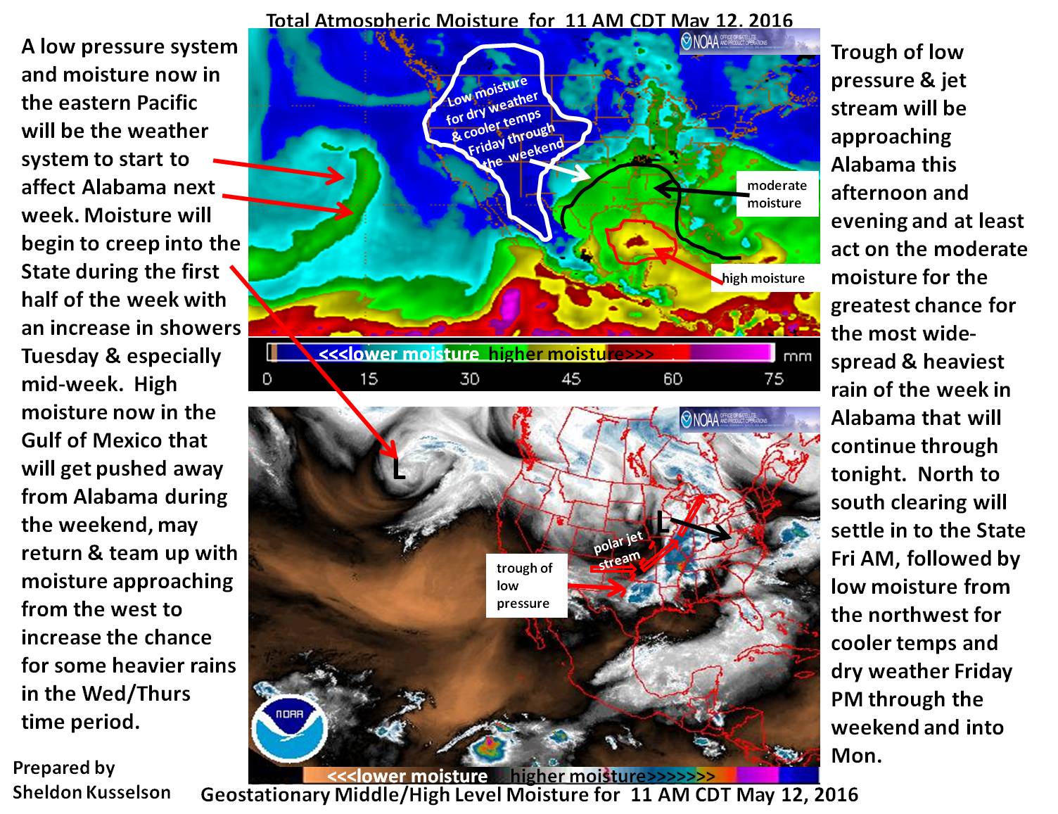
Attached is my satellite imagery, analysis and discussion of the features seen on satellite now that should affect Alabama weather at least through Tuesday and maybe as far out as Wednesday or even Thursday…oh my!
Click to enlarge
One note for later this afternoon and at least the first part of tonight…a little nervous for the northern third to northern half of Alabama with the Arkansas/southeastern Missouri wave going by to the north. The wave will be going by far enough north to I believe keep the severe from getting to much out of hand at least the further south you go in the state.
Maybe the case for heavy rain as well as that real high moisture (almost 2″ precipitable water in Central Gulf) probably won’t have a chance to get sucked up to far north. But if that moisture can get north…then and only then would there be more severe weather and heavy rain than what is being forecasted.
Will have to keep an eye on the total precipitable water satellite product top see if the small red in the Gulf expands north (which at least for now does not look to be the case).
Now, I have to go mow my wet lawn here in D.C. and hope I can get my garden started after things dry out some later in the weekend. Oh, by the way, have another nice weekend…I am envious.
-Sheldon Kusselson
Category: Alabama's Weather
About the Author (Author Profile)
Bill Murray is the President of The Weather Factory. He is the site's official weather historian and a weekend forecaster. He also anchors the site's severe weather coverage. Bill Murray is the proud holder of National Weather Association Digital Seal #0001 @wxhistorianSubscribe
If you enjoyed this article, subscribe to receive more just like it.


