

Radar Check at 4:00PM
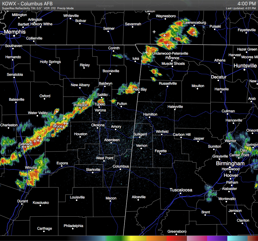
A line of strong storms are starting to push into the northwestern corner of the state. A Severe Thunderstorm Warning is current in effect for Tishomingo County in extreme northeastern Mississippi. This storm is starting to cross over the state line into Lauderdale and Colbert Counties. The warning has not been extended over into Alabama, but you can still expect dangerous lightning, wind gusts up to 40 MPH, and hail up to 1/2 inch in diameter.
This line of storms is currently ahead of a cold front, and they are stretching back from South-Central Tennessee, through the northwestern tip of Alabama, through the northern parts of Mississippi, and continues back into Southeastern Arkansas and extreme Northern Louisiana.
These storms will push across the state later this evening. Severe weather is not expected with these storms for much of the area, but the SPC continues to have parts of North Alabama under the standard “Slight Risk” of severe storms, with the rest of the northern-quarter of the state under a “Marginal Risk.” Main threat from these storms will be dangerous lightning, wind gusts up to 40 MPH, and hail up to 1/2 inch in diameter.
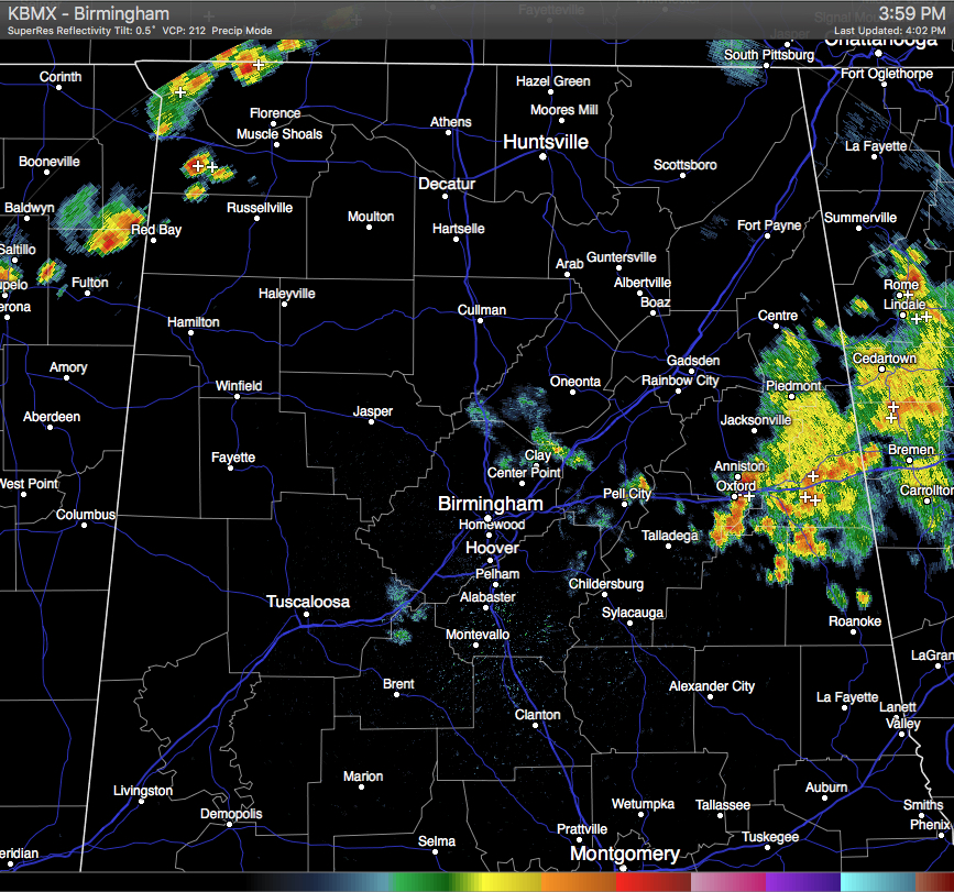
Other showers across the state are located along the I-20 corridor in Talladega, Calhoun, Cleburne, and Randolph Counties. These have continued to weaken as they push off to the east into Georgia.
Category: Alabama's Weather
About the Author (Author Profile)
Scott Martin is an operational meteorologist, professional graphic artist, musician, husband, and father. Not only is Scott a member of the National Weather Association, but he is also the Central Alabama Chapter of the NWA president. Scott is also the co-founder of Racecast Weather, which provides forecasts for many racing series across the USA. He also supplies forecasts for the BassMaster Elite Series events including the BassMaster Classic.Subscribe
If you enjoyed this article, subscribe to receive more just like it.


