

Storms Marching Southeast
Our line of strong storms is pushing southeast this evening.
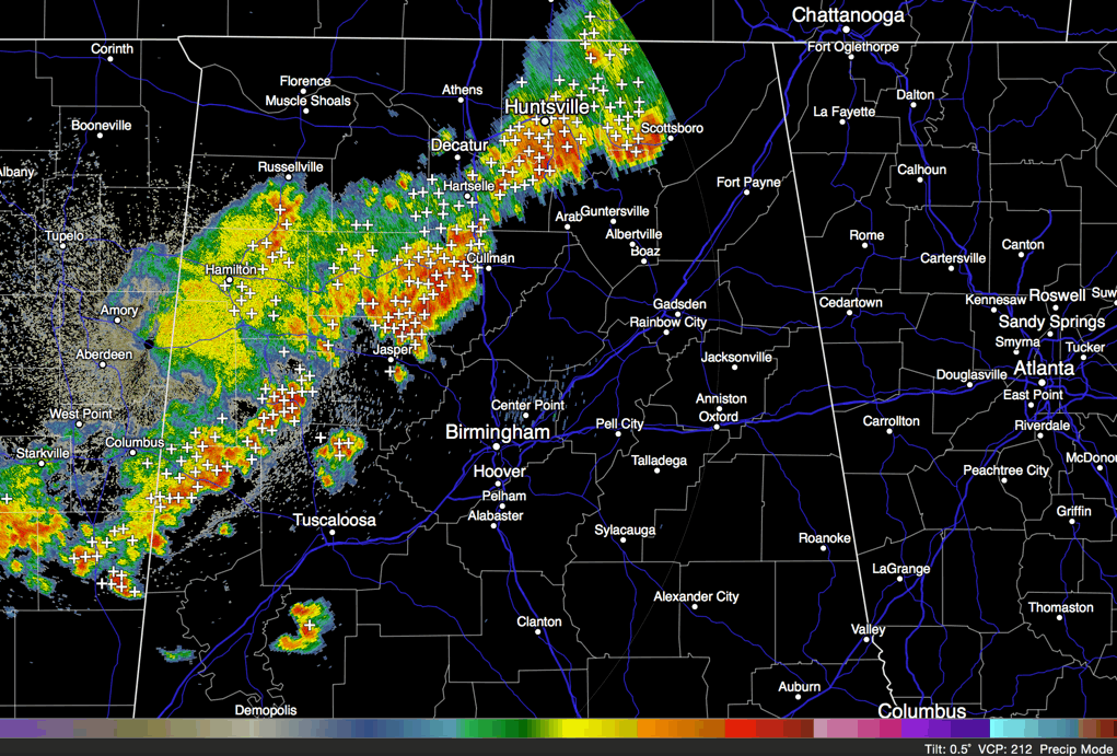
It is past Huntsville, approaching Cullman and Jasper. There is a break in the line back until you get into Fayette County. Storms extend from Fayette to west of Reform to near Pickensville.
The strongest storms are near Jasper, Fayette and north of Carrollton.
None of the storms are severe, but the strongest storms could produce wind gusts to near 50 mph, along with torrential rain and deadly lightning.
There is moderate instability across Central Alabama tonight, but all forms of wind shear are very weak. The storms are along a pre-frontal trough that is preceding a cold front that is knocking on the door of Northwest Alabama at this hour.
This will set us up for some fine weather for the weekend with highs near 80F and lows in the 50s along with lots of sunshine.
Category: Alabama's Weather
About the Author (Author Profile)
Bill Murray is the President of The Weather Factory. He is the site's official weather historian and a weekend forecaster. He also anchors the site's severe weather coverage. Bill Murray is the proud holder of National Weather Association Digital Seal #0001 @wxhistorianSubscribe
If you enjoyed this article, subscribe to receive more just like it.


