

Radar Check at 8:20 PM – Storms Pushing Through Central Alabama
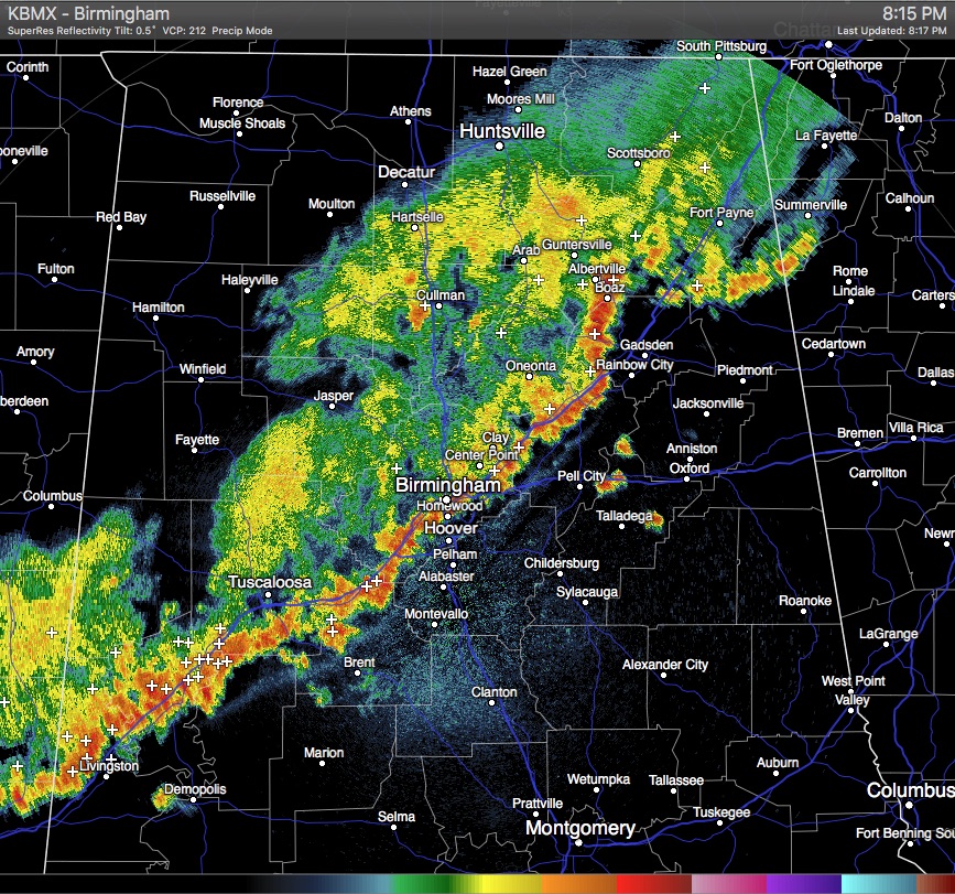
Storms are currently lined up along the I-59 and I-20 corridors, stretching from the northeast corner of the state, down to the southwest through downtown Birmingham, and exiting into Mississippi through Emelle in Sumter County.
Rain is already started to end in places such as Hazel Green, Decatur, Moulton, Haleyville, Fayette, and Millport. The line is moving to the east-southeast
These storms are along a prefrontal trough that is preceeding a cold front that is starting to cross over the state line in the northwest corner of the state. None of these storms are severe at the moment, but gusty winds up to 40 MPH, dangerous cloud-to-ground lightning, and some hail could still be possible.
Category: Alabama's Weather
About the Author (Author Profile)
Scott Martin is an operational meteorologist, professional graphic artist, musician, husband, and father. Not only is Scott a member of the National Weather Association, but he is also the Central Alabama Chapter of the NWA president. Scott is also the co-founder of Racecast Weather, which provides forecasts for many racing series across the USA. He also supplies forecasts for the BassMaster Elite Series events including the BassMaster Classic.Subscribe
If you enjoyed this article, subscribe to receive more just like it.


