

Alabama Weather Update at 5:00 PM
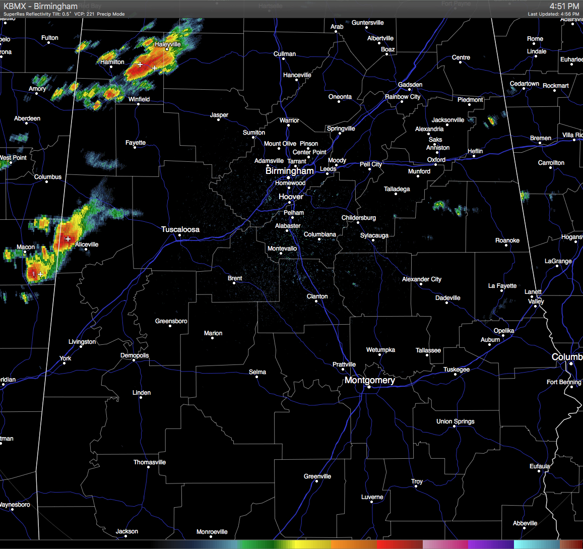
RADAR CHECK: At this time, strong thunderstorms are located in the western counties of the state. One of the strongest on radar is located over eastern Marion County, pushing into Winston County. Winds up to 35 MPH and some small hail could be possible with this storm. It is moving to the southeast at 30 MPH.
Another strong storm, that currently has a Severe Thunderstorm Warning issued on it in Noxubee County until 5:00 PM, is pushing into Pickens County. Quarter-size hail and winds up to 60 MPH are possible with this storm. Moving to the southeast at 15 MPH.
Elsewhere across Central Alabama, radar is pretty quiet. If these storms hold together, they should impact Tuscaloosa by 6-8PM, and may reach the Birmingham/Hoover areas by 8-10PM.
Category: Alabama's Weather, Severe Weather
About the Author (Author Profile)
Scott Martin is an operational meteorologist, professional graphic artist, musician, husband, and father. Not only is Scott a member of the National Weather Association, but he is also the Central Alabama Chapter of the NWA president. Scott is also the co-founder of Racecast Weather, which provides forecasts for many racing series across the USA. He also supplies forecasts for the BassMaster Elite Series events including the BassMaster Classic.Subscribe
If you enjoyed this article, subscribe to receive more just like it.


