

Significant Weather Advisory – Northern Fayette County Until 8:00 PM CDT
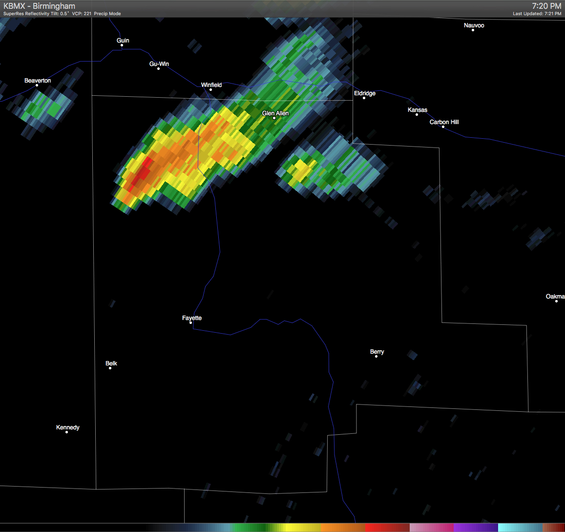
A Significant Weather Advisory has been issued for Northern Fayette County until 8:00 PM CDT. A strong thunderstorm was located near Bluff and Winfield, and was moving southeast at 15 MPH. Half-inch size hail and wind gusts in excess of 40 MPH will be possible with this storm. If you are in the path of this storm, seek safe shelter until it has passed. Locations in the path are listed below.
ALZ011-013-210100-
MARION AL-FAYETTE AL-
711 PM CDT FRI MAY 20 2016
…SIGNIFICANT WEATHER ADVISORY FOR NORTHERN FAYETTE COUNTY UNTIL 800
PM CDT…
AT 710 PM CDT…DOPPLER RADAR WAS TRACKING A STRONG THUNDERSTORM NEAR
BLUFF…OR 8 MILES SOUTHWEST OF WINFIELD…MOVING SOUTHEAST AT 15 MPH.
HALF INCH HAIL AND WINDS IN EXCESS OF 40 MPH WILL BE POSSIBLE WITH
THIS STORM.
LOCATIONS IMPACTED INCLUDE…
WINFIELD…FAYETTE…GUIN…GLEN ALLEN…GU-
WIN…BANKSTON…BLUFF…FAYETTE COUNTY PUBLIC LAKE…WAYSIDE…FOWLERS
CROSSROADS…RICHARD ARTHUR FIELD…BAZEMORE…HUBBERTVILLE AND BEVILL
STATE COLLEGE FAYETTE.
Category: Alabama's Weather, Severe Weather
About the Author (Author Profile)
Scott Martin is an operational meteorologist, professional graphic artist, musician, husband, and father. Not only is Scott a member of the National Weather Association, but he is also the Central Alabama Chapter of the NWA president. Scott is also the co-founder of Racecast Weather, which provides forecasts for many racing series across the USA. He also supplies forecasts for the BassMaster Elite Series events including the BassMaster Classic.Subscribe
If you enjoyed this article, subscribe to receive more just like it.


