

Summer-like Weather in the Week Ahead
Looks like Central Alabama will be in a summer-like weather pattern for the week ahead as we remain between active weather east and west of us.
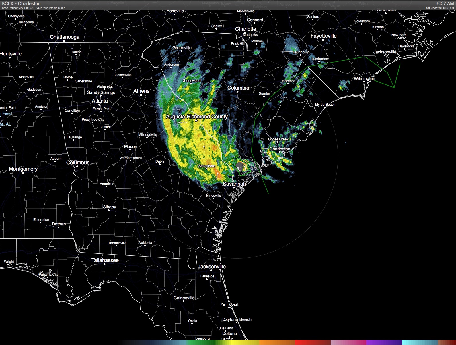
Tropical Storm Bonnie was located right on the South Carolina coast this morning bringing heavy rain to parts of South Carolina, eastern Georgia, and North Carolina. Bonnie was still classified as a tropical storm, however, with about half of the circulation over land, it should continue to weaken and become a depression on Memorial Day as it drifts northeastward along the coast. To our west, active weather continued to plague West Texas with an upper trough over the Southwest US.
Here in Central Alabama, we remained under a weakened upper ridge, but an upper ridge nevertheless. That along with the relatively high humidity will keep us in a summer-ish pattern where we’ll have to mention the possibility of isolated thunderstorms just about each day through the end of the week when our chances are likely to get boosted a bit with the approach of a weak frontal boundary. Radar was clear this morning, and the infrared satellite image indicated a few clouds passing across the Alabama sky. With less clouds today, we should see the highs rebound back into the upper 80s with some spots possibly pushing the 90-degree mark. Great weather for the SEC Championship game today at the Hoover Met where the Florida Gators will take on the Texas A & M Aggies. You can get your tickets here.
Great weather continues for the beaches of Alabama and Northwest Florida through the rest of the holiday weekend and for much of the week ahead. Expect mostly sunny days and fair nights. Highs on the immediate coast will be in the lower to mid 80s with upper 80s and lower 90s just inland. Rip currents are in the moderate range for most locations, so pay attention to the flags at the beaches. The water temperature at Perdido Pass at Orange Beach was 82 degrees. See the complete Gulf Coast 7 Day Planner here.
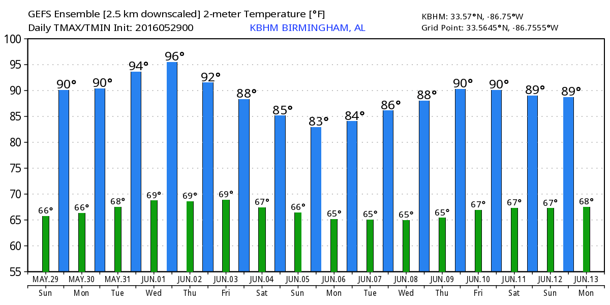
Weak ridging remains the primary pattern for us through much of the week ahead. This means morning lows in the upper 60s and afternoon highs in the 88 to 92 range. That pattern begins to change Wednesday and into the latter part of the week as a strong trough comes across the North Central US and finally breaks down the ridge pattern that has been with us for so many days. That trough will come across the Great Lakes on Thursday and Friday dragging the trough across the Mississippi River and bringing a surface frontal boundary into the Southeast US. The GFS is holding back a piece of that trough over the Northwest Gulf of Mexico, so rain chances should drop off Saturday but may not drop completely to zero as the front washes out south of Central Alabama. More clouds along with more numerous showers should see our highs drop back into the 80s.
The seven day periods ends next Sunday with a trough position over the eastern third of the US. The GFS keeps that pattern in place through June 8th and then gradually moves the upper ridge back into the eastern US while the traveling weather systems stay well north of Alabama along the US-Canadian border.
It is a holiday weekend, so while James Spann will be back with the next edition of the Weather Xtreme Video, he will probably produce only one video on Memorial Day. You can always check back for notes on what we expect the Alabama weather to do. Enjoy the day and take a moment to remember all of those people in the armed services that have sacrificed to keep our country strong and free. Godspeed.
-Brian-
Note: While I was preparing the video, NHC downgraded Bonnie to a tropical depression.
Category: Alabama's Weather
About the Author (Author Profile)
Brian Peters is one of the television meteorologists at ABC3340 in Birmingham and a retired NWS Warning Coordination Meteorologist. He handles the weekend Weather Xtreme Videos and forecast discussion and is the Webmaster for the popular WeatherBrains podcast.Subscribe
If you enjoyed this article, subscribe to receive more just like it.


