

Tuesday Midday Nowcast for Central Alabama: Last Day of May Edition
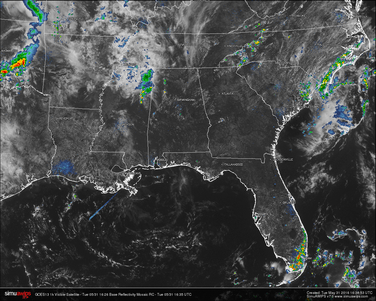
SATELLITE & RADAR CHECK: Hello on this beautiful, but warm, Tuesday morning. As we are nearing the noon hour in Central Alabama. The radar is currently clear and skies are mostly sunny across the area. Some shower activity that is currently located in northeastern Mississippi is slowly moving to the northeast, and may enter into Lamar and Marion counties within the next 60-90 minutes, if they hold together. There is an outflow boundary that has pushed across the state line and is currently located over Winston, Walker, Tuscaloosa, and Greene Counties. This may be a focal point for development of any more showers later on today.
As I type that, a shower has developed over the county line of northeastern Sumter and eastern Greene Counties. It appears to be stationary in movement, but still currently developing off to the northeast. Looks like a decent shower ahead for people in Gainesville. Another shower had developed in northeastern Walker County, just to the east of Carbon Hill. And yet another one has popped up just south of Clanton in Chilton County. This just goes to show you how fast these showers can pop during the daytime heating during summer conditions.
QUICK LOOK AT TEMPERATURES: Temperatures at this time are already well up in the upper 80s, with some 90s showing up in the southern part of the area. The warm spot in the state is Montgomery at 92. Here is a list of temperature readings from across the state at this time:
Birmingham 88
Tuscaloosa 90
Muscle Shoals 88
Huntsville 87
Anniston 87
Alexander City 88
Montgomery 90
Dothan 90
Mobile 88
REST OF TODAY: For most communities in Central Alabama, with partly to mostly sunny skies. It will be hot and humid, with afternoon highs in the low 90s today. Just as with a typical summertime forecast, the chance for any one location to get rain today is only about one in five.
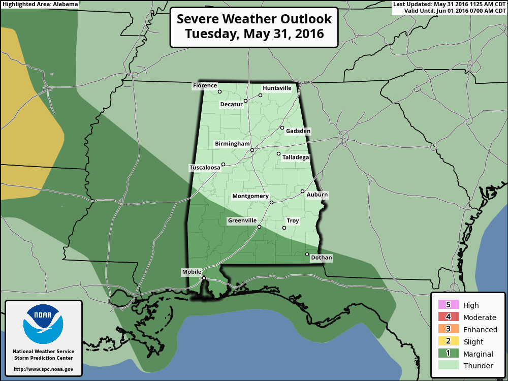
We do not that the SPC has the southern-third of the state defined in a “Marginal Risk” for severe storms through the rest of the day. A few storms in that area could produce some small hail and gusty winds.
AIR QUALITY ALERT FOR BIRMINGHAM AREA: Today’s Air Quality Index will be in the CODE YELLOW (moderate) for ozone and particulate matter. Unusually sensitive people should consider limiting prolonged outdoor exertion.
CLIMATOLOGY FOR BIRMINGHAM: The normal high temperature for May 31th in Birmingham is 84, while the normal low is 62. The record high of 94 was reached in 2006. The record low of 40 was set back in 1984.
TOMORROW: Hot and humid once again tomorrow, with partly to mostly sunny skies and afternoon highs in the low 90s. Expect a small risk of isolated shower and storm development once again, but most communities in the area will remain dry.
HEADED TO THE BEACH: Expect mostly sunny days and fair nights on the Gulf Coast (Panama City Beach over to Gulf Shores) through Friday with only isolated showers and storms. Highs will be in the 80s along the immediate coast, with low 90s inland. Scattered showers and storms will increase a bit this weekend on the coast, but you will still see a decent amount of sun Saturday and Sunday. See a very detailed beach forecast here.
WEATHERBRAINS: Don’t forget you can listen to our weekly 90 minute netcast anytime on the web, or on iTunes. This is the show all about weather featuring many familiar voices, including our meteorologists at ABC 33/40. You can find it here.
Category: Alabama's Weather
About the Author (Author Profile)
Scott Martin is an operational meteorologist, professional graphic artist, musician, husband, and father. Not only is Scott a member of the National Weather Association, but he is also the Central Alabama Chapter of the NWA president. Scott is also the co-founder of Racecast Weather, which provides forecasts for many racing series across the USA. He also supplies forecasts for the BassMaster Elite Series events including the BassMaster Classic.Subscribe
If you enjoyed this article, subscribe to receive more just like it.


