

TD #3 Has Formed
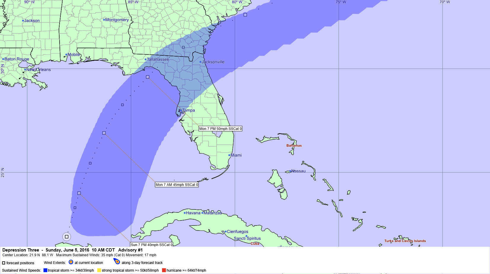
This graphic shows the forecast track and expected swath of tropical storm force winds from TD#3 (Colin)
The system in the Gulf of Mexico has developed enough to be designated tropical depression number three with top winds of 35 mph.
It is located on the northern coast of the Yucatan Peninsula and is moving north at 8 mph.
It should become Tropical Storm Colin later today. It won’t become a hurricane, and should max out with top winds of 50 mph late tomorrow. It will make landfall in the Florida Big Bend area, somewhere between Port St. Joe and Cross City, Florida late tomorrow night.
Areas from Apalachicola to Tampa could experience tropical storm force wind conditions (39 mph or greater). The gradient will tighten across the northern Gulf of Mexico, and winds will pick up along the beaches tomorrow into early Tuesday. Waves will increase to 4-6 feet along the coast and the rip current threat is expected to be high along the beautiful beaches of Alabama and Northwest Florida.
Rain and storms will be a common feature along the beach of Alabama and Northwest Florida today through tomorrow night, with improving weather by late Tuesday.
The system will cross northern Florida, southeastern Georgia and southern South Carolina, passing back out to sea near Charleston and then racing off to the northeast as a post tropical storm.
James has more thoughts in an excellent post he made this morning. Scroll down to read that.
Category: Alabama's Weather, Tropical
About the Author (Author Profile)
Bill Murray is the President of The Weather Factory. He is the site's official weather historian and a weekend forecaster. He also anchors the site's severe weather coverage. Bill Murray is the proud holder of National Weather Association Digital Seal #0001 @wxhistorianSubscribe
If you enjoyed this article, subscribe to receive more just like it.


