

TD4 Soon?
Invest 94L over the southwestern Gulf of Mexico may well already be a tropical depression.
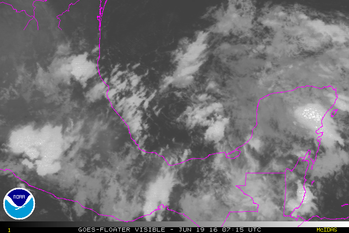
Air Force Reconnaissance will investigate the system this afternoon.
Wind shear is fairly light over the system and thunderstorms continue to concentrate near the center.
It will continue moving west northwest and will reach the Mexican Coast late tonight or tomorrow morning.
There is a small chance it could become a tropical storm before landfall. It is does, it will be named Danielle.
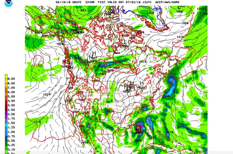
TROPICAL MISCHIEF TO BEGIN JULY?
An interesting feature has appeared on recent GFS output. A tropical depression forms north of the Yucatan on July 1 and moves slowly north northwest, arriving on the northern Gulf Coast somewhere between Louisiana and Northwest Florida as a strong tropical storm or minimal hurricane on July 3rd. It will be something to watch.
Category: Tropical
About the Author (Author Profile)
Bill Murray is the President of The Weather Factory. He is the site's official weather historian and a weekend forecaster. He also anchors the site's severe weather coverage. Bill Murray is the proud holder of National Weather Association Digital Seal #0001 @wxhistorianSubscribe
If you enjoyed this article, subscribe to receive more just like it.


