

Midday Nowcast: Hot And Dry For The First Full Day of Summer
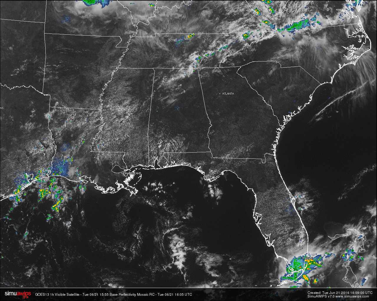
Across much of Central Alabama at this time, skies are mostly clear and temperatures are already well up into the 80s. Up in the northeastern counties of the state, there are a few isolated showers that are falling up in Madison and Jackson counties. These are moving to the southeast and could affect the towns of Stevenson, Gurley, Pleasant Groves, and Paint Rock within the next hour. The rest of the state is dry at this moment.

TEMPERATURES ACROSS CENTRAL ALABAMA: At the 11:00 AM hour, temperatures across Central Alabama were mostly in the mid to upper 80s. Here is a list of readings from across the state:
Birmingham: 86
Anniston: 84
Tuscaloosa: 85
Florence: 81
Huntsville: 79
Alexander City: 82
Montgomery: 86
Dothan: 84
Mobile: 85
REST OF TODAY: Skies should remain mostly clear to partly cloudy through the remainder of the day. There will be a weak shortwave moving through the northern counties of Alabama, and there will be just enough instability and moisture present that a few isolated showers and storms could develop north of a line from Hamilton to Cullman to Gadsden. South of that, hot and dry conditions will prevail, with afternoon highs reaching the low 90s.
CODE YELLOW AIR QUALITY: The Air Quality Index for the Birmingham Metropolitan Area will be in the “Code Yellow” (moderate range) for ozone. People who are unusually sensitive should consider limiting prolonged outdoor exertion.
TODAY’S CLIMATOLOGY FOR BIRMINGHAM: The normal high for June 21st is 89, while the normal low is 67. The record high for today was set back in 1933 at 102. The record low was set back in 1976 at 57.
TOMORROW’S WEATHER: Another hot and dry day is in store for the area. With a dry airmass in place over Central Alabama from an expanding ridge out to our west, and warm air aloft, convection will be held in check. Highs will once again be in the low to mid 90s, with the early morning lows in the upper 60s to low 70s.
HEADED TO THE BEACH: One of the most gorgeous weeks of the summer is occurring now along the beautiful beaches of Alabama and Northwest Florida. Mostly sunny skies, only isolated afternoon and evening showers and storms, and warm temperatures typical of June will highlight the week. Highs will be near 90F. Lows will be in the middle 70s. Water temperatures are climbing out of the lower 80s into the middle 80s. See a very detailed Gulf Coast forecast here.
THE TROPICS: TD #4 became Tropical Storm Danielle yesterday and moved inland on the Mexican Coast last evening. It weakened quickly but has been dumping heavy rains in the mountainous regions near the coastline, which can lead to deadly mudslides. Elsewhere the tropics are quiet.
TODAY IN WEATHER HISTORY: Back in 2006, Birmingham reached 100F for the first time since August 29, 2000. It was 101F at Pinson on this very hot day.
WEATHERBRAINS: This is the show all about weather featuring many familiar voices, including our meteorologists at ABC 33/40. This week, the panel entertained Dr. James Fleming from Colby College. Dr. Fleming is a weather and climate historian. You’ll love his stories about the history of weather modification and biographies of weather luminaries Bjerknes, Rossby and Wexler. You can listen anytime on the web, or on iTunes. You can find it here.
Category: Alabama's Weather
About the Author (Author Profile)
Scott Martin is an operational meteorologist, professional graphic artist, musician, husband, and father. Not only is Scott a member of the National Weather Association, but he is also the Central Alabama Chapter of the NWA president. Scott is also the co-founder of Racecast Weather, which provides forecasts for many racing series across the USA. He also supplies forecasts for the BassMaster Elite Series events including the BassMaster Classic.Subscribe
If you enjoyed this article, subscribe to receive more just like it.


